TopoQuest Logo
Do you find TopoQuest useful?
Help keep TopoQuest running and adding new maps/features by donating!
Bitcoin:  19c7KJd3qBynnjoSw5npx9KScwjBe4ifkT
Litecoin:  LXs6TkuXGGXo1vDsWCkWVdjQX94eUKd6ui
Home View Maps Find Maps Find Places Resources & Links


Holcomb, Mississippi Topographic Map

USGS Map Title: Holcomb, MS
USGS Map MRC: 33089G8
DRG (GeoTIFF) Download: o33089g8.tif


Neighboring USGS Topographic Map Quads:


  Paynes, MS  
33090H1
 

  Tillatoba, MS  
33089H8
 

  Scobey, MS  
33089H7
 

  Cascilla, MS  
33090G1
 

  Holcomb, MS  
33089G8
 

  Grenada, MS  
33089G7
 

  Avalon, MS  
33090F1
 

  Jefferson, MS  
33089F8
 

  Tie Plant, MS  
33089F7


Map MRC Location:

N34°
W90°
N34°
W89°
H8 H7 H6 H5 H4 H3 H2 H1
G8 G7 G6 G5 G4 G3 G2 G1
F8 F7 F6 F5 F4 F3 F2 F1
E8 E7 E6 E5 E4 E3 E2 E1
D8 D7 D6 D5 D4 D3 D2 D1
C8 C7 C6 C5 C4 C3 C2 C1
B8 B7 B6 B5 B4 B3 B2 B1
A8 A7 A6 A5 A4 A3 A2 A1
N33°
W90°
N33°
W89°

Holcomb, MS USGS 1:24K Topographic Map Preview:
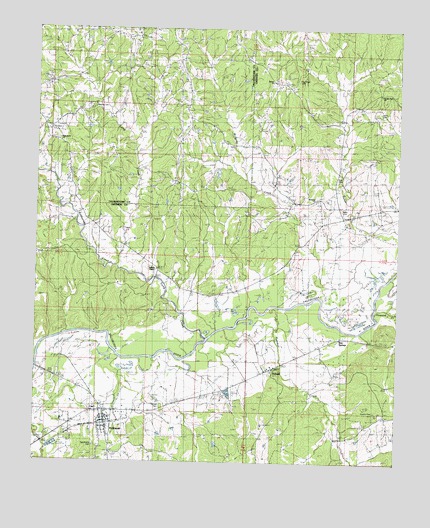
Holcomb, MS USGS Topographic Map
Click on map above to begin viewing in our Map Viewer.

This topographic map contains these locations and features:
Feature Name Type Latitude Longitude GNIS ID View Map
Ashland CemeteryCemeteryN33.8526°W89.9815°666395View Map
Baker CemeteryCemeteryN33.8234°W89.8940°666467View Map
Bethel ChurchChurchN33.8598°W89.9187°666946View Map
Bew PondSwampN33.7837°W89.8874°683048View Map
Bew SpringsPopulated PlaceN33.7862°W89.8948°667062View Map
Brushy Fork ChurchChurchN33.8598°W89.8829°667697View Map
Brushy Fork SchoolSchoolN33.8562°W89.8809°667698View Map
Cascilla SchoolSchoolN33.8457°W89.9970°668134View Map
Cole CemeteryCemeteryN33.8318°W89.8954°668671View Map
Cooke Lake DamDamN33.8284°W89.8818°682357View Map
DubardPopulated PlaceN33.7765°W89.9187°669462View Map
Gillon Lake DamDamN33.7801°W89.9018°682336View Map
Griffen Lake DamDamN33.8168°W89.8868°682354View Map
Harris CemeteryCemeteryN33.8507°W89.8809°670972View Map
HolcombPopulated PlaceN33.7612°W89.9759°671276View Map
Holcomb Census Designated PlaceCensusN33.7642°W89.9732°2586599View Map
Holcomb Elementary SchoolSchoolN33.7651°W89.9793°705796View Map
Holcomb Post OfficePost OfficeN33.7643°W89.9766°2768792View Map
Horseshoe LakeLakeN33.7804°W89.9770°683081View Map
Howard CreekStreamN33.7940°W89.8818°671531View Map
Jackson ChapelChurchN33.8062°W89.9604°671773View Map
Jackson SchoolSchoolN33.8059°W89.9598°671788View Map
Long CreekStreamN33.7854°W89.9412°693824View Map
McSwine CemeteryCemeteryN33.8254°W89.9034°673441View Map
McSwine ChurchChurchN33.8254°W89.9031°673442View Map
McSwine CreekStreamN33.7971°W89.9023°673443View Map
McSwine SchoolSchoolN33.8254°W89.9034°673444View Map
Moorehead Lake DamDamN33.7584°W89.9568°682328View Map
Owens CemeteryCemeteryN33.7648°W89.8817°675350View Map
Pea Ridge CemeteryCemeteryN33.8604°W89.9106°683097View Map
Pine Grove ChurchChurchN33.8440°W89.9962°675848View Map
Piney Grove SchoolSchoolN33.7704°W89.9143°675905View Map
Pleasant Hill Church Number 1ChurchN33.7779°W89.8837°676088View Map
Pleasant Hill Church Number 2ChurchN33.7801°W89.9001°676089View Map
Pleasant Hill SchoolSchoolN33.7807°W89.8998°676090View Map
Poa Ridge CemeteryCemeteryN33.8607°W89.9095°676159View Map
Rattlesnake CreekStreamN33.8071°W89.9729°676482View Map
Tascohoma CemeteryCemeteryN33.7548°W89.9795°683111View Map
Taseohoma ChurchChurchN33.7559°W89.9893°678576View Map
Taseohoma SchoolSchoolN33.7559°W89.9893°678577View Map
Trimbell CemeteryCemeteryN33.7662°W89.9562°678876View Map
Turnbull CreekStreamN33.7943°W89.9187°678968View Map
Tuscahoma (historical)LocaleN33.7773°W89.9931°705803View Map
Tuscahoma Academy (historical)SchoolN33.7659°W89.9801°705804View Map
Tuscahoma Church (historical)ChurchN33.7546°W89.9790°683113View Map

Note: Coordinates in the location and feature list above are referenced to NAD83 datum.


Copyright (C) 2008-2024 Ryan Niemi / Sunset Dynamics ... All Rights Reserved