TopoQuest Logo
Do you find TopoQuest useful?
Help keep TopoQuest running and adding new maps/features by donating!
Bitcoin:  19c7KJd3qBynnjoSw5npx9KScwjBe4ifkT
Litecoin:  LXs6TkuXGGXo1vDsWCkWVdjQX94eUKd6ui
Home View Maps Find Maps Find Places Resources & Links


High Plateau Mountain, California Topographic Map

USGS Map Title: High Plateau Mountain, CA
USGS Map MRC: 41123H8
DRG (GeoTIFF) Download: o41123h8.tif


Neighboring USGS Topographic Map Quads:


  Fourth of July Creek, OR  
42124A1
 

  Biscuit Hill, OR  
42123A8
 

  Buckskin Peak, OR  
42123A7
 

  High Divide, CA  
41124H1
 

  High Plateau Mountain, CA  
41123H8
 

  Shelly Creek Ridge, CA  
41123H7
 

  Hiouchi, CA  
41124G1
 

  Gasquet, CA  
41123G8
 

  Hurdygurdy Butte, CA  
41123G7


Map MRC Location:

N42°
W124°
N42°
W123°
H8 H7 H6 H5 H4 H3 H2 H1
G8 G7 G6 G5 G4 G3 G2 G1
F8 F7 F6 F5 F4 F3 F2 F1
E8 E7 E6 E5 E4 E3 E2 E1
D8 D7 D6 D5 D4 D3 D2 D1
C8 C7 C6 C5 C4 C3 C2 C1
B8 B7 B6 B5 B4 B3 B2 B1
A8 A7 A6 A5 A4 A3 A2 A1
N41°
W124°
N41°
W123°

High Plateau Mountain, CA USGS 1:24K Topographic Map Preview:
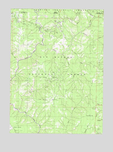
High Plateau Mountain, CA USGS Topographic Map
Click on map above to begin viewing in our Map Viewer.

This topographic map contains these locations and features:
Feature Name Type Latitude Longitude GNIS ID View Map
Bear CreekStreamN41.9598°W123.9248°256639View Map
Big Boy MineMineN41.9943°W123.8995°256895View Map
Bluebird MineMineN41.9257°W123.9762°1683090View Map
Bonanza MineMineN41.9326°W123.9465°1683091View Map
Browns MineMineN41.9282°W123.9512°257514View Map
Cedar CreekStreamN41.9973°W123.9687°1139510View Map
Cleopatra MineMineN41.9871°W123.9429°258453View Map
Cold SpringSpringN41.8837°W123.8906°1657317View Map
Cold Spring MountainSummitN41.8943°W123.8973°258563View Map
Diamond CreekStreamN41.9634°W123.9566°259342View Map
Diamond Creek MineMineN41.9732°W123.9170°1683096View Map
Elk CampLocaleN41.9512°W123.8795°259842View Map
Elk Camp RidgeRidgeN41.8901°W123.8970°259843View Map
Elk Camp Ridge TrailTrailN41.9293°W123.8906°275166View Map
Gasquet MountainSummitN41.8782°W123.9848°260502View Map
High Plateau CreekStreamN41.9546°W123.9315°261324View Map
High Plateau MountainSummitN41.9165°W123.9262°261325View Map
Judy MineMineN41.9279°W123.9801°1657329View Map
Lee Brown Ranch (historical)LocaleN41.9829°W123.9629°1682418View Map
North Fork Diamond CreekStreamN41.9767°W123.9086°254982View Map
Peridotite CanyonValleyN41.8971°W123.9854°264650View Map
Pine Flat Chromite MineMineN41.9776°W123.9823°1683108View Map
Pine Flat MountainSummitN41.9621°W123.9887°264756View Map
RocklandPopulated PlaceN41.9809°W123.9617°1682281View Map
Skyline MineMineN41.9173°W123.9931°1683110View Map
Still CreekStreamN41.9473°W123.9912°267746View Map
Sunny Brook ProspectMineN41.9757°W123.9190°1683111View Map
Tangarene MineMineN41.9543°W123.8851°1683114View Map
Toujours Gal MineMineN41.9493°W123.8812°1683116View Map
Webb MineMineN41.9368°W123.8756°1683117View Map
Wimer CreekStreamN41.9760°W123.9102°269245View Map

Note: Coordinates in the location and feature list above are referenced to NAD83 datum.


Copyright (C) 2008-2024 Ryan Niemi / Sunset Dynamics ... All Rights Reserved