TopoQuest Logo
Do you find TopoQuest useful?
Help keep TopoQuest running and adding new maps/features by donating!
Bitcoin:  19c7KJd3qBynnjoSw5npx9KScwjBe4ifkT
Litecoin:  LXs6TkuXGGXo1vDsWCkWVdjQX94eUKd6ui
Home View Maps Find Maps Find Places Resources & Links


Hickory Corners, Wisconsin Topographic Map

USGS Map Title: Hickory Corners, WI
USGS Map MRC: 45088A3
DRG (GeoTIFF) Download: o45088a3.tif


Neighboring USGS Topographic Map Quads:


  Mountain, WI  
45088B4
 

  Shay Lake, WI  
45088B3
 

  White Potato Lake, WI  
45088B2
 

  Breed, WI  
45088A4
 

  Hickory Corners, WI  
45088A3
 

  Kelly Lake, WI  
45088A2
 

  Berry Lake, WI  
44088H4
 

  Gillett, WI  
44088H3
 

  Oconto Falls North, WI  
44088H2


Map MRC Location:

N46°
W89°
N46°
W88°
H8 H7 H6 H5 H4 H3 H2 H1
G8 G7 G6 G5 G4 G3 G2 G1
F8 F7 F6 F5 F4 F3 F2 F1
E8 E7 E6 E5 E4 E3 E2 E1
D8 D7 D6 D5 D4 D3 D2 D1
C8 C7 C6 C5 C4 C3 C2 C1
B8 B7 B6 B5 B4 B3 B2 B1
A8 A7 A6 A5 A4 A3 A2 A1
N45°
W89°
N45°
W88°

Hickory Corners, WI USGS 1:24K Topographic Map Preview:
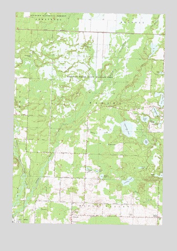
Hickory Corners, WI USGS Topographic Map
Click on map above to begin viewing in our Map Viewer.

This topographic map contains these locations and features:
Feature Name Type Latitude Longitude GNIS ID View Map
Bagley CreekStreamN45.0600°W88.3279°1578680View Map
Bagley Lookout TowerTowerN45.1058°W88.3168°1581168View Map
Community ChurchChurchN45.0014°W88.3251°1843951View Map
Cooley LakeLakeN45.0258°W88.2793°1579039View Map
Deer LakeLakeN45.0492°W88.2645°1579100View Map
FrostvillePopulated PlaceN45.0053°W88.3251°1579299View Map
Funk LakeLakeN45.0627°W88.2658°1579304View Map
Hickory CemeteryCemeteryN45.0061°W88.2748°1579440View Map
Hickory CornersPopulated PlaceN45.0047°W88.2540°1579441View Map
Hoerth LakeLakeN45.0313°W88.3049°1579463View Map
Impassable LakeLakeN45.0570°W88.2808°1579503View Map
Little Squaw LakeLakeN45.0601°W88.2530°1579715View Map
Makholm LakeLakeN45.0284°W88.3010°1579802View Map
No Mans LakeLakeN45.0473°W88.2969°1580015View Map
Our Redeemers ChurchChurchN45.0047°W88.3098°1570939View Map
Papoose LakeLakeN45.0611°W88.2571°1580087View Map
Peshtigo Brook School (historical)SchoolN45.0450°W88.3145°1844005View Map
Peshtigo Brook State Wildlife AreaParkN45.0861°W88.3115°1580125View Map
Peterson LakeLakeN45.0329°W88.3125°1580127View Map
Ponsegrau LakeLakeN45.0989°W88.3615°1580184View Map
Spies LakeLakeN45.0902°W88.2526°1580475View Map
Town of BagleyCivilN45.0703°W88.3023°1582741View Map
Turtle LakeLakeN45.0338°W88.2694°1580661View Map
Ucil LakeLakeN45.0749°W88.2530°1580689View Map
Village of SuringCivilN45.0007°W88.3693°1584260View Map
Wescott LakeLakeN45.0670°W88.2570°1580741View Map

Note: Coordinates in the location and feature list above are referenced to NAD83 datum.


Copyright (C) 2008-2024 Ryan Niemi / Sunset Dynamics ... All Rights Reserved