TopoQuest Logo
Do you find TopoQuest useful?
Help keep TopoQuest running and adding new maps/features by donating!
Bitcoin:  19c7KJd3qBynnjoSw5npx9KScwjBe4ifkT
Litecoin:  LXs6TkuXGGXo1vDsWCkWVdjQX94eUKd6ui
Home View Maps Find Maps Find Places Resources & Links


Helena Ridge, Washington Topographic Map

USGS Map Title: Helena Ridge, WA
USGS Map MRC: 48121B5
DRG (GeoTIFF) Download: o48121b5.tif


Neighboring USGS Topographic Map Quads:


  Fortson, WA  
48121C6
 

  Darrington, WA  
48121C5
 

  Prairie Mountain, WA  
48121C4
 

  Whitehorse Mountain, WA  
48121B6
 

  Helena Ridge, WA  
48121B5
 

  White Chuck Mountain, WA  
48121B4
 

  Mallardy Ridge, WA  
48121A6
 

  Silverton, WA  
48121A5
 

  Bedal, WA  
48121A4


Map MRC Location:

N49°
W122°
N49°
W121°
H8 H7 H6 H5 H4 H3 H2 H1
G8 G7 G6 G5 G4 G3 G2 G1
F8 F7 F6 F5 F4 F3 F2 F1
E8 E7 E6 E5 E4 E3 E2 E1
D8 D7 D6 D5 D4 D3 D2 D1
C8 C7 C6 C5 C4 C3 C2 C1
B8 B7 B6 B5 B4 B3 B2 B1
A8 A7 A6 A5 A4 A3 A2 A1
N48°
W122°
N48°
W121°

Helena Ridge, WA USGS 1:24K Topographic Map Preview:
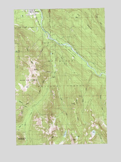
Helena Ridge, WA USGS Topographic Map
Click on map above to begin viewing in our Map Viewer.

This topographic map contains these locations and features:
Feature Name Type Latitude Longitude GNIS ID View Map
Asbestos CreekStreamN48.1909°W121.5715°1515967View Map
Asbestos FallsFallsN48.1868°W121.5748°1528526View Map
Backman County ParkParkN48.2365°W121.5876°1529861View Map
Backman CreekStreamN48.2232°W121.5793°1516018View Map
Burns CreekStreamN48.2107°W121.5701°1517120View Map
Cedar BasinBasinN48.1784°W121.6126°1517523View Map
Clear CreekStreamN48.1907°W121.5715°1517829View Map
Clear Creek CampgroundLocaleN48.2207°W121.5723°1529875View Map
Copper CreekStreamN48.1440°W121.6143°1518081View Map
Darrington High SchoolSchoolN48.2477°W121.6028°1530434View Map
Darrington Mobile Home Park 2Populated PlaceN48.2489°W121.6091°2607175View Map
Darrington Water Works DamDamN48.2332°W121.5946°1532197View Map
Decline CreekStreamN48.2293°W121.5012°1518575View Map
Devils ThumbSummitN48.1290°W121.5490°1518727View Map
Eightmile CreekStreamN48.1593°W121.6046°1519210View Map
Falls CreekStreamN48.2404°W121.5887°1530331View Map
Frog LakeLakeN48.2086°W121.5762°1519825View Map
Gold MountainSummitN48.2421°W121.5360°1520106View Map
Helena CreekStreamN48.1909°W121.5715°1520682View Map
Helena LakeLakeN48.1343°W121.5587°1520683View Map
Helena PeakSummitN48.1323°W121.5785°1520684View Map
Helena RidgeRidgeN48.1623°W121.5426°1520685View Map
Iron MountainSummitN48.1623°W121.5426°1521246View Map
Jumbo MountainSummitN48.1959°W121.5998°1521502View Map
Kids Place Early Learning CenterSchoolN48.2478°W121.6013°2605356View Map
Kirk LakeLakeN48.2439°W121.6161°1521700View Map
Lake AngelineLakeN48.2418°W121.5417°1515902View Map
Murphy CreekStreamN48.1918°W121.5160°1523523View Map
North LakeLakeN48.1354°W121.5196°1523892View Map
Windon LakeLakeN48.1315°W121.5429°1528525View Map

Note: Coordinates in the location and feature list above are referenced to NAD83 datum.


Copyright (C) 2008-2024 Ryan Niemi / Sunset Dynamics ... All Rights Reserved