TopoQuest Logo
Do you find TopoQuest useful?
Help keep TopoQuest running and adding new maps/features by donating!
Bitcoin:  19c7KJd3qBynnjoSw5npx9KScwjBe4ifkT
Litecoin:  LXs6TkuXGGXo1vDsWCkWVdjQX94eUKd6ui
Home View Maps Find Maps Find Places Resources & Links


Heald Pond, Maine Topographic Map

USGS Map Title: Heald Pond, ME
USGS Map MRC: 45070F2
DRG (GeoTIFF) Download: o45070f2.tif


Neighboring USGS Topographic Map Quads:


  Campbell Brook, ME  
45070G3
 

  Boundary Bald Mountain, ME  
45070G2
 

  Canada Falls Lake, ME  
45070G1
 

  Jackman, ME  
45070F3
 

  Heald Pond, ME  
45070F2
 

  Churchill Stream, ME  
45070F1
 

  Attean Pond, ME  
45070E3
 

  Catheart Mountain, ME  
45070E2
 

  Long Pond, ME  
45070E1


Map MRC Location:

N46°
W71°
N46°
W70°
H8 H7 H6 H5 H4 H3 H2 H1
G8 G7 G6 G5 G4 G3 G2 G1
F8 F7 F6 F5 F4 F3 F2 F1
E8 E7 E6 E5 E4 E3 E2 E1
D8 D7 D6 D5 D4 D3 D2 D1
C8 C7 C6 C5 C4 C3 C2 C1
B8 B7 B6 B5 B4 B3 B2 B1
A8 A7 A6 A5 A4 A3 A2 A1
N45°
W71°
N45°
W70°

Heald Pond, ME USGS 1:24K Topographic Map Preview:
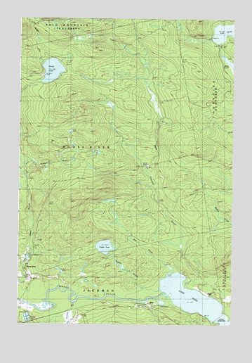
Heald Pond, ME USGS Topographic Map
Click on map above to begin viewing in our Map Viewer.

This topographic map contains these locations and features:
Feature Name Type Latitude Longitude GNIS ID View Map
Alder Brook TrailTrailN45.7448°W70.1773°561145View Map
BlairPopulated PlaceN45.6331°W70.1753°579142View Map
Bog BrookStreamN45.6470°W70.1617°562656View Map
Camp Number Two (historical)LocaleN45.7381°W70.2409°563408View Map
Fish PondLakeN45.7449°W70.1287°566217View Map
Halfway BrookStreamN45.6337°W70.2178°567483View Map
Heald InletStreamN45.7317°W70.2376°567857View Map
Heald PondLakeN45.7287°W70.2310°567860View Map
Heald Pond Camp (historical)LocaleN45.7264°W70.2367°567861View Map
Heald Stream DamDamN45.6510°W70.2448°1774269View Map
Holden CemeteryCemeteryN45.6415°W70.2496°2737027View Map
Hughey Camp (historical)LocaleN45.6473°W70.1540°568443View Map
Jackman Mill (historical)Populated PlaceN45.6462°W70.2451°568725View Map
Kimball BrookStreamN45.6898°W70.2487°569170View Map
Moose River CampgroundLocaleN45.6534°W70.2481°1908622View Map
Mud PondLakeN45.7308°W70.1255°571949View Map
Supply PondLakeN45.6567°W70.1989°576561View Map
Supply StreamStreamN45.6395°W70.1662°576562View Map
Town of Moose RiverCivilN45.6970°W70.2150°582606View Map
Upper Churchill StreamStreamN45.6414°W70.1534°577581View Map
Upper NarrowsChannelN45.6259°W70.1312°577634View Map
Whipple FarmLocaleN45.6381°W70.1412°578327View Map

Note: Coordinates in the location and feature list above are referenced to NAD83 datum.


Copyright (C) 2008-2024 Ryan Niemi / Sunset Dynamics ... All Rights Reserved