TopoQuest Logo
Do you find TopoQuest useful?
Help keep TopoQuest running and adding new maps/features by donating!
Bitcoin:  19c7KJd3qBynnjoSw5npx9KScwjBe4ifkT
Litecoin:  LXs6TkuXGGXo1vDsWCkWVdjQX94eUKd6ui
Home View Maps Find Maps Find Places Resources & Links


Hawley Gulch, Idaho Topographic Map

USGS Map Title: Hawley Gulch, ID
USGS Map MRC: 43111F5
DRG (GeoTIFF) Download: o43111f5.tif


Neighboring USGS Topographic Map Quads:


  Moody, ID  
43111G6
 

  White Owl Butte, ID  
43111G5
 

  Wright Creek, ID  
43111G4
 

  Heise, ID  
43111F6
 

  Hawley Gulch, ID  
43111F5
 

  Temple Peak, ID  
43111F4
 

  Poplar, ID  
43111E6
 

  Heise SE, ID  
43111E5
 

  Wheaton Mountain, ID  
43111E4


Map MRC Location:

N44°
W112°
N44°
W111°
H8 H7 H6 H5 H4 H3 H2 H1
G8 G7 G6 G5 G4 G3 G2 G1
F8 F7 F6 F5 F4 F3 F2 F1
E8 E7 E6 E5 E4 E3 E2 E1
D8 D7 D6 D5 D4 D3 D2 D1
C8 C7 C6 C5 C4 C3 C2 C1
B8 B7 B6 B5 B4 B3 B2 B1
A8 A7 A6 A5 A4 A3 A2 A1
N43°
W112°
N43°
W111°

Hawley Gulch, ID USGS 1:24K Topographic Map Preview:
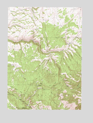
Hawley Gulch, ID USGS Topographic Map
Click on map above to begin viewing in our Map Viewer.

This topographic map contains these locations and features:
Feature Name Type Latitude Longitude GNIS ID View Map
Browning CreekStreamN43.7060°W111.5202°378273View Map
Buck SpringSpringN43.6723°W111.5803°378395View Map
Buckhorn SpringSpringN43.6367°W111.6041°378420View Map
Buckskin Morgan RidgeRidgeN43.6477°W111.6069°378435View Map
Clarke CreekStreamN43.6977°W111.5280°379375View Map
Cold SpringSpringN43.6493°W111.5616°379529View Map
Conner SpringSpringN43.6409°W111.5406°379623View Map
Dora SpringSpringN43.6267°W111.5868°380725View Map
East Fork Hilton CreekStreamN43.6899°W111.5088°381111View Map
Fish CreekStreamN43.6930°W111.5533°381739View Map
Garner CreekStreamN43.6977°W111.5302°382201View Map
Graham HollowValleyN43.6944°W111.5566°382488View Map
Hawley GulchValleyN43.6294°W111.5905°382975View Map
Hawley Gulch Ranger StationLocaleN43.6546°W111.5744°382976View Map
Hawley SpringSpringN43.6575°W111.5699°382978View Map
Hinckley CreekStreamN43.6532°W111.5063°383218View Map
Kelly SpringSpringN43.6432°W111.6201°384154View Map
Limekiln CanyonValleyN43.6616°W111.5316°384669View Map
Lookout MountainSummitN43.6357°W111.5677°386112View Map
Morning Glory MineMineN43.6485°W111.5347°387229View Map
Mud SpringsSpringN43.7210°W111.5265°387358View Map
North Moody CreekStreamN43.6957°W111.5530°397954View Map
Poison FlatFlatN43.6305°W111.5894°388644View Map
Pole CanyonValleyN43.6996°W111.5252°388672View Map
Sawmill GulchValleyN43.6991°W111.5266°389978View Map
South Moody CreekStreamN43.6957°W111.5530°398157View Map
Spooky CanyonValleyN43.6605°W111.5311°391137View Map
Spori CanyonValleyN43.6527°W111.5225°391138View Map
State CreekStreamN43.6857°W111.5561°391364View Map
Sweetwater CanyonValleyN43.6905°W111.5486°391769View Map
Windy RidgeRidgeN43.6552°W111.5475°393586View Map

Note: Coordinates in the location and feature list above are referenced to NAD83 datum.


Copyright (C) 2008-2024 Ryan Niemi / Sunset Dynamics ... All Rights Reserved