TopoQuest Logo
Do you find TopoQuest useful?
Help keep TopoQuest running and adding new maps/features by donating!
Bitcoin:  19c7KJd3qBynnjoSw5npx9KScwjBe4ifkT
Litecoin:  LXs6TkuXGGXo1vDsWCkWVdjQX94eUKd6ui
Home View Maps Find Maps Find Places Resources & Links


Harveys Lake, Pennsylvania Topographic Map

USGS Map Title: Harveys Lake, PA
USGS Map MRC: 41076C1
DRG (GeoTIFF) Download: o41076c1.tif


Neighboring USGS Topographic Map Quads:


  Dutch Mountain, PA  
41076D2
 

  Noxen, PA  
41076D1
 

  Center Moreland, PA  
41075D8
 

  Sweet Valley, PA  
41076C2
 

  Harveys Lake, PA  
41076C1
 

  Kingston, PA  
41075C8
 

  Shickshinny, PA  
41076B2
 

  Nanticoke, PA  
41076B1
 

  Wilkes-Barre West, PA  
41075B8


Map MRC Location:

N42°
W77°
N42°
W76°
H8 H7 H6 H5 H4 H3 H2 H1
G8 G7 G6 G5 G4 G3 G2 G1
F8 F7 F6 F5 F4 F3 F2 F1
E8 E7 E6 E5 E4 E3 E2 E1
D8 D7 D6 D5 D4 D3 D2 D1
C8 C7 C6 C5 C4 C3 C2 C1
B8 B7 B6 B5 B4 B3 B2 B1
A8 A7 A6 A5 A4 A3 A2 A1
N41°
W77°
N41°
W76°

Harveys Lake, PA USGS 1:24K Topographic Map Preview:
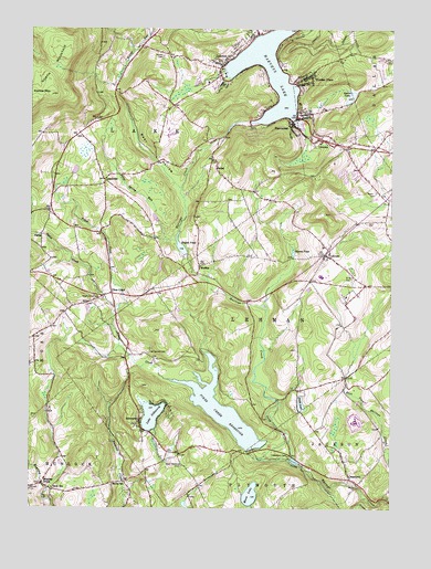
Harveys Lake, PA USGS Topographic Map
Click on map above to begin viewing in our Map Viewer.

This topographic map contains these locations and features:
Feature Name Type Latitude Longitude GNIS ID View Map
Back Mountain Census Designated PlaceCensusN41.3329°W76.0032°2389164View Map
Back Mountain Fire Department - Dallas Station 156BuildingN41.3183°W76.0207°2653068View Map
Bear HollowValleyN41.3340°W76.0736°1168882View Map
Bear Hollow CreekStreamN41.3337°W76.0730°1212409View Map
Borough of Harveys LakeCivilN41.3625°W76.0384°1215391View Map
Bryant PondReservoirN41.3198°W76.0733°1170486View Map
Bryant Pond DamDamN41.3167°W76.0713°1195471View Map
Cease MillsPopulated PlaceN41.2526°W76.0271°1200572View Map
CeasetownPopulated PlaceN41.2579°W76.0130°1171356View Map
Ceasetown CemeteryCemeteryN41.2640°W76.0346°1171357View Map
Countryside Airport (historical)AirportN41.2837°W76.0352°1194206View Map
FadesPopulated PlaceN41.3206°W76.1208°1203541View Map
Fades CreekStreamN41.3217°W76.1247°1192440View Map
Good Shepherd CemeteryCemeteryN41.2612°W76.0716°1175800View Map
Harveys LakeReservoirN41.3649°W76.0413°1200085View Map
Harveys Lake Borough Police DepartmentBuildingN41.3506°W76.0291°2780575View Map
Harveys Lake Post OfficePost OfficeN41.3643°W76.0598°2773152View Map
IdetownPopulated PlaceN41.3470°W76.0252°1177684View Map
Jonathan R Davis Volunteer Fire CompanyBuildingN41.3445°W76.0163°2653440View Map
Kocher CemeteryCemeteryN41.3678°W76.0791°1178630View Map
Kocher MountainSummitN41.3579°W76.1174°1178632View Map
LakePopulated PlaceN41.3526°W76.0324°1197934View Map
Lake SilkworthLakeN41.2743°W76.0823°1187663View Map
Lake Silkworth Volunteer Fire CompanyBuildingN41.2738°W76.0865°2653359View Map
LaketonPopulated PlaceN41.3656°W76.0577°1178803View Map
LehmanPopulated PlaceN41.3170°W76.0224°1179164View Map
Lehman Airport (historical)AirportN41.3167°W76.0496°1194210View Map
Lehman Post OfficePost OfficeN41.3157°W76.0227°2773182View Map
Lehman Township Police DepartmentBuildingN41.3084°W76.0196°2780581View Map
Lewis RunStreamN41.2554°W76.1180°1212410View Map
LoyalvillePopulated PlaceN41.3362°W76.0991°1204073View Map
Maple Grove CemeteryCemeteryN41.3045°W76.1005°1180327View Map
MeekerPopulated PlaceN41.3137°W76.0658°1204147View Map
Moon LakeLakeN41.2537°W76.0481°1181495View Map
Mount Carmel CemeteryCemeteryN41.2909°W76.0833°1181667View Map
Oakdale CemeteryCemeteryN41.2548°W76.1241°1182837View Map
OrchardLocaleN41.2570°W76.0955°1212411View Map
OutletPopulated PlaceN41.3392°W76.0602°1183129View Map
Outlet Station (historical)LocaleN41.3617°W76.0010°1197932View Map
Paint Spring RunStreamN41.3206°W76.0741°1183200View Map
Parks CemeteryCemeteryN41.3334°W76.0049°1183329View Map
Pennsylvania State University - Wilkes-Barre CampusSchoolN41.3056°W76.0149°1211539View Map
Pikes CreekPopulated PlaceN41.3065°W76.0960°1204391View Map
Pikes CreekStreamN41.2837°W76.0766°1183731View Map
Pikes Creek Census Designated PlaceCensusN41.3086°W76.1029°2634424View Map
Pikes Creek DamDamN41.2659°W76.0456°1195420View Map
Pikes Creek ReservoirReservoirN41.2758°W76.0577°1183732View Map
Roaring BrookPopulated PlaceN41.2565°W76.1199°1193195View Map
Rock SchoolSchoolN41.2554°W76.1163°1185295View Map
RugglesPopulated PlaceN41.3717°W76.0849°1197933View Map
Saint Anns CemeteryCemeteryN41.3101°W76.0127°1185777View Map
Santee SchoolSchoolN41.2567°W76.0916°1186976View Map
Scarlat LakeLakeN41.3574°W76.0142°1187061View Map
ShawanesePopulated PlaceN41.3515°W76.0341°1187399View Map
Shawanese Post Office (historical)Post OfficeN41.3515°W76.0341°2027097View Map
SilkworthPopulated PlaceN41.2723°W76.0863°1187662View Map
Silkworth Census Designated PlaceCensusN41.2698°W76.0748°2634426View Map
Simms PondLakeN41.3176°W76.0333°1187700View Map
Smith PondLakeN41.2772°W76.0307°1187881View Map
State Correctional Institution DallasBuildingN41.2728°W76.0114°2757199View Map
Township of LakeCivilN41.3474°W76.1059°1216723View Map
Township of LehmanCivilN41.2993°W76.0432°1216724View Map
Wordan PlacePopulated PlaceN41.3634°W76.0288°1191789View Map
WPSU-FM (Lehman)TowerN41.3054°W76.0155°1200302View Map

Note: Coordinates in the location and feature list above are referenced to NAD83 datum.


Copyright (C) 2008-2024 Ryan Niemi / Sunset Dynamics ... All Rights Reserved