TopoQuest Logo
Do you find TopoQuest useful?
Help keep TopoQuest running and adding new maps/features by donating!
Bitcoin:  19c7KJd3qBynnjoSw5npx9KScwjBe4ifkT
Litecoin:  LXs6TkuXGGXo1vDsWCkWVdjQX94eUKd6ui
Home View Maps Find Maps Find Places Resources & Links


Harvard Lakes, Colorado Topographic Map

USGS Map Title: Harvard Lakes, CO
USGS Map MRC: 38106H2
DRG (GeoTIFF) Download: o38106h2.tif


Neighboring USGS Topographic Map Quads:


  Granite, CO  
39106A3
 

  South Peak, CO  
39106A2
 

  Jones Hill, CO  
39106A1
 

  Mount Harvard, CO  
38106H3
 

  Harvard Lakes, CO  
38106H2
 

  Marmot Peak, CO  
38106H1
 

  Mount Yale, CO  
38106G3
 

  Buena Vista West, CO  
38106G2
 

  Buena Vista East, CO  
38106G1


Map MRC Location:

N39°
W107°
N39°
W106°
H8 H7 H6 H5 H4 H3 H2 H1
G8 G7 G6 G5 G4 G3 G2 G1
F8 F7 F6 F5 F4 F3 F2 F1
E8 E7 E6 E5 E4 E3 E2 E1
D8 D7 D6 D5 D4 D3 D2 D1
C8 C7 C6 C5 C4 C3 C2 C1
B8 B7 B6 B5 B4 B3 B2 B1
A8 A7 A6 A5 A4 A3 A2 A1
N38°
W107°
N38°
W106°

Harvard Lakes, CO USGS 1:24K Topographic Map Preview:
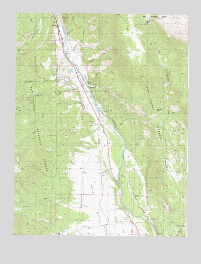
Harvard Lakes, CO USGS Topographic Map
Click on map above to begin viewing in our Map Viewer.

This topographic map contains these locations and features:
Feature Name Type Latitude Longitude GNIS ID View Map
3 Elk DamDamN38.8950°W106.2156°201318View Map
3 Elk ReservoirReservoirN38.8950°W106.2156°201319View Map
AmericusPopulated PlaceN38.9025°W106.1656°189265View Map
Berrian ParkFlatN38.8958°W106.1950°189249View Map
Berrian SchoolLocaleN38.8831°W106.1836°189248View Map
Buena Vista DivisionCivilN38.8818°W106.2408°1935414View Map
Buffalo CreekStreamN38.9678°W106.1997°196820View Map
Chaffee County Fire Protection District Station 3BuildingN38.9624°W106.2037°2667288View Map
Elephant RockPillarN38.8850°W106.1517°189266View Map
Ferris CreekStreamN38.9106°W106.1897°196827View Map
Four Elk CreekStreamN38.9100°W106.1750°189250View Map
Fourmile Creek - Buffalo Meadows TrailTrailN38.9967°W106.1528°169372View Map
Frenchman CreekStreamN38.9342°W106.1759°189190View Map
Gable CreekStreamN38.9597°W106.1984°196823View Map
Harvard LakesLakeN38.8917°W106.2406°189247View Map
Harvard TrailTrailN38.9344°W106.2295°203384View Map
Langhoff GulchValleyN38.9879°W106.2135°180444View Map
Little Annie MineMineN38.9461°W106.1481°189263View Map
McFadden CreekStreamN38.9656°W106.2109°189253View Map
Morris CreekStreamN38.9469°W106.1911°189254View Map
Morrison CreekStreamN38.9600°W106.1992°189187View Map
Pine Creek SchoolLocaleN38.9767°W106.2156°189252View Map
Powell CreekStreamN38.8867°W106.1645°189184View Map
PrincetonPopulated PlaceN38.9933°W106.2200°189251View Map
RiversidePopulated PlaceN38.9383°W106.1839°189256View Map
Riverside DitchCanalN38.9178°W106.1853°189257View Map
Riverside SchoolLocaleN38.9422°W106.1892°189255View Map
Rock CreekStreamN38.9364°W106.1770°196822View Map
Sevenmile CreekStreamN38.8758°W106.1297°189273View Map
Three Elk CreekStreamN38.8906°W106.1692°189183View Map
Tumble CreekStreamN38.9706°W106.2067°2785992View Map
Wapaca TrailTrailN38.9467°W106.2436°169415View Map

Note: Coordinates in the location and feature list above are referenced to NAD83 datum.


Copyright (C) 2008-2024 Ryan Niemi / Sunset Dynamics ... All Rights Reserved