TopoQuest Logo
Do you find TopoQuest useful?
Help keep TopoQuest running and adding new maps/features by donating!
Bitcoin:  19c7KJd3qBynnjoSw5npx9KScwjBe4ifkT
Litecoin:  LXs6TkuXGGXo1vDsWCkWVdjQX94eUKd6ui
Home View Maps Find Maps Find Places Resources & Links


Adelanto, California Topographic Map

USGS Map Title: Adelanto, CA
USGS Map MRC: 34117E4
DRG (GeoTIFF) Download: o34117e4.tif


Neighboring USGS Topographic Map Quads:


  Shadow Mountains, CA  
34117F5
 

  Victorville NW, CA  
34117F4
 

  Helendale, CA  
34117F3
 

  Shadow Mountains SE, CA  
34117E5
 

  Adelanto, CA  
34117E4
 

  Victorville, CA  
34117E3
 

  Phelan, CA  
34117D5
 

  Baldy Mesa, CA  
34117D4
 

  Hesperia, CA  
34117D3


Map MRC Location:

N35°
W118°
N35°
W117°
H8 H7 H6 H5 H4 H3 H2 H1
G8 G7 G6 G5 G4 G3 G2 G1
F8 F7 F6 F5 F4 F3 F2 F1
E8 E7 E6 E5 E4 E3 E2 E1
D8 D7 D6 D5 D4 D3 D2 D1
C8 C7 C6 C5 C4 C3 C2 C1
B8 B7 B6 B5 B4 B3 B2 B1
A8 A7 A6 A5 A4 A3 A2 A1
N34°
W118°
N34°
W117°

Adelanto, CA USGS 1:24K Topographic Map Preview:
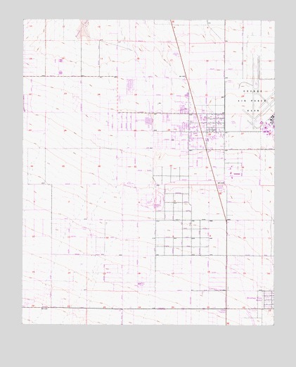
Adelanto, CA USGS Topographic Map
Click on map above to begin viewing in our Map Viewer.

This topographic map contains these locations and features:
Feature Name Type Latitude Longitude GNIS ID View Map
AdelantoPopulated PlaceN34.5828°W117.4092°1660232View Map
Adelanto AirportAirportN34.5382°W117.4679°1653200View Map
Adelanto Branch San Bernardino County LibraryBuildingN34.5794°W117.4139°1841527View Map
Adelanto Christian SchoolSchoolN34.5903°W117.4175°1841528View Map
Adelanto Correctional FacilityBuildingN34.5593°W117.4411°1841529View Map
Adelanto Elementary SchoolSchoolN34.5761°W117.4089°1841530View Map
Adelanto ParkParkN34.5758°W117.4078°1841531View Map
Adelanto Post OfficePost OfficeN34.5602°W117.4132°1841532View Map
Adobe CornersLocaleN34.5069°W117.3995°238424View Map
Bartlett Square Shopping CenterLocaleN34.5803°W117.4181°1841535View Map
City of AdelantoCivilN34.5815°W117.4395°2409663View Map
Desert View Modified Community Correctional FacilityBuildingN34.5599°W117.4373°2739966View Map
George Air Force Base (historical)MilitaryN34.5947°W117.3842°2090481View Map
Harold H Bender SchoolSchoolN34.5844°W117.4445°1841541View Map
Howard Loy ParkParkN34.5725°W117.4081°1841544View Map
Ipp Adelanto HeliportAirportN34.5478°W117.4373°1653199View Map
Maverick Baseball StadiumParkN34.5550°W117.4014°1841546View Map
Richardson ParkParkN34.5728°W117.4125°1841550View Map
San Bernardino County Fire Department Station 321 AdelantoBuildingN34.5799°W117.4088°2664538View Map
San Bernardino County Fire Department Station 322 AdelantoBuildingN34.5580°W117.4391°2664543View Map
San Bernardino County Sheriff's Department - Victor ValleyBuildingN34.5787°W117.4111°2756250View Map
South AdelantoPopulated PlaceN34.5283°W117.4170°1841553View Map
Southern California Logistics AirportAirportN34.5888°W117.3767°2650984View Map
Sunrise Motorcycle ParkParkN34.6103°W117.4259°1841555View Map
Victor Valley Baptist ChurchChurchN34.5119°W117.3750°1841616View Map
Victorville Army Air Field (historical)MilitaryN34.5861°W117.3831°1989914View Map
Westside ParkParkN34.5825°W117.4225°1841560View Map
Westside Park Elementary SchoolSchoolN34.5823°W117.4225°1841561View Map

Note: Coordinates in the location and feature list above are referenced to NAD83 datum.


Copyright (C) 2008-2024 Ryan Niemi / Sunset Dynamics ... All Rights Reserved