TopoQuest Logo
Do you find TopoQuest useful?
Help keep TopoQuest running and adding new maps/features by donating!
Bitcoin:  19c7KJd3qBynnjoSw5npx9KScwjBe4ifkT
Litecoin:  LXs6TkuXGGXo1vDsWCkWVdjQX94eUKd6ui
Home View Maps Find Maps Find Places Resources & Links


Grizzly Peak, California Topographic Map

USGS Map Title: Grizzly Peak, CA
USGS Map MRC: 41121B8
DRG (GeoTIFF) Download: o41121b8.tif


Neighboring USGS Topographic Map Quads:


  Elk Spring, CA  
41122C1
 

  Kinyon, CA  
41121C8
 

  Bartle, CA  
41121C7
 

  Lake McCloud, CA  
41122B1
 

  Grizzly Peak, CA  
41121B8
 

  Dead Horse Summit, CA  
41121B7
 

  Shoeinhorse Mountain, CA  
41122A1
 

  Big Bend, CA  
41121A8
 

  Skunk Ridge, CA  
41121A7


Map MRC Location:

N42°
W122°
N42°
W121°
H8 H7 H6 H5 H4 H3 H2 H1
G8 G7 G6 G5 G4 G3 G2 G1
F8 F7 F6 F5 F4 F3 F2 F1
E8 E7 E6 E5 E4 E3 E2 E1
D8 D7 D6 D5 D4 D3 D2 D1
C8 C7 C6 C5 C4 C3 C2 C1
B8 B7 B6 B5 B4 B3 B2 B1
A8 A7 A6 A5 A4 A3 A2 A1
N41°
W122°
N41°
W121°

Grizzly Peak, CA USGS 1:24K Topographic Map Preview:
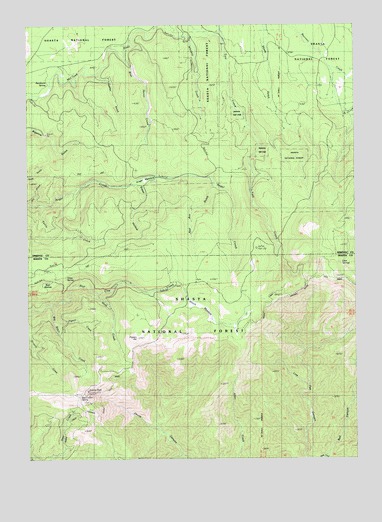
Grizzly Peak, CA USGS Topographic Map
Click on map above to begin viewing in our Map Viewer.

This topographic map contains these locations and features:
Feature Name Type Latitude Longitude GNIS ID View Map
Angel MeadowFlatN41.2052°W121.9561°256254View Map
Angel Meadow TrailTrailN41.1913°W121.9500°256255View Map
Bear WallowBasinN41.1743°W121.9950°218899View Map
Big Basin CreekStreamN41.1693°W121.9925°256878View Map
Blue Heron CreekStreamN41.2407°W121.9644°257244View Map
Bull CanyonValleyN41.1268°W121.8881°257656View Map
Bundoora SpringSpringN41.2330°W121.9928°257686View Map
Cone Point TrailTrailN41.1765°W121.9747°258638View Map
Dad Lofton SpringSpringN41.1435°W121.9812°259007View Map
Deer SpringsSpringN41.1810°W121.8839°259250View Map
Dry GulchValleyN41.1996°W121.9994°259568View Map
Gold CreekStreamN41.1724°W121.9744°260644View Map
Gopher GulchValleyN41.2352°W121.9739°260714View Map
Grass SpringSpringN41.1775°W121.9865°260792View Map
Grizzly PeakSummitN41.1446°W121.9792°260933View Map
Live Oak CanyonValleyN41.1277°W121.8967°262755View Map
Pigeon CreekStreamN41.1652°W121.9914°264716View Map
Pigeon HillSummitN41.1596°W121.9606°264719View Map
Red Ant GulchValleyN41.2029°W121.9317°265251View Map
Steep HollowValleyN41.2024°W121.9572°267713View Map
Stouts MeadowFlatN41.1693°W121.9344°267797View Map
Turtle CreekStreamN41.1985°W121.9961°268503View Map
Whiskey CreekStreamN41.2471°W121.9436°268963View Map

Note: Coordinates in the location and feature list above are referenced to NAD83 datum.


Copyright (C) 2008-2024 Ryan Niemi / Sunset Dynamics ... All Rights Reserved