TopoQuest Logo
Do you find TopoQuest useful?
Help keep TopoQuest running and adding new maps/features by donating!
Bitcoin:  19c7KJd3qBynnjoSw5npx9KScwjBe4ifkT
Litecoin:  LXs6TkuXGGXo1vDsWCkWVdjQX94eUKd6ui
Home View Maps Find Maps Find Places Resources & Links


Grimes Pass, Idaho Topographic Map

USGS Map Title: Grimes Pass, ID
USGS Map MRC: 44115A7
DRG (GeoTIFF) Download: o44115a7.tif


Neighboring USGS Topographic Map Quads:


  Pyle Creek, ID  
44115B8
 

  Lightning Ridge, ID  
44115B7
 

  Scott Creek, ID  
44115B6
 

  Garden Valley, ID  
44115A8
 

  Grimes Pass, ID  
44115A7
 

  Pine Flat, ID  
44115A6
 

  Placerville, ID  
43115H8
 

  Pioneerville, ID  
43115H7
 

  Sunset Mountain, ID  
43115H6


Map MRC Location:

N45°
W116°
N45°
W115°
H8 H7 H6 H5 H4 H3 H2 H1
G8 G7 G6 G5 G4 G3 G2 G1
F8 F7 F6 F5 F4 F3 F2 F1
E8 E7 E6 E5 E4 E3 E2 E1
D8 D7 D6 D5 D4 D3 D2 D1
C8 C7 C6 C5 C4 C3 C2 C1
B8 B7 B6 B5 B4 B3 B2 B1
A8 A7 A6 A5 A4 A3 A2 A1
N44°
W116°
N44°
W115°

Grimes Pass, ID USGS 1:24K Topographic Map Preview:
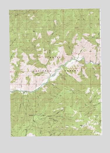
Grimes Pass, ID USGS Topographic Map
Click on map above to begin viewing in our Map Viewer.

This topographic map contains these locations and features:
Feature Name Type Latitude Longitude GNIS ID View Map
Ader GulchValleyN44.0182°W115.8221°376478View Map
Bae CreekStreamN44.0621°W115.8123°371331View Map
Basque SpringSpringN44.1032°W115.8415°377021View Map
Big Gallagher CreekStreamN44.0755°W115.7859°377534View Map
Big Pine CreekStreamN44.0707°W115.7579°399790View Map
Black Bear CreekStreamN44.0696°W115.8037°377718View Map
Calderwood CreekStreamN44.0446°W115.8615°378701View Map
Carlson GulchValleyN44.0291°W115.7651°378941View Map
Charlotte GulchValleyN44.0177°W115.8368°379202View Map
Comeback MineMineN44.0038°W115.8209°379598View Map
Cup CreekStreamN44.0363°W115.7740°380163View Map
Danskin CreekStreamN44.0591°W115.8193°380242View Map
Diana School (historical)SchoolN44.0199°W115.8418°380583View Map
Dodge CreekStreamN44.0532°W115.8234°380664View Map
East Fork Big Pine CreekStreamN44.0963°W115.7579°381056View Map
Forks of Big Pine Creek CampgroundLocaleN44.0996°W115.7590°381933View Map
Gallagher Guard Station (historical)LocaleN44.0768°W115.7854°382152View Map
Gallagher PastureFlatN44.0757°W115.7821°394100View Map
Gallagher PeakSummitN44.1063°W115.7857°399052View Map
Golden Age MineMineN44.0207°W115.8282°382405View Map
Golden Age Mine HeliportAirportN44.0027°W115.8121°400840View Map
Grayback CreekStreamN44.0707°W115.7718°382607View Map
Grimes MonumentParkN44.0224°W115.8446°382687View Map
Grimes PassPopulated PlaceN44.0446°W115.8573°396593View Map
Grimes PassGapN44.0196°W115.8437°382688View Map
Hanks CreekStreamN44.0446°W115.8504°382868View Map
Hopkins CreekStreamN44.0457°W115.8387°383325View Map
Jackson PeakSummitN44.0096°W115.7762°383839View Map
Left Fork Danskin CreekStreamN44.0688°W115.8254°384525View Map
Little Fall CreekStreamN44.0705°W115.7598°384826View Map
Little FallsFallsN44.0724°W115.7626°384829View Map
Little Gallagher CreekStreamN44.0746°W115.7840°384841View Map
Middle Fork Big Pine CreekStreamN44.0960°W115.7579°386797View Map
Missouri MineMineN44.0005°W115.8562°387052View Map
Mohawk GulchValleyN44.0205°W115.8140°387073View Map
Oro Mine (historical)MineN44.0096°W115.8468°387997View Map
Pinch GulchValleyN44.0238°W115.7668°388465View Map
Pine Creek CampgroundLocaleN44.0996°W115.7590°398407View Map
Rae CreekStreamN44.0630°W115.8126°398409View Map
Russell CreekStreamN44.0449°W115.8604°389738View Map
Schoolhouse CreekStreamN44.0441°W115.8526°390025View Map
Slide GulchValleyN44.0443°W115.8407°390617View Map
Sweet CreekStreamN44.0446°W115.8548°391766View Map
West Fork Big Pine CreekStreamN44.0999°W115.7532°393053View Map
Wet GulchValleyN44.0224°W115.7551°393264View Map
Whiskey CreekStreamN44.0624°W115.8229°393288View Map
Whitecap CreekStreamN44.0330°W115.7709°393378View Map

Note: Coordinates in the location and feature list above are referenced to NAD83 datum.


Copyright (C) 2008-2024 Ryan Niemi / Sunset Dynamics ... All Rights Reserved