TopoQuest Logo
Do you find TopoQuest useful?
Help keep TopoQuest running and adding new maps/features by donating!
Bitcoin:  19c7KJd3qBynnjoSw5npx9KScwjBe4ifkT
Litecoin:  LXs6TkuXGGXo1vDsWCkWVdjQX94eUKd6ui
Home View Maps Find Maps Find Places Resources & Links


Greenwood Butte, Oregon Topographic Map

USGS Map Title: Greenwood Butte, OR
USGS Map MRC: 45117F1
DRG (GeoTIFF) Download: o45117f1.tif


Neighboring USGS Topographic Map Quads:


  Table Mountain, OR  
45117G2
 

  Billy Meadows, OR  
45117G1
 

  Poison Point, OR  
45116G8
 

  Roberts Butte, OR  
45117F2
 

  Greenwood Butte, OR  
45117F1
 

  Zumwalt, OR  
45116F8
 

  Elk Mountain, OR  
45117E2
 

  Elk Mountain SE, OR  
45117E1
 

  Findley Buttes, OR  
45116E8


Map MRC Location:

N46°
W118°
N46°
W117°
H8 H7 H6 H5 H4 H3 H2 H1
G8 G7 G6 G5 G4 G3 G2 G1
F8 F7 F6 F5 F4 F3 F2 F1
E8 E7 E6 E5 E4 E3 E2 E1
D8 D7 D6 D5 D4 D3 D2 D1
C8 C7 C6 C5 C4 C3 C2 C1
B8 B7 B6 B5 B4 B3 B2 B1
A8 A7 A6 A5 A4 A3 A2 A1
N45°
W118°
N45°
W117°

Greenwood Butte, OR USGS 1:24K Topographic Map Preview:
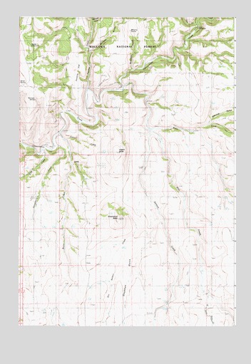
Greenwood Butte, OR USGS Topographic Map
Click on map above to begin viewing in our Map Viewer.

This topographic map contains these locations and features:
Feature Name Type Latitude Longitude GNIS ID View Map
Alder CreekStreamN45.7052°W117.0499°1137082View Map
Arcadia Post Office (historical)Post OfficeN45.6415°W117.0010°1164851View Map
B and H RanchLocaleN45.7165°W117.0821°1638639View Map
Boner SpringSpringN45.7236°W117.1246°1158134View Map
Butte CreekStreamN45.7024°W117.1024°1139060View Map
Calf CreekStreamN45.6960°W117.1121°1139153View Map
Corral CreekStreamN45.7004°W117.0982°1140137View Map
Deadman GulchValleyN45.6640°W117.0465°1140743View Map
Doe CreekStreamN45.7477°W117.0227°1141112View Map
Dry Salmon CreekStreamN45.6729°W117.0463°1141357View Map
Gooseberry CreekStreamN45.6968°W117.1046°1142859View Map
Greenwood ButteSummitN45.6682°W117.0679°1158270View Map
Haskin ButteSummitN45.6963°W117.0696°1158282View Map
Hinton RanchLocaleN45.7121°W117.0982°1143617View Map
LewisPopulated PlaceN45.6907°W117.0946°1144961View Map
Lewis Post Office (historical)Post OfficeN45.6907°W117.0946°1165533View Map
Lewis School (historical)SchoolN45.6986°W117.1108°1144971View Map
McCarty GulchValleyN45.7363°W117.0840°1158353View Map
McCarty SpringSpringN45.7444°W117.0608°1145932View Map
Muddy ReservoirReservoirN45.7389°W117.1184°1146617View Map
Peavine CreekStreamN45.7199°W117.0860°1147541View Map
Pine CreekStreamN45.7038°W117.0499°1158422View Map
Poverty FlatFlatN45.7293°W117.0921°1147953View Map
Romaine GulchValleyN45.7277°W117.0593°1154339View Map
Salmon CreekStreamN45.7213°W117.0654°1148977View Map
Spangler SpringSpringN45.7167°W117.1159°1150100View Map
Sterling GulchValleyN45.7068°W117.0163°1150411View Map
Vigne Recreation SiteLocaleN45.7454°W117.0218°1156636View Map
Warnock GulchValleyN45.7482°W117.0824°1151911View Map
West Fork Pine CreekStreamN45.6374°W117.0163°1152861View Map

Note: Coordinates in the location and feature list above are referenced to NAD83 datum.


Copyright (C) 2008-2024 Ryan Niemi / Sunset Dynamics ... All Rights Reserved