TopoQuest Logo
Do you find TopoQuest useful?
Help keep TopoQuest running and adding new maps/features by donating!
Bitcoin:  19c7KJd3qBynnjoSw5npx9KScwjBe4ifkT
Litecoin:  LXs6TkuXGGXo1vDsWCkWVdjQX94eUKd6ui
Home View Maps Find Maps Find Places Resources & Links


Goshen, Alabama Topographic Map

USGS Map Title: Goshen, AL
USGS Map MRC: 31086F1
DRG (GeoTIFF) Download: o31086f1.tif


Neighboring USGS Topographic Map Quads:


  Petrey, AL  
31086G2
 

  Youngblood, AL  
31086G1
 

  Troy, AL  
31085G8
 

  Glenwood, AL  
31086F2
 

  Goshen, AL  
31086F1
 

  Brundidge NW, AL  
31085F8
 

  Bullock, AL  
31086E2
 

  Bluff Springs, AL  
31086E1
 

  Victoria, AL  
31085E8


Map MRC Location:

N32°
W87°
N32°
W86°
H8 H7 H6 H5 H4 H3 H2 H1
G8 G7 G6 G5 G4 G3 G2 G1
F8 F7 F6 F5 F4 F3 F2 F1
E8 E7 E6 E5 E4 E3 E2 E1
D8 D7 D6 D5 D4 D3 D2 D1
C8 C7 C6 C5 C4 C3 C2 C1
B8 B7 B6 B5 B4 B3 B2 B1
A8 A7 A6 A5 A4 A3 A2 A1
N31°
W87°
N31°
W86°

Goshen, AL USGS 1:24K Topographic Map Preview:
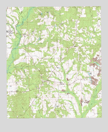
Goshen, AL USGS Topographic Map
Click on map above to begin viewing in our Map Viewer.

This topographic map contains these locations and features:
Feature Name Type Latitude Longitude GNIS ID View Map
BalticPopulated PlaceN31.6518°W86.0041°156018View Map
Bear BranchStreamN31.6252°W86.0263°113640View Map
Bethel ChurchChurchN31.7221°W86.0897°114045View Map
Billwood CreekStreamN31.6768°W86.1236°114346View Map
Broadhead CreekStreamN31.6796°W86.1244°114932View Map
Dallasville Post Office (historical)Post OfficeN31.6885°W86.0991°139841View Map
Davidson CemeteryCemeteryN31.7454°W86.1169°139842View Map
Dogwood AcresPopulated PlaceN31.7071°W86.0577°139844View Map
Dolton BranchStreamN31.6671°W86.0483°117365View Map
Dunbar PondReservoirN31.7421°W86.0780°117656View Map
Elam BranchStreamN31.7288°W86.1183°117898View Map
Elam ChurchChurchN31.7485°W86.1238°117901View Map
Elam-Davidson Memorial CemeteryCemeteryN31.7452°W86.1244°139847View Map
Folmars PondReservoirN31.7141°W86.0816°118468View Map
Friendship ChurchChurchN31.6554°W86.1125°118667View Map
Gainers Store Post Office (historical)Post OfficeN31.6715°W86.0186°166100View Map
Gibson PondLakeN31.6614°W86.1214°118931View Map
GoshenPopulated PlaceN31.7229°W86.1183°119184View Map
Goshen Elementary SchoolSchoolN31.7193°W86.1030°139863View Map
Goshen High SchoolSchoolN31.7227°W86.1241°163530View Map
Goshen Post OfficePost OfficeN31.7215°W86.1209°167917View Map
HallsvillePopulated PlaceN31.7454°W86.1038°139865View Map
Hanchey (historical)LocaleN31.7321°W86.1091°139867View Map
HendersonPopulated PlaceN31.6665°W86.0733°119946View Map
Henderson CemeteryCemeteryN31.6918°W86.0030°163533View Map
Henderson ChurchChurchN31.6646°W86.0783°163534View Map
Henderson ChurchChurchN31.6665°W86.0755°139869View Map
Henderson Memorial CemeteryCemeteryN31.6574°W86.0838°139870View Map
Henderson Volunteer Fire DepartmentBuildingN31.6664°W86.0730°2691435View Map
Henderson-Spring Hill DivisionCivilN31.6801°W86.0300°165931View Map
Hillcrest CemeteryCemeteryN31.7185°W86.1211°120119View Map
Hopewell CemeteryCemeteryN31.6638°W86.0527°163537View Map
Hopewell Primitive Baptist ChurchChurchN31.6649°W86.0541°120365View Map
Howard CreekStreamN31.7152°W86.1077°120475View Map
Lewis CemeteryCemeteryN31.6604°W86.0794°163544View Map
Little OakPopulated PlaceN31.7310°W86.0538°156617View Map
Little Oak Methodist ChurchChurchN31.7318°W86.0544°139885View Map
Loflins PondReservoirN31.6813°W86.0554°121959View Map
Lynn Mill CreekStreamN31.7363°W86.1025°122124View Map
Mount Hillard ChurchChurchN31.7346°W86.0036°152427View Map
Murphree LakeReservoirN31.7335°W86.0833°129940View Map
Murphree Lake DamDamN31.7335°W86.0833°129939View Map
Norris PondReservoirN31.6618°W86.0066°139893View Map
Ogletree BranchStreamN31.6724°W86.0488°164092View Map
Old Salem CemeteryCemeteryN31.7402°W86.0630°124244View Map
PalmyraPopulated PlaceN31.6679°W86.0272°139900View Map
Parks BranchStreamN31.6538°W86.0419°124453View Map
Pleasant RidgePopulated PlaceN31.6646°W86.0544°125028View Map
Pleasant Ridge ChurchChurchN31.6649°W86.0483°139912View Map
Pleasant Ridge Elementary SchoolSchoolN31.6568°W86.0575°165616View Map
Robertson BranchStreamN31.7288°W86.1183°125705View Map
Sanders CreekStreamN31.6813°W86.1038°126345View Map
Sanders HillPopulated PlaceN31.7054°W86.0363°126347View Map
Sanders PondReservoirN31.6742°W86.0161°126349View Map
Sanders Pond DamDamN31.6735°W86.0149°129922View Map
Sanford-Barron CemeteryCemeteryN31.6907°W86.0302°163562View Map
Shaver PondReservoirN31.7437°W86.0697°126648View Map
Silers Mill CreekStreamN31.6268°W86.0255°126843View Map
Smart Road AirportAirportN31.7406°W86.0055°2676340View Map
Smilie CemeteryCemeteryN31.7179°W86.1027°163565View Map
Smilies Mill CreekStreamN31.7043°W86.1102°126983View Map
Spillars CemeteryCemeteryN31.7143°W86.0599°163566View Map
Stewarts PondLakeN31.6381°W86.0602°153575View Map
Stringer High School (historical)SchoolN31.7193°W86.1022°164130View Map
Tenmile BranchStreamN31.6863°W86.0522°127755View Map
Town of GoshenCivilN31.7182°W86.1242°2406594View Map
Ward-Thompson CemeteryCemeteryN31.7349°W86.0972°163574View Map
Warrick CreekStreamN31.6796°W86.1219°128593View Map
Wellington Academy (historical)SchoolN31.7310°W86.0522°139935View Map
White BranchStreamN31.6724°W86.0488°128857View Map
William Carter CemeteryCemeteryN31.7038°W86.0408°139938View Map

Note: Coordinates in the location and feature list above are referenced to NAD83 datum.


Copyright (C) 2008-2024 Ryan Niemi / Sunset Dynamics ... All Rights Reserved