TopoQuest Logo
Do you find TopoQuest useful?
Help keep TopoQuest running and adding new maps/features by donating!
Bitcoin:  19c7KJd3qBynnjoSw5npx9KScwjBe4ifkT
Litecoin:  LXs6TkuXGGXo1vDsWCkWVdjQX94eUKd6ui
Home View Maps Find Maps Find Places Resources & Links


Goodyears Bar, California Topographic Map

USGS Map Title: Goodyears Bar, CA
USGS Map MRC: 39120E8
DRG (GeoTIFF) Download: o39120e8.tif


Neighboring USGS Topographic Map Quads:


  American House, CA  
39121F1
 

  La Porte, CA  
39120F8
 

  Mount Fillmore, CA  
39120F7
 

  Strawberry Valley, CA  
39121E1
 

  Goodyears Bar, CA  
39120E8
 

  Downieville, CA  
39120E7
 

  Camptonville, CA  
39121D1
 

  Pike, CA  
39120D8
 

  Alleghany, CA  
39120D7


Map MRC Location:

N40°
W121°
N40°
W120°
H8 H7 H6 H5 H4 H3 H2 H1
G8 G7 G6 G5 G4 G3 G2 G1
F8 F7 F6 F5 F4 F3 F2 F1
E8 E7 E6 E5 E4 E3 E2 E1
D8 D7 D6 D5 D4 D3 D2 D1
C8 C7 C6 C5 C4 C3 C2 C1
B8 B7 B6 B5 B4 B3 B2 B1
A8 A7 A6 A5 A4 A3 A2 A1
N39°
W121°
N39°
W120°

Goodyears Bar, CA USGS 1:24K Topographic Map Preview:
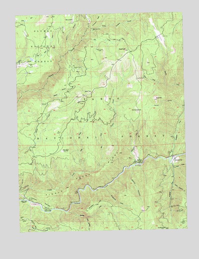
Goodyears Bar, CA USGS Topographic Map
Click on map above to begin viewing in our Map Viewer.

This topographic map contains these locations and features:
Feature Name Type Latitude Longitude GNIS ID View Map
Bald MountainSummitN39.5752°W120.8980°256464View Map
Bald TopSummitN39.5796°W120.9469°1657987View Map
Bee Tree Borrow PitMineN39.6174°W120.8908°276100View Map
Bow CreekStreamN39.5402°W120.9380°257394View Map
Brown Bear MineMineN39.5877°W120.9052°257480View Map
Brush Creek MineMineN39.5124°W120.8888°257530View Map
Bunker Hill MineLocaleN39.5741°W120.9783°257694View Map
Collins RavineValleyN39.5699°W120.8758°258599View Map
Colony MineLocaleN39.5041°W120.8777°258604View Map
Convict Flat Picnic AreaLocaleN39.5241°W120.9527°276106View Map
Devils CanyonValleyN39.5366°W120.9152°259298View Map
Eureka (historical)Populated PlaceN39.6107°W120.8961°1701299View Map
Eureka CemeteryCemeteryN39.6118°W120.8899°259974View Map
Eureka CreekStreamN39.5824°W120.8766°259976View Map
Eureka DiggingsMineN39.6132°W120.8949°259977View Map
Fiddle CreekStreamN39.5185°W120.9969°260095View Map
Fiddle Creek Camp GroundLocaleN39.5188°W120.9977°260096View Map
Fiddle Creek RidgeRidgeN39.5329°W120.9419°260097View Map
Fiddle Creek TrailTrailN39.5285°W120.9672°276105View Map
Florida House (historical)LocaleN39.5041°W120.9119°1733155View Map
Golden Bear MineMineN39.5130°W120.9036°276103View Map
Goodyears BarPopulated PlaceN39.5399°W120.8844°1658637View Map
Goodyears Bar Census Designated PlaceCensusN39.5458°W120.8881°2583027View Map
Goodyears CreekStreamN39.5407°W120.8880°260702View Map
Grant RavineValleyN39.5016°W120.9894°260772View Map
Halls Ranch (historical)LocaleN39.5466°W120.9680°1733158View Map
Halls Ranch Guard StationLocaleN39.5466°W120.9669°1652968View Map
Halls Ranch TrailTrailN39.5374°W120.9394°276107View Map
Head DamLocaleN39.6154°W120.9413°261202View Map
Humbug CreekStreamN39.5113°W120.9661°261615View Map
Indian Hill (historical)Populated PlaceN39.5068°W120.9925°1701300View Map
Indian Rock Picnic AreaLocaleN39.5382°W120.9141°1662475View Map
Indian ValleyValleyN39.5191°W120.9955°261771View Map
Indian Valley Camp GroundLocaleN39.5129°W120.9797°261774View Map
Little Canyon CreekStreamN39.6132°W120.9480°262561View Map
Little Fiddle CreekStreamN39.5341°W120.9516°262599View Map
Little Humbug CreekStreamN39.5079°W120.9511°262636View Map
Lower Carton CampgroundLocaleN39.5196°W120.9997°276108View Map
Magnolia MineLocaleN39.6043°W120.9391°263120View Map
Marvin RanchLocaleN39.6221°W120.9569°263243View Map
McMahon MineMineN39.5938°W120.9555°263404View Map
McMahons (historical)Populated PlaceN39.5929°W120.9594°1701301View Map
Mount PleasantPopulated PlaceN39.6124°W120.9786°1701304View Map
Mount Pleasant Ranch (historical)LocaleN39.6121°W120.9786°1733173View Map
New Kirk MineMineN39.5107°W120.8788°264058View Map
Old Mountain HouseLocaleN39.5002°W120.8916°272787View Map
Pipe CreekStreamN39.6099°W120.9505°264811View Map
Ramshorn Camp GroundLocaleN39.5391°W120.9094°265167View Map
Ramshorn CreekStreamN39.5382°W120.9122°265168View Map
Ramshorn TrailTrailN39.5543°W120.9111°276104View Map
Rock CreekStreamN39.5368°W120.8855°265488View Map
Rocky PeakSummitN39.5735°W120.9530°265538View Map
Rocky Rest CampgroundLocaleN39.5138°W120.9744°276110View Map
Saint Catherine CreekStreamN39.5249°W120.9372°265738View Map
Saint Charles HillSummitN39.5679°W120.9111°265739View Map
Saint Charles Ranch (historical)LocaleN39.5632°W120.9175°1701305View Map
Saint Joe BarBarN39.5379°W120.9094°1733176View Map
Sawmill RavineValleyN39.6038°W120.9597°265883View Map
Scalan MineMineN39.5013°W120.9797°265896View Map
ScalesPopulated PlaceN39.5982°W120.9925°1659607View Map
Shower BranchStreamN39.5816°W120.9841°266146View Map
Snow CreekStreamN39.5835°W120.8897°267315View Map
Snowden HillSummitN39.5166°W120.9400°267334View Map
SugarloafSummitN39.6038°W120.9183°267865View Map
Upper Carlton CampgroundLocaleN39.5213°W120.9975°276109View Map
Wet RavineValleyN39.5207°W120.9975°268951View Map
Woodruff CreekStreamN39.5385°W120.8869°269299View Map
Young America CreekStreamN39.5260°W120.8858°269370View Map

Note: Coordinates in the location and feature list above are referenced to NAD83 datum.


Copyright (C) 2008-2024 Ryan Niemi / Sunset Dynamics ... All Rights Reserved