TopoQuest Logo
Do you find TopoQuest useful?
Help keep TopoQuest running and adding new maps/features by donating!
Bitcoin:  19c7KJd3qBynnjoSw5npx9KScwjBe4ifkT
Litecoin:  LXs6TkuXGGXo1vDsWCkWVdjQX94eUKd6ui
Home View Maps Find Maps Find Places Resources & Links


Goode Mountain, Washington Topographic Map

USGS Map Title: Goode Mountain, WA
USGS Map MRC: 48120D8
DRG (GeoTIFF) Download: o48120d8.tif


Neighboring USGS Topographic Map Quads:


  Forbidden Peak, WA  
48121E1
 

  Mount Logan, WA  
48120E8
 

  Mount Arriva, WA  
48120E7
 

  Cascade Pass, WA  
48121D1
 

  Goode Mountain, WA  
48120D8
 

  McGregor Mountain, WA  
48120D7
 

  Dome Peak, WA  
48121C1
 

  Agnes Mountain, WA  
48120C8
 

  Mount Lyall, WA  
48120C7


Map MRC Location:

N49°
W121°
N49°
W120°
H8 H7 H6 H5 H4 H3 H2 H1
G8 G7 G6 G5 G4 G3 G2 G1
F8 F7 F6 F5 F4 F3 F2 F1
E8 E7 E6 E5 E4 E3 E2 E1
D8 D7 D6 D5 D4 D3 D2 D1
C8 C7 C6 C5 C4 C3 C2 C1
B8 B7 B6 B5 B4 B3 B2 B1
A8 A7 A6 A5 A4 A3 A2 A1
N48°
W121°
N48°
W120°

Goode Mountain, WA USGS 1:24K Topographic Map Preview:
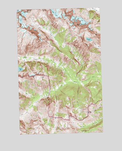
Goode Mountain, WA USGS Topographic Map
Click on map above to begin viewing in our Map Viewer.

This topographic map contains these locations and features:
Feature Name Type Latitude Longitude GNIS ID View Map
Booker MountainSummitN48.4764°W120.9809°1516795View Map
Buckner GlacierGlacierN48.4865°W120.9937°1517062View Map
Buckner MountainSummitN48.4952°W120.9979°1517063View Map
Cottonwood CampLocaleN48.4515°W120.9918°1518137View Map
Cottonwood CreekStreamN48.4504°W120.9898°1518140View Map
Flat CreekStreamN48.4251°W120.9165°1519639View Map
Flat Creek CampsiteLocaleN48.4297°W120.9236°2554591View Map
Glory LakeLakeN48.4315°W120.9663°1520009View Map
Glory MountainSummitN48.4321°W120.9802°1520011View Map
Goode GlacierGlacierN48.4885°W120.9048°1520127View Map
Goode MountainSummitN48.4832°W120.9115°1520128View Map
Goode RidgeRidgeN48.4784°W120.9077°1520129View Map
Green View LakeLakeN48.4682°W120.8936°1520333View Map
Junction MountainSummitN48.3760°W120.9041°1521514View Map
Memaloose RidgeRidgeN48.4812°W120.8963°1523001View Map
Park CreekStreamN48.4257°W120.9104°1524201View Map
Park Creek CampsiteLocaleN48.4270°W120.9152°1530069View Map
Park Creek PassGapN48.4985°W120.9623°1524204View Map
Park Creek Pass TrailTrailN48.4624°W120.9313°1524206View Map
Park Creek RidgeRidgeN48.4748°W120.9764°1524205View Map
Seven SistersRangeN48.3774°W120.9337°1525586View Map
South Fork Flat CreekStreamN48.4179°W120.9448°1526192View Map
Storm KingSummitN48.4912°W120.9303°1526595View Map
Theis CreekStreamN48.4324°W120.8776°1527080View Map
Tolo CreekStreamN48.4251°W120.9118°1527285View Map
Tolo MountainSummitN48.3954°W120.8963°1527286View Map
Two Mile CampsiteLocaleN48.4448°W120.9078°2554697View Map
West Fork Flat CreekStreamN48.4121°W120.9682°1527944View Map
Wyeth GlacierGlacierN48.4946°W120.9393°1528330View Map

Note: Coordinates in the location and feature list above are referenced to NAD83 datum.


Copyright (C) 2008-2024 Ryan Niemi / Sunset Dynamics ... All Rights Reserved