TopoQuest Logo
Do you find TopoQuest useful?
Help keep TopoQuest running and adding new maps/features by donating!
Bitcoin:  19c7KJd3qBynnjoSw5npx9KScwjBe4ifkT
Litecoin:  LXs6TkuXGGXo1vDsWCkWVdjQX94eUKd6ui
Home View Maps Find Maps Find Places Resources & Links


Gilson Mountain, Vermont Topographic Map

USGS Map Title: Gilson Mountain, VT
USGS Map MRC: 44072F8
DRG (GeoTIFF) Download: o44072f8.tif


Neighboring USGS Topographic Map Quads:


  Saint Albans, VT  
44073G1
 

  Fairfield, VT  
44072G8
 

  Bakersfield, VT  
44072G7
 

  Milton, VT  
44073F1
 

  Gilson Mountain, VT  
44072F8
 

  Jeffersonville, VT  
44072F7
 

  Essex Center, VT  
44073E1
 

  Underhill, VT  
44072E8
 

  Mount Mansfield, VT  
44072E7


Map MRC Location:

N45°
W73°
N45°
W72°
H8 H7 H6 H5 H4 H3 H2 H1
G8 G7 G6 G5 G4 G3 G2 G1
F8 F7 F6 F5 F4 F3 F2 F1
E8 E7 E6 E5 E4 E3 E2 E1
D8 D7 D6 D5 D4 D3 D2 D1
C8 C7 C6 C5 C4 C3 C2 C1
B8 B7 B6 B5 B4 B3 B2 B1
A8 A7 A6 A5 A4 A3 A2 A1
N44°
W73°
N44°
W72°

Gilson Mountain, VT USGS 1:24K Topographic Map Preview:
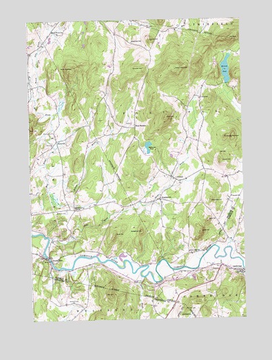
Gilson Mountain, VT USGS Topographic Map
Click on map above to begin viewing in our Map Viewer.

This topographic map contains these locations and features:
Feature Name Type Latitude Longitude GNIS ID View Map
Armstrong HillSummitN44.7006°W72.8810°1456173View Map
Bald KnobSummitN44.6662°W72.8962°1456223View Map
Beaver BrookStreamN44.6434°W72.9362°1456340View Map
BinghamvillePopulated PlaceN44.6750°W72.9235°1456427View Map
Binghamville CemeteryCemeteryN44.6736°W72.9228°1920539View Map
Black HillSummitN44.6617°W72.8999°1456444View Map
Buck HillSummitN44.7048°W72.9996°1456622View Map
Buck HollowValleyN44.7178°W72.9953°1459026View Map
Buck Hollow SchoolSchoolN44.7453°W72.9851°1456623View Map
Buck MountainSummitN44.7295°W72.9732°1456626View Map
CambridgePopulated PlaceN44.6448°W72.8762°1456721View Map
Cambridge Congregational ChurchChurchN44.6453°W72.8782°1918296View Map
Cambridge Post OfficePost OfficeN44.6444°W72.8762°1918300View Map
Cambridge State ForestForestN44.6528°W72.8754°1918301View Map
Carroll Hill CemeteryCemeteryN44.7394°W72.9999°1920551View Map
Church HillSummitN44.6912°W72.8871°1456890View Map
Cobbler HillSummitN44.7417°W72.9271°1456710View Map
Cobler Hill CemeteryCemeteryN44.7404°W72.9400°1920557View Map
Coombs HillSummitN44.7292°W72.9312°1457011View Map
Ellenwood HillSummitN44.6745°W72.8935°1457355View Map
Fairfax FallsPopulated PlaceN44.6503°W72.9879°1457392View Map
Fairfax Falls DamDamN44.6517°W72.9896°1766360View Map
Fairfax Falls PondReservoirN44.6517°W72.9896°1766361View Map
FletcherPopulated PlaceN44.6834°W72.9137°1457453View Map
Fletcher Elementary SchoolSchoolN44.6453°W72.8807°1918337View Map
Fletcher Elementary SchoolSchoolN44.6703°W72.9238°2427416View Map
Fletcher Union ChurchChurchN44.6828°W72.9115°1920608View Map
Gates CemeteryCemeteryN44.6467°W72.8897°1918339View Map
Giddings CemeteryCemeteryN44.6425°W72.9176°1918341View Map
Gilson MountainSummitN44.7295°W72.9126°1457551View Map
Halfmoon PondLakeN44.6972°W72.9301°1457686View Map
Hedgehog HillSummitN44.6623°W72.9346°1457793View Map
HuntsvillePopulated PlaceN44.6998°W72.9840°1457941View Map
Leach HillSummitN44.7092°W72.9187°1458182View Map
Metcalf PondLakeN44.7291°W72.8835°1458425View Map
Mountainview CemeteryCemeteryN44.6524°W72.8758°1918413View Map
Mudgett CemeteryCemeteryN44.6726°W72.9721°1920700View Map
Oak HillSummitN44.6353°W72.9540°1458810View Map
Oak HillSummitN44.6939°W72.8887°1458811View Map
Parsons SchoolSchoolN44.6762°W72.8818°1458900View Map
Pioneer CemeteryCemeteryN44.6824°W72.9123°1920718View Map
Polly BrookStreamN44.7170°W72.9960°1459025View Map
Pond SchoolSchoolN44.7173°W72.8979°1459039View Map
Putnam HillSummitN44.6323°W72.9018°1459108View Map
River Road CemeteryCemeteryN44.6527°W72.9080°1920733View Map
River View SchoolSchoolN44.6534°W72.9074°1459196View Map
Saint Marys Catholic ChurchChurchN44.6453°W72.8810°1918444View Map
Sand HillSummitN44.6606°W72.9507°1459360View Map
Sanderson CemeteryCemeteryN44.6707°W72.9787°1459364View Map
Sanderson CornerPopulated PlaceN44.6712°W72.9737°1459365View Map
Shepardson SchoolSchoolN44.7406°W72.9374°1459489View Map
Spafford CemeteryCemeteryN44.6513°W72.9541°1920780View Map
Stones BrookStreamN44.6589°W72.9890°1459732View Map
The GoreSummitN44.7417°W72.8815°1459858View Map
Town of FletcherCivilN44.7108°W72.9008°1462099View Map
Village of CambridgeCivilN44.6389°W72.8788°2378302View Map
West FletcherPopulated PlaceN44.7050°W72.9368°1460138View Map
Westford Plains CemeteryCemeteryN44.6320°W72.9760°1460180View Map
Wilkins BrookStreamN44.6806°W72.9890°1460263View Map

Note: Coordinates in the location and feature list above are referenced to NAD83 datum.


Copyright (C) 2008-2024 Ryan Niemi / Sunset Dynamics ... All Rights Reserved