TopoQuest Logo
Do you find TopoQuest useful?
Help keep TopoQuest running and adding new maps/features by donating!
Bitcoin:  19c7KJd3qBynnjoSw5npx9KScwjBe4ifkT
Litecoin:  LXs6TkuXGGXo1vDsWCkWVdjQX94eUKd6ui
Home View Maps Find Maps Find Places Resources & Links


French Gulch, California Topographic Map

USGS Map Title: French Gulch, CA
USGS Map MRC: 40122F6
DRG (GeoTIFF) Download: o40122f6.tif


Neighboring USGS Topographic Map Quads:


  Trinity Dam, CA  
40122G7
 

  Papoose Creek, CA  
40122G6
 

  Schell Mountain, CA  
40122G5
 

  Lewiston, CA  
40122F7
 

  French Gulch, CA  
40122F6
 

  Whiskeytown, CA  
40122F5
 

  Bully Choop Mountain, CA  
40122E7
 

  Shasta Bally, CA  
40122E6
 

  Igo, CA  
40122E5


Map MRC Location:

N41°
W123°
N41°
W122°
H8 H7 H6 H5 H4 H3 H2 H1
G8 G7 G6 G5 G4 G3 G2 G1
F8 F7 F6 F5 F4 F3 F2 F1
E8 E7 E6 E5 E4 E3 E2 E1
D8 D7 D6 D5 D4 D3 D2 D1
C8 C7 C6 C5 C4 C3 C2 C1
B8 B7 B6 B5 B4 B3 B2 B1
A8 A7 A6 A5 A4 A3 A2 A1
N40°
W123°
N40°
W122°

French Gulch, CA USGS 1:24K Topographic Map Preview:
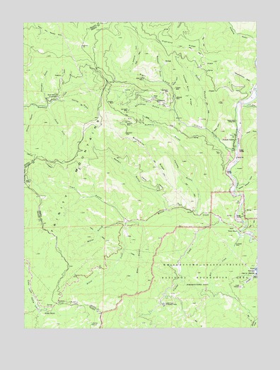
French Gulch, CA USGS Topographic Map
Click on map above to begin viewing in our Map Viewer.

This topographic map contains these locations and features:
Feature Name Type Latitude Longitude GNIS ID View Map
Bear GulchValleyN40.6674°W122.6889°218846View Map
Black Tom MineMineN40.7265°W122.6881°219410View Map
Boswell GulchValleyN40.7263°W122.6772°219669View Map
Brown Bear MineMineN40.7199°W122.7320°219885View Map
Brunswick MineMineN40.7090°W122.6950°219919View Map
Brunswick RidgeRidgeN40.6968°W122.6856°219920View Map
Buckhorn SummitGapN40.6354°W122.7336°1655851View Map
Centennial GulchValleyN40.7304°W122.6953°220813View Map
Church GulchValleyN40.7154°W122.7459°221100View Map
Cline GulchValleyN40.7154°W122.6322°258462View Map
Crystal CreekStreamN40.6674°W122.6453°221883View Map
Crystal Creek Conservation CampLocaleN40.6343°W122.6764°221884View Map
Crystal Creek FallsFallsN40.6461°W122.6667°2080296View Map
DeadwoodPopulated PlaceN40.7193°W122.7336°1655958View Map
Donnelly GulchValleyN40.7174°W122.7386°222502View Map
Dutch GulchValleyN40.7071°W122.6539°222765View Map
El Dorado MineMineN40.6593°W122.6378°223036View Map
Fivemile GulchValleyN40.7421°W122.6267°260187View Map
Franklin GulchValleyN40.7240°W122.6728°223814View Map
Franklin MineMineN40.7226°W122.6709°223819View Map
French GulchPopulated PlaceN40.7007°W122.6384°223907View Map
French GulchValleyN40.6976°W122.6409°223909View Map
French Gulch - Whiskeytown Elementary SchoolSchoolN40.7082°W122.6351°1682488View Map
French Gulch Census Designated PlaceCensusN40.7165°W122.6312°2408262View Map
French Gulch County ParkParkN40.7093°W122.6372°223911View Map
French Gulch Historic DistrictParkN40.7054°W122.6386°1682487View Map
French Gulch Post OfficePost OfficeN40.7012°W122.6384°2760033View Map
French Gulch Volunteer Fire CompanyBuildingN40.7060°W122.6356°2622073View Map
George Williams GulchValleyN40.6810°W122.6370°260526View Map
Highland RidgeRidgeN40.7424°W122.6806°261343View Map
Johns GulchValleyN40.7032°W122.6339°261967View Map
Judge Carr PowerplantLocaleN40.6468°W122.6267°1654287View Map
Milkmaid MineMineN40.7190°W122.6703°228661View Map
Mill CreekStreamN40.6618°W122.6345°228679View Map
Mill GulchValleyN40.7221°W122.7306°228716View Map
Niagara MineMineN40.7263°W122.7022°1661836View Map
Niagara Summit MineMineN40.7163°W122.6989°1661837View Map
Philladelphia MineMineN40.7176°W122.6806°230597View Map
Queens DrawValleyN40.7049°W122.6489°231133View Map
Right Fork French GulchValleyN40.7149°W122.6714°231580View Map
Sawpit GulchValleyN40.6746°W122.6756°232625View Map
Scorpion GulchValleyN40.7140°W122.6728°232708View Map
Scorpion MineMineN40.7168°W122.7039°232710View Map
Shingle ShantyLocaleN40.6313°W122.7386°233019View Map
Slaughterhouse GulchValleyN40.7251°W122.6292°233258View Map
South Fork Deadwood CreekStreamN40.7154°W122.7384°234993View Map
State GulchValleyN40.6635°W122.6275°267699View Map
Summit GulchValleyN40.6863°W122.6606°235746View Map
Summit MineMineN40.7090°W122.6953°235756View Map
Thorne GulchValleyN40.7179°W122.7322°236288View Map
Tom Green MineMineN40.7132°W122.6967°236430View Map
Tower HouseLocaleN40.6643°W122.6367°236473View Map
Trail GulchValleyN40.6693°W122.6975°236508View Map
Washington MineMineN40.7210°W122.6753°237286View Map
Water GulchValleyN40.6679°W122.6989°237325View Map
Whiskeytown FallsFallsN40.6264°W122.6692°2076385View Map
Willow CreekStreamN40.6632°W122.6359°237883View Map
Yankee Billy RidgeRidgeN40.7238°W122.6653°238226View Map
Yankee GulchValleyN40.6738°W122.6581°238227View Map

Note: Coordinates in the location and feature list above are referenced to NAD83 datum.


Copyright (C) 2008-2024 Ryan Niemi / Sunset Dynamics ... All Rights Reserved