TopoQuest Logo
Do you find TopoQuest useful?
Help keep TopoQuest running and adding new maps/features by donating!
Bitcoin:  19c7KJd3qBynnjoSw5npx9KScwjBe4ifkT
Litecoin:  LXs6TkuXGGXo1vDsWCkWVdjQX94eUKd6ui
Home View Maps Find Maps Find Places Resources & Links


Franconia, New Hampshire Topographic Map

USGS Map Title: Franconia, NH
USGS Map MRC: 44071B6
DRG (GeoTIFF) Download: o44071b6.tif


Neighboring USGS Topographic Map Quads:


  Littleton, NH  
44071C7


  Sugar Hill, NH  
44071B7
 

  Franconia, NH  
44071B6
 

  South Twin Mountain, NH  
44071B5
 

  Mount Moosilauke, NH  
44071A7
 

  Lincoln, NH  
44071A6
 

  Mount Osceola, NH  
44071A5


Map MRC Location:

N45°
W72°
N45°
W71°
H8 H7 H6 H5 H4 H3 H2 H1
G8 G7 G6 G5 G4 G3 G2 G1
F8 F7 F6 F5 F4 F3 F2 F1
E8 E7 E6 E5 E4 E3 E2 E1
D8 D7 D6 D5 D4 D3 D2 D1
C8 C7 C6 C5 C4 C3 C2 C1
B8 B7 B6 B5 B4 B3 B2 B1
A8 A7 A6 A5 A4 A3 A2 A1
N44°
W72°
N44°
W71°

Franconia, NH USGS 1:24K Topographic Map Preview:
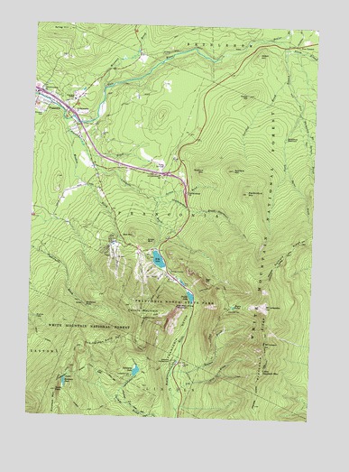
Franconia, NH USGS Topographic Map
Click on map above to begin viewing in our Map Viewer.

This topographic map contains these locations and features:
Feature Name Type Latitude Longitude GNIS ID View Map
Abbie Greenleaf Memorial LibraryBuildingN44.2265°W71.7440°1916389View Map
Abbot HillSummitN44.2406°W71.6498°871374View Map
AMC Kingsman Pond ShelterLocaleN44.1376°W71.7326°873006View Map
Around the Lake TrailTrailN44.1406°W71.7029°873008View Map
Artists BluffCliffN44.1812°W71.6976°871406View Map
Bald MountainSummitN44.1828°W71.7034°871434View Map
Beaver BrookStreamN44.2156°W71.7340°871472View Map
Beaver BrookStreamN44.2459°W71.6515°871473View Map
Bethlehem ReservoirReservoirN44.2149°W71.6373°871494View Map
Bickford MountainRidgeN44.2040°W71.6720°871495View Map
Big Bickford MountainSummitN44.1967°W71.6540°871498View Map
Bridalveil FallsFallsN44.1603°W71.7237°871579View Map
Burnt BrookStreamN44.2062°W71.6367°871593View Map
Cannon MountainSummitN44.1565°W71.6984°873192View Map
Cannon Mountain Aerial Passenger TramwayLocaleN44.1698°W71.6887°1916470View Map
Cannon Mountain Aerial TramwayLocaleN44.1667°W71.6918°873286View Map
Cannon Mountain Ski AreaLocaleN44.1773°W71.7015°1916471View Map
Cannon Mountain Winter Sports AreaLocaleN44.1717°W71.6990°873299View Map
Cascade Brook TrailTrailN44.1292°W71.7031°871641View Map
Cleveland Mountain OverlookLocaleN44.2442°W71.6529°873009View Map
Community Church of ChristChurchN44.2262°W71.7493°1916501View Map
Coppermine Shelter WMNFLocaleN44.1606°W71.6923°873016View Map
Dry BrookStreamN44.1315°W71.6842°871801View Map
Eagle CliffCliffN44.1681°W71.6712°871818View Map
Eagle Lakes HutLocaleN44.1606°W71.6604°873287View Map
Eagles LakesLakeN44.1606°W71.6589°871824View Map
Echo LakeLakeN44.1754°W71.6925°873288View Map
Elmwood CemeteryCemeteryN44.2220°W71.7470°871863View Map
Falling Water TrailTrailN44.1381°W71.6654°871873View Map
Fishin Jimmy TrailTrailN44.1387°W71.7148°871881View Map
Five CornersPopulated PlaceN44.2442°W71.6337°871882View Map
FranconiaPopulated PlaceN44.2270°W71.7479°871902View Map
Franconia CollegeSchoolN44.2256°W71.7315°871905View Map
Franconia Fire DepartmentBuildingN44.2202°W71.7342°2605107View Map
Franconia Life SquadBuildingN44.2201°W71.7343°2658890View Map
Franconia NotchGapN44.1526°W71.6795°871907View Map
Franconia Notch State ParkParkN44.1495°W71.6868°873289View Map
Franconia Police DeptBuildingN44.2202°W71.7344°2752834View Map
Franconia Post OfficePost OfficeN44.2280°W71.7498°1916552View Map
Franconia RidgeRidgeN44.1506°W71.6442°871908View Map
Franconia Ridge TrailTrailN44.1417°W71.6442°871909View Map
Franconia Town HallBuildingN44.2270°W71.7437°1916553View Map
Franconia-Sugar Hill-Easton Chamber of CommerceBuildingN44.2267°W71.7448°1916554View Map
Gale River CampgroundLocaleN44.2431°W71.6320°1916558View Map
Gale River TrailTrailN44.2267°W71.6331°871918View Map
Garfield RidgeRidgeN44.1790°W71.6334°871922View Map
Garfield TrailTrailN44.2073°W71.6284°871924View Map
Greenleaf HutLocaleN44.1603°W71.6601°871971View Map
Greenleaf TrailTrailN44.1670°W71.6679°871972View Map
High Cannon TrailTrailN44.1462°W71.6973°872037View Map
Interchange 35CrossingN44.1973°W71.6815°1916617View Map
Interchange 36CrossingN44.2026°W71.6904°873291View Map
Interchange 37CrossingN44.2226°W71.7337°873292View Map
Interchange 38CrossingN44.2281°W71.7473°873293View Map
Jordan BrookStreamN44.1948°W71.6948°872114View Map
Kinsman CabinLocaleN44.1481°W71.7459°873294View Map
Kinsman MountainRidgeN44.1287°W71.7365°872140View Map
Kinsman PondLakeN44.1361°W71.7331°872142View Map
Kinsman Pond TrailTrailN44.1270°W71.7195°872143View Map
Lafayatte Brook Scenic AreaAreaN44.1720°W71.6606°873011View Map
Lafayette BrookStreamN44.2084°W71.7254°872149View Map
Lafayette CampgroundLocaleN44.1428°W71.6842°873295View Map
Little Haystack MountainSummitN44.1406°W71.6448°872189View Map
Lonesome LakeLakeN44.1399°W71.7012°872208View Map
Lonesome Lake HutLocaleN44.1384°W71.7037°872209View Map
Lonesome Lake TrailTrailN44.1401°W71.6987°872210View Map
Meadow BrookStreamN44.2201°W71.7365°872275View Map
MittersillPopulated PlaceN44.1801°W71.7143°873003View Map
Mittersill Alpine ResortLocaleN44.1776°W71.7020°873002View Map
Mount Kinsman TrailTrailN44.1551°W71.7468°872344View Map
Mount LafayetteSummitN44.1570°W71.6404°872150View Map
Mount LincolnSummitN44.1490°W71.6445°872176View Map
North Branch Gale RiverStreamN44.2437°W71.6381°872389View Map
North PeakSummitN44.1331°W71.7368°872404View Map
Old Bridle PathTrailN44.1534°W71.6673°872425View Map
Old Man of the Mountain (historical)CliffN44.1606°W71.6834°873300View Map
Our Lady of the Snows Roman Catholic ChurchChurchN44.2273°W71.7462°1916746View Map
Presby FieldAirportN44.2327°W71.7166°2770546View Map
Priest HillSummitN44.2278°W71.6543°872525View Map
Profile Golf ClubLocaleN44.2053°W71.6909°873268View Map
Profile LakeLakeN44.1638°W71.6778°873296View Map
Scarface BrookStreamN44.2337°W71.6365°872633View Map
Scarface MountainSummitN44.2042°W71.6601°872634View Map
Scrag HillSummitN44.2481°W71.7348°872638View Map
Skookumchuck BrookStreamN44.1937°W71.6937°872670View Map
Skookumchuck TrailTrailN44.1862°W71.6573°872671View Map
South Branch Gale RiverStreamN44.2437°W71.6381°872694View Map
Spruce BrookStreamN44.2165°W71.6279°872717View Map
Stone Iron Furnace MuseumBuildingN44.2298°W71.7462°1916831View Map
The Cannon BallsSummitN44.1473°W71.7165°872784View Map
Thompson BrookStreamN44.2223°W71.6309°872802View Map
Town of FranconiaCivilN44.1843°W71.6614°873599View Map
Walker BrookStreamN44.1390°W71.6851°872858View Map
Wiseman BrookStreamN44.2295°W71.7181°872960View Map

Note: Coordinates in the location and feature list above are referenced to NAD83 datum.


Copyright (C) 2008-2024 Ryan Niemi / Sunset Dynamics ... All Rights Reserved