TopoQuest Logo
Do you find TopoQuest useful?
Help keep TopoQuest running and adding new maps/features by donating!
Bitcoin:  19c7KJd3qBynnjoSw5npx9KScwjBe4ifkT
Litecoin:  LXs6TkuXGGXo1vDsWCkWVdjQX94eUKd6ui
Home View Maps Find Maps Find Places Resources & Links


Four Peaks, Arizona Topographic Map

USGS Map Title: Four Peaks, AZ
USGS Map MRC: 33111F3
DRG (GeoTIFF) Download: o33111f3.tif


Neighboring USGS Topographic Map Quads:


  Boulder Mountain, AZ  
33111G4
 

  Tonto Basin, AZ  
33111G3
 

  Greenback Creek, AZ  
33111G2
 

  Mine Mountain, AZ  
33111F4
 

  Four Peaks, AZ  
33111F3
 

  Theodore Roosevelt Dam, AZ  
33111F2
 

  Mormon Flat Dam, AZ  
33111E4
 

  Horse Mesa Dam, AZ  
33111E3
 

  Pinyon Mountain, AZ  
33111E2


Map MRC Location:

N34°
W112°
N34°
W111°
H8 H7 H6 H5 H4 H3 H2 H1
G8 G7 G6 G5 G4 G3 G2 G1
F8 F7 F6 F5 F4 F3 F2 F1
E8 E7 E6 E5 E4 E3 E2 E1
D8 D7 D6 D5 D4 D3 D2 D1
C8 C7 C6 C5 C4 C3 C2 C1
B8 B7 B6 B5 B4 B3 B2 B1
A8 A7 A6 A5 A4 A3 A2 A1
N33°
W112°
N33°
W111°

Four Peaks, AZ USGS 1:24K Topographic Map Preview:
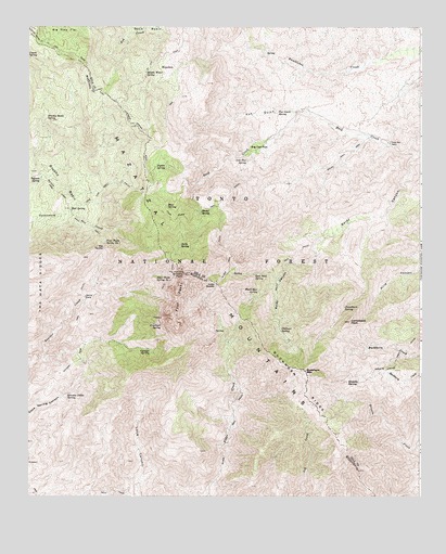
Four Peaks, AZ USGS Topographic Map
Click on map above to begin viewing in our Map Viewer.

This topographic map contains these locations and features:
Feature Name Type Latitude Longitude GNIS ID View Map
Alder SaddleGapN33.6812°W111.3140°25578View Map
Alder TrailTrailN33.6312°W111.3137°25581View Map
Amethyst MineMineN33.6725°W111.3324°36918View Map
Amethyst SpringSpringN33.6712°W111.3332°25632View Map
Baldy CanyonValleyN33.7156°W111.2518°25925View Map
Baldy TrailTrailN33.6823°W111.2957°25928View Map
Baldy TrailTrailN33.7131°W111.2774°25929View Map
Bear SpringSpringN33.7022°W111.3313°26110View Map
Big Oak FlatFlatN33.7175°W111.3026°26280View Map
Big SaddleGapN33.6914°W111.3512°26291View Map
Black Bear SaddleGapN33.6764°W111.3074°40867View Map
Black Bear SpringSpringN33.6798°W111.3020°26366View Map
Browns Cabin SpringSpringN33.6523°W111.3626°26795View Map
Browns PeakSummitN33.6842°W111.3254°26798View Map
Brushy BasinBasinN33.7087°W111.3651°26818View Map
Brushy Basin SpringSpringN33.7260°W111.3694°26820View Map
Buckhorn MountainSummitN33.6584°W111.2868°26915View Map
Buckhorn Mountain Research Natural AreaParkN33.6753°W111.2854°40866View Map
Buckhorn RidgeRidgeN33.6556°W111.2882°26918View Map
Camelback PeakSummitN33.6714°W111.2726°27190View Map
Camelback SpringSpringN33.6753°W111.2747°27191View Map
Chillicut SpringSpringN33.6690°W111.2947°27580View Map
Cienega SpringSpringN33.6640°W111.3365°27641View Map
Dan Neal SpringSpringN33.6841°W111.3027°28257View Map
Four PeaksSummitN33.6773°W111.3271°29145View Map
Four Peaks Spring Number OneSpringN33.6927°W111.3504°29146View Map
Four Peaks Spring Number TwoSpringN33.6835°W111.3336°29147View Map
Four Peaks TrailTrailN33.7023°W111.3151°29148View Map
Four Peaks WildernessReserveN33.6385°W111.3629°2035125View Map
Fox GulchValleyN33.7270°W111.2885°29156View Map
Fox Gulch SpringSpringN33.7280°W111.2956°29157View Map
Granite SpringSpringN33.6554°W111.2704°29493View Map
Jacks SpringSpringN33.6919°W111.3270°30477View Map
Laubs MineMineN33.6603°W111.3574°37015View Map
Lone Pine SaddleGapN33.7014°W111.3432°37020View Map
Lone Pine TrailTrailN33.7067°W111.3512°31215View Map
Long Pine TrailheadLocaleN33.7056°W111.3379°40869View Map
Mazatzal MountainsRangeN33.7087°W111.3649°31614View Map
Middle Water SpringSpringN33.7373°W111.3299°40871View Map
Middle Water SpringSpringN33.7379°W111.3383°31832View Map
Mud SpringSpringN33.7016°W111.3619°40868View Map
Mud SpringSpringN33.7014°W111.3615°32106View Map
Mud Spring TrailheadLocaleN33.7014°W111.3626°2057366View Map
Oak Flat SpringSpringN33.7140°W111.3056°32441View Map
Pigeon SpringSpringN33.7128°W111.3349°32894View Map
Shake SpringSpringN33.7010°W111.3202°34303View Map
Soldier CampLocaleN33.6784°W111.3571°34612View Map
Soldier Camp TrailTrailN33.6781°W111.3571°37077View Map
Tejanos SpringSpringN33.7094°W111.3713°35175View Map
Three Bar CabinLocaleN33.7189°W111.2601°35293View Map
Three Bar Watershed Research AreaAreaN33.7264°W111.3040°39834View Map
Water Hole TankReservoirN33.7399°W111.3322°39872View Map
Ziltadin MountainSummitN33.6884°W111.3237°2676280View Map

Note: Coordinates in the location and feature list above are referenced to NAD83 datum.


Copyright (C) 2008-2024 Ryan Niemi / Sunset Dynamics ... All Rights Reserved