TopoQuest Logo
Do you find TopoQuest useful?
Help keep TopoQuest running and adding new maps/features by donating!
Bitcoin:  19c7KJd3qBynnjoSw5npx9KScwjBe4ifkT
Litecoin:  LXs6TkuXGGXo1vDsWCkWVdjQX94eUKd6ui
Home View Maps Find Maps Find Places Resources & Links


Fish Springs SW, Utah Topographic Map

USGS Map Title: Fish Springs SW, UT
USGS Map MRC: 39113G4
DRG (GeoTIFF) Download: o39113g4.tif


Neighboring USGS Topographic Map Quads:


  Callao NE, UT  
39113H5
 

  Fish Springs NW, UT  
39113H4
 

  Fish Springs NE, UT  
39113H3
 

  Boyd Station, UT  
39113G5
 

  Fish Springs SW, UT  
39113G4
 

  Fish Springs SE, UT  
39113G3
 

  Middle Range North, UT  
39113F5
 

  Sand Pass NW, UT  
39113F4
 

  Sand Pass NE, UT  
39113F3


Map MRC Location:

N40°
W114°
N40°
W113°
H8 H7 H6 H5 H4 H3 H2 H1
G8 G7 G6 G5 G4 G3 G2 G1
F8 F7 F6 F5 F4 F3 F2 F1
E8 E7 E6 E5 E4 E3 E2 E1
D8 D7 D6 D5 D4 D3 D2 D1
C8 C7 C6 C5 C4 C3 C2 C1
B8 B7 B6 B5 B4 B3 B2 B1
A8 A7 A6 A5 A4 A3 A2 A1
N39°
W114°
N39°
W113°

Fish Springs SW, UT USGS 1:24K Topographic Map Preview:
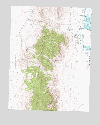
Fish Springs SW, UT USGS Topographic Map
Click on map above to begin viewing in our Map Viewer.

This topographic map contains these locations and features:
Feature Name Type Latitude Longitude GNIS ID View Map
Cactus MineMineN39.8324°W113.4828°1426261View Map
Cane SpringsSpringN39.7565°W113.3873°1426337View Map
Crater SpringSpringN39.8353°W113.3900°1427083View Map
Devils HoleLocaleN39.7711°W113.4008°1435420View Map
Early Harvest ShaftMineN39.8580°W113.4697°1427656View Map
Emma MineMineN39.8527°W113.4541°1427820View Map
Fish SpringsSpringN39.8608°W113.3953°1427960View Map
Fish SpringsPopulated PlaceN39.8391°W113.3986°1455277View Map
Galena MineMineN39.8569°W113.4575°1428129View Map
House SpringsSpringN39.8499°W113.3955°1428914View Map
Joseph AditMineN39.8591°W113.4719°1429251View Map
Lost SpringSpringN39.8378°W113.3915°1429952View Map
Mallard PoolReservoirN39.8533°W113.3796°1430067View Map
Middle SpringSpringN39.8419°W113.3939°1430302View Map
Mirror SpringSpringN39.8488°W113.3942°1430382View Map
Percy SpringSpringN39.8320°W113.3917°1431179View Map
Pony Express MonumentParkN39.8480°W113.4103°1431401View Map
Shoveler PoolReservoirN39.8663°W113.3792°1432426View Map
South SpringsSpringN39.8346°W113.3901°1432760View Map
Thomas SpringsSpringN39.8467°W113.3958°1433467View Map
Utah MineMineN39.8566°W113.4561°1433841View Map
Vulcan MineMineN39.8513°W113.4539°1433909View Map
Walter SpringSpringN39.8706°W113.4028°1433939View Map
Wilson MineMineN39.8497°W113.4536°1434379View Map

Note: Coordinates in the location and feature list above are referenced to NAD83 datum.


Copyright (C) 2008-2024 Ryan Niemi / Sunset Dynamics ... All Rights Reserved