TopoQuest Logo
Do you find TopoQuest useful?
Help keep TopoQuest running and adding new maps/features by donating!
Bitcoin:  19c7KJd3qBynnjoSw5npx9KScwjBe4ifkT
Litecoin:  LXs6TkuXGGXo1vDsWCkWVdjQX94eUKd6ui
Home View Maps Find Maps Find Places Resources & Links


Fayette, Maine Topographic Map

USGS Map Title: Fayette, ME
USGS Map MRC: 44070D1
DRG (GeoTIFF) Download: o44070d1.tif


Neighboring USGS Topographic Map Quads:


  Wilton, ME  
44070E2
 

  Farmington Falls, ME  
44070E1
 

  Belgrade Lakes, ME  
44069E8
 

  Livermore Falls, ME  
44070D2
 

  Fayette, ME  
44070D1
 

  Readfield, ME  
44069D8
 

  Turner Center, ME  
44070C2
 

  Wayne, ME  
44070C1
 

  Winthrop, ME  
44069C8


Map MRC Location:

N45°
W71°
N45°
W70°
H8 H7 H6 H5 H4 H3 H2 H1
G8 G7 G6 G5 G4 G3 G2 G1
F8 F7 F6 F5 F4 F3 F2 F1
E8 E7 E6 E5 E4 E3 E2 E1
D8 D7 D6 D5 D4 D3 D2 D1
C8 C7 C6 C5 C4 C3 C2 C1
B8 B7 B6 B5 B4 B3 B2 B1
A8 A7 A6 A5 A4 A3 A2 A1
N44°
W71°
N44°
W70°

Fayette, ME USGS 1:24K Topographic Map Preview:
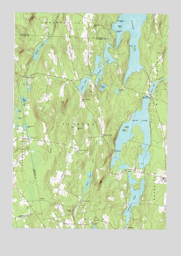
Fayette, ME USGS Topographic Map
Click on map above to begin viewing in our Map Viewer.

This topographic map contains these locations and features:
Feature Name Type Latitude Longitude GNIS ID View Map
Baldwin HillSummitN44.4326°W70.0756°561546View Map
Basin PondLakeN44.4572°W70.0525°561691View Map
Birch IslandIslandN44.4809°W70.0287°562301View Map
Blunt Robinson CemeteryCemeteryN44.4779°W70.0035°2736358View Map
Burgess PondLakeN44.4494°W70.1164°563203View Map
Camp WinnebagoLocaleN44.4206°W70.0423°563423View Map
Causeway IslandIslandN44.4901°W70.0420°563705View Map
Cranberry PondLakeN44.4551°W70.0410°564472View Map
David PondLakeN44.4739°W70.0471°564788View Map
East Livermore CampgroundsLocaleN44.4267°W70.1103°565631View Map
Echo IslandIslandN44.4326°W70.0328°565768View Map
Echo LakeReservoirN44.4579°W70.0110°565769View Map
Echo Lake Dam Number 1DamN44.4159°W70.0387°1774290View Map
Echo Lake Dam Number 2DamN44.4096°W70.0315°1774304View Map
FayettePopulated PlaceN44.4090°W70.0337°566085View Map
Fayette Central SchoolSchoolN44.4073°W70.0391°2737988View Map
Fayette CornerPopulated PlaceN44.4206°W70.0720°579307View Map
Fayette Corner CemeteryCemeteryN44.4236°W70.0735°2736710View Map
Fayette Mills CemeteryCemeteryN44.4049°W70.0398°2736711View Map
Fayette RidgeRidgeN44.4465°W70.0993°566086View Map
Fayette Volunteer Fire DepartmentBuildingN44.4318°W70.0540°2553130View Map
Gooseneck IslandIslandN44.4956°W70.0356°566962View Map
Gordon CemeteryCemeteryN44.3778°W70.0811°2736720View Map
Gordon HillSummitN44.4967°W70.1128°566969View Map
Hales PondLakeN44.4024°W70.0637°567441View Map
Hopkins StreamStreamN44.4601°W70.0087°568259View Map
Kent CemeteryCemeteryN44.4201°W70.0715°569123View Map
Kents HillPopulated PlaceN44.4051°W70.0009°569126View Map
Kents Hill SchoolSchoolN44.4045°W70.0021°2737967View Map
Knowles HillSummitN44.4931°W70.0607°569260View Map
Lakeview CemeteryCemeteryN44.4516°W70.0125°2736734View Map
Lovejoy PondReservoirN44.3939°W70.0264°570445View Map
Manter HillSummitN44.3850°W70.0767°570716View Map
Mosher PondLakeN44.4805°W70.1031°581463View Map
Mount WinnebagoSummitN44.4149°W70.0509°2749496View Map
North FayettePopulated PlaceN44.4501°W70.0689°579565View Map
North Fayette CemeteryCemeteryN44.4793°W70.0798°2736751View Map
Oak HillSummitN44.4016°W70.0559°572583View Map
Old North Fayette CemeteryCemeteryN44.4788°W70.0780°2736756View Map
Parker PondLakeN44.4913°W70.0289°572994View Map
Pine HillSummitN44.4480°W70.0832°573372View Map
Rack PondLakeN44.4425°W70.1218°573956View Map
Richmond MillPopulated PlaceN44.3909°W70.0692°579655View Map
Round PondLakeN44.4387°W70.1214°574503View Map
Sanderson CornersPopulated PlaceN44.4290°W70.0526°579673View Map
Schoolhouse PondLakeN44.4323°W70.1141°575028View Map
Spruce IslandIslandN44.4915°W70.0389°576138View Map
Taylor PondReservoirN44.4531°W70.0144°576688View Map
Taylor Pond DamDamN44.4531°W70.0144°1774065View Map
Tilton PondLakeN44.4585°W70.0681°577108View Map
Town of FayetteCivilN44.4373°W70.0701°582475View Map
Turner PondLakeN44.4340°W70.1223°577436View Map
Turtle IslandIslandN44.4342°W70.0342°577453View Map
Twelve CornersPopulated PlaceN44.4628°W70.1156°579779View Map
Underwood Memorial LibraryBuildingN44.4071°W70.0371°2738348View Map
West Mount VernonPopulated PlaceN44.4531°W70.0153°578175View Map

Note: Coordinates in the location and feature list above are referenced to NAD83 datum.


Copyright (C) 2008-2024 Ryan Niemi / Sunset Dynamics ... All Rights Reserved