TopoQuest Logo
Do you find TopoQuest useful?
Help keep TopoQuest running and adding new maps/features by donating!
Bitcoin:  19c7KJd3qBynnjoSw5npx9KScwjBe4ifkT
Litecoin:  LXs6TkuXGGXo1vDsWCkWVdjQX94eUKd6ui
Home View Maps Find Maps Find Places Resources & Links


Ettersburg, California Topographic Map

USGS Map Title: Ettersburg, CA
USGS Map MRC: 40123B8
DRG (GeoTIFF) Download: o40123b8.tif


Neighboring USGS Topographic Map Quads:


  Bull Creek, CA  
40124C1
 

  Weott, CA  
40123C8
 

  Myers Flat, CA  
40123C7
 

  Honeydew, CA  
40124B1
 

  Ettersburg, CA  
40123B8
 

  Miranda, CA  
40123B7
 

  Shelter Cove, CA  
40124A1
 

  Briceland, CA  
40123A8
 

  Garberville, CA  
40123A7


Map MRC Location:

N41°
W124°
N41°
W123°
H8 H7 H6 H5 H4 H3 H2 H1
G8 G7 G6 G5 G4 G3 G2 G1
F8 F7 F6 F5 F4 F3 F2 F1
E8 E7 E6 E5 E4 E3 E2 E1
D8 D7 D6 D5 D4 D3 D2 D1
C8 C7 C6 C5 C4 C3 C2 C1
B8 B7 B6 B5 B4 B3 B2 B1
A8 A7 A6 A5 A4 A3 A2 A1
N40°
W124°
N40°
W123°

Ettersburg, CA USGS 1:24K Topographic Map Preview:
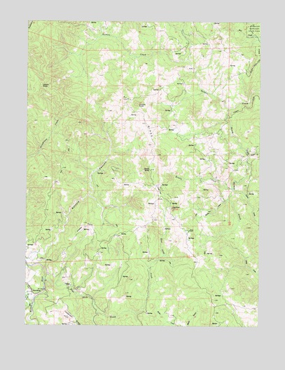
Ettersburg, CA USGS Topographic Map
Click on map above to begin viewing in our Map Viewer.

This topographic map contains these locations and features:
Feature Name Type Latitude Longitude GNIS ID View Map
Bear CreekStreamN40.1354°W123.9967°218826View Map
Beginnings Volunteer Fire Department Station 2BuildingN40.1638°W123.9644°2621980View Map
Beginnings Volunteer Fire Department Station 3BuildingN40.1269°W123.9207°2621982View Map
Blue Slide CreekStreamN40.1435°W123.9911°219525View Map
Bogus CreekStreamN40.1954°W123.8817°219588View Map
Briceland RanchLocaleN40.1413°W123.9767°219812View Map
Cedar FlatFlatN40.1804°W123.9303°220776View Map
Clarks ButteSummitN40.1890°W123.9342°221169View Map
Crooked PrairieFlatN40.1654°W123.9692°221846View Map
Dickson ButteSummitN40.2157°W123.9420°1655968View Map
Elk RidgeRidgeN40.2096°W123.9381°223124View Map
EttersburgPopulated PlaceN40.1385°W123.9973°252673View Map
French CreekStreamN40.1371°W123.9998°223904View Map
Gilham ButteSummitN40.2232°W123.9936°1656045View Map
Goat RockPillarN40.1735°W123.9228°224250View Map
Hacker CreekStreamN40.1771°W123.8928°224761View Map
Kinsey CreekStreamN40.1815°W123.8906°226620View Map
Mattole CanyonValleyN40.1526°W123.9984°1655132View Map
Phelps RanchLocaleN40.1640°W123.9134°230593View Map
Salmon Creek Volunteer Fire DepartmentBuildingN40.2011°W123.9182°2622226View Map
South Fork Salmon CreekStreamN40.2146°W123.8925°235048View Map
Tostin CreekStreamN40.1810°W123.8900°236470View Map

Note: Coordinates in the location and feature list above are referenced to NAD83 datum.


Copyright (C) 2008-2024 Ryan Niemi / Sunset Dynamics ... All Rights Reserved