TopoQuest Logo
Do you find TopoQuest useful?
Help keep TopoQuest running and adding new maps/features by donating!
Bitcoin:  19c7KJd3qBynnjoSw5npx9KScwjBe4ifkT
Litecoin:  LXs6TkuXGGXo1vDsWCkWVdjQX94eUKd6ui
Home View Maps Find Maps Find Places Resources & Links


Erickson Basin, Utah Topographic Map

USGS Map Title: Erickson Basin, UT
USGS Map MRC: 40111F1
DRG (GeoTIFF) Download: o40111f1.tif


Neighboring USGS Topographic Map Quads:


  Hidden Lake, UT  
40111G2
 

  Slader Basin, UT  
40111G1
 

  Whitney Reservoir, UT  
40110G8
 

  Hoyt Peak, UT  
40111F2
 

  Erickson Basin, UT  
40111F1
 

  Mirror Lake, UT  
40110F8
 

  Woodland, UT  
40111E2
 

  Soapstone Basin, UT  
40111E1
 

  Iron Mine Mountain, UT  
40110E8


Map MRC Location:

N41°
W112°
N41°
W111°
H8 H7 H6 H5 H4 H3 H2 H1
G8 G7 G6 G5 G4 G3 G2 G1
F8 F7 F6 F5 F4 F3 F2 F1
E8 E7 E6 E5 E4 E3 E2 E1
D8 D7 D6 D5 D4 D3 D2 D1
C8 C7 C6 C5 C4 C3 C2 C1
B8 B7 B6 B5 B4 B3 B2 B1
A8 A7 A6 A5 A4 A3 A2 A1
N40°
W112°
N40°
W111°

Erickson Basin, UT USGS 1:24K Topographic Map Preview:
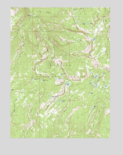
Erickson Basin, UT USGS Topographic Map
Click on map above to begin viewing in our Map Viewer.

This topographic map contains these locations and features:
Feature Name Type Latitude Longitude GNIS ID View Map
Adax LakeLakeN40.7369°W111.0076°1438131View Map
Anchor LakeReservoirN40.7199°W111.0157°1455931View Map
Anchor LakeLakeN40.7193°W111.0203°1438205View Map
Anchor Lake Reservoir DamDamN40.7199°W111.0157°1447930View Map
Beaver LakeLakeN40.6678°W111.0253°1438533View Map
Big Elk LakeReservoirN40.6763°W111.0534°1447904View Map
Big Elk Lake DamDamN40.6749°W111.0507°1447905View Map
Box CanyonValleyN40.7324°W111.1080°1439064View Map
Broad CanyonValleyN40.7458°W111.0985°1439129View Map
Cutthroat LakeLakeN40.6813°W111.0099°1852119View Map
Duck LakeReservoirN40.6747°W111.0177°1440705View Map
Duck Lake DamDamN40.6733°W111.0174°1447899View Map
East Shingle Creek LakeLakeN40.6798°W111.0861°1440845View Map
Erickson BasinBasinN40.6861°W111.0785°1440951View Map
Erickson CreekStreamN40.7091°W111.0702°1440952View Map
Fire LakeReservoirN40.6771°W111.0229°1441046View Map
Fire Lake DamDamN40.6766°W111.0224°1447907View Map
Hells KitchenBasinN40.7169°W111.0435°1441692View Map
Hidden LakeLakeN40.6547°W111.0225°1441739View Map
Hourglass LakeLakeN40.6604°W111.0696°1923069View Map
Island LakeLakeN40.6836°W111.0181°1442063View Map
Jean LakeLakeN40.7188°W111.0398°1442114View Map
Jerry LakeLakeN40.7053°W111.0152°1852122View Map
Ledgefork CampgroundLocaleN40.7411°W111.0938°1442477View Map
Ledgefork Guard StationLocaleN40.7422°W111.1002°1442478View Map
Little Elk LakeLakeN40.6605°W111.0621°1442713View Map
Lower Shingle Creek LakeLakeN40.6642°W111.0754°1443025View Map
Mud Lake FlatFlatN40.7388°W111.1213°1443678View Map
North Erickson LakeLakeN40.6859°W111.0639°1443881View Map
Norway FlatFlatN40.6508°W111.0696°1443999View Map
Olsen LakeLakeN40.7346°W111.0270°1444087View Map
Pot DamDamN40.6733°W111.0091°1447897View Map
Pot ReservoirReservoirN40.6737°W111.0079°1447896View Map
Ramona LakeLakeN40.6868°W111.0104°1444720View Map
Red Pine CreekStreamN40.7455°W111.0980°1444825View Map
Rhoads LakeLakeN40.7349°W111.0320°1444882View Map
Shingle Creek NarrowsChannelN40.6466°W111.0980°1454893View Map
Smith Morehouse TrailTrailN40.6813°W111.0182°1445707View Map
South Erickson LakeLakeN40.6817°W111.0667°1445819View Map
The Deli DellBasinN40.6455°W111.0377°1446437View Map
Weir DamDamN40.6749°W111.0007°1447903View Map
West Shingle Creek LakeLakeN40.6809°W111.0973°1447175View Map

Note: Coordinates in the location and feature list above are referenced to NAD83 datum.


Copyright (C) 2008-2024 Ryan Niemi / Sunset Dynamics ... All Rights Reserved