TopoQuest Logo
Do you find TopoQuest useful?
Help keep TopoQuest running and adding new maps/features by donating!
Bitcoin:  19c7KJd3qBynnjoSw5npx9KScwjBe4ifkT
Litecoin:  LXs6TkuXGGXo1vDsWCkWVdjQX94eUKd6ui
Home View Maps Find Maps Find Places Resources & Links


Ellis Corners, Michigan Topographic Map

USGS Map Title: Ellis Corners, MI
USGS Map MRC: 42085B1
DRG (GeoTIFF) Download: o42085b1.tif


Neighboring USGS Topographic Map Quads:


  Battle Creek, MI  
42085C2
 

  Ceresco, MI  
42085C1
 

  Marshall, MI  
42084C8
 

  East Leroy, MI  
42085B2
 

  Ellis Corners, MI  
42085B1
 

  Lyon Lake, MI  
42084B8
 

  Union City, MI  
42085A2
 

  Burlington, MI  
42085A1
 

  Tekonsha, MI  
42084A8


Map MRC Location:

N43°
W86°
N43°
W85°
H8 H7 H6 H5 H4 H3 H2 H1
G8 G7 G6 G5 G4 G3 G2 G1
F8 F7 F6 F5 F4 F3 F2 F1
E8 E7 E6 E5 E4 E3 E2 E1
D8 D7 D6 D5 D4 D3 D2 D1
C8 C7 C6 C5 C4 C3 C2 C1
B8 B7 B6 B5 B4 B3 B2 B1
A8 A7 A6 A5 A4 A3 A2 A1
N42°
W86°
N42°
W85°

Ellis Corners, MI USGS 1:24K Topographic Map Preview:
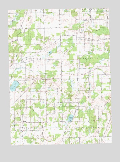
Ellis Corners, MI USGS Topographic Map
Click on map above to begin viewing in our Map Viewer.

This topographic map contains these locations and features:
Feature Name Type Latitude Longitude GNIS ID View Map
Acker Extension DrainCanalN42.1403°W85.0369°2109280View Map
Barrington CemeteryCemeteryN42.1461°W85.1092°2109281View Map
Cain SchoolSchoolN42.1775°W85.0766°622445View Map
Calhoun CountyCivilN42.2465°W85.0056°1622955View Map
Dodge SchoolSchoolN42.2323°W85.1069°624734View Map
Ellis CornersLocaleN42.1887°W85.0403°625484View Map
Ellis Post Office (historical)Post OfficeN42.1886°W85.0403°2630168View Map
Francisco SchoolSchoolN42.2039°W85.0794°626400View Map
Fredonia Holiness ChurchChurchN42.2389°W85.0319°2109285View Map
Fredonia Township Fire Department Station 2BuildingN42.1913°W85.0258°2636198View Map
Gleason DrainCanalN42.1819°W85.0486°2109283View Map
Houston CemeteryCemeteryN42.2208°W85.0264°2630243View Map
Houston SchoolSchoolN42.2203°W85.0261°628682View Map
Hyde LakeLakeN42.2099°W85.0736°628903View Map
Laurel Grove SchoolSchoolN42.1464°W85.1191°630189View Map
Lee LakeLakeN42.1798°W85.1189°630256View Map
Meyers SchoolSchoolN42.1464°W85.0841°632183View Map
Mud CreekCanalN42.2161°W85.1097°2109284View Map
Newton ChurchChurchN42.2028°W85.1217°633377View Map
Newton Township CemeteryCemeteryN42.2033°W85.1228°2630223View Map
Pierce SchoolSchoolN42.2323°W85.0650°634832View Map
Pout LakeLakeN42.2082°W85.0243°635363View Map
Salem ChurchChurchN42.1669°W85.0411°2109282View Map
Tekonsha SchoolSchoolN42.1373°W85.0064°1614668View Map
Township of FredoniaCivilN42.2017°W85.0037°1626312View Map
Township of NewtonCivilN42.2032°W85.1195°1626804View Map
Underwood SchoolSchoolN42.1739°W85.1047°1615327View Map
Warner LakeLakeN42.1491°W85.0502°1615774View Map
Yost Francisco DrainCanalN42.2067°W85.0930°1616895View Map

Note: Coordinates in the location and feature list above are referenced to NAD83 datum.


Copyright (C) 2008-2024 Ryan Niemi / Sunset Dynamics ... All Rights Reserved