TopoQuest Logo
Do you find TopoQuest useful?
Help keep TopoQuest running and adding new maps/features by donating!
Bitcoin:  19c7KJd3qBynnjoSw5npx9KScwjBe4ifkT
Litecoin:  LXs6TkuXGGXo1vDsWCkWVdjQX94eUKd6ui
Home View Maps Find Maps Find Places Resources & Links


Elkader, Iowa Topographic Map

USGS Map Title: Elkader, IA
USGS Map MRC: 42091G4
DRG (GeoTIFF) Download: o42091g4.tif


Neighboring USGS Topographic Map Quads:


  Gunder, IA  
42091H5
 

  Saint Olaf, IA  
42091H4
 

  Farmersburg, IA  
42091H3
 

  Volga, IA  
42091G5
 

  Elkader, IA  
42091G4
 

  Littleport, IA  
42091G3
 

  Strawberry Point, IA  
42091F5
 

  Edgewood, IA  
42091F4
 

  Garber, IA  
42091F3


Map MRC Location:

N43°
W92°
N43°
W91°
H8 H7 H6 H5 H4 H3 H2 H1
G8 G7 G6 G5 G4 G3 G2 G1
F8 F7 F6 F5 F4 F3 F2 F1
E8 E7 E6 E5 E4 E3 E2 E1
D8 D7 D6 D5 D4 D3 D2 D1
C8 C7 C6 C5 C4 C3 C2 C1
B8 B7 B6 B5 B4 B3 B2 B1
A8 A7 A6 A5 A4 A3 A2 A1
N42°
W92°
N42°
W91°

Elkader, IA USGS 1:24K Topographic Map Preview:
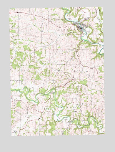
Elkader, IA USGS Topographic Map
Click on map above to begin viewing in our Map Viewer.

This topographic map contains these locations and features:
Feature Name Type Latitude Longitude GNIS ID View Map
Ardell Kader City ParkParkN42.8539°W91.4054°1949000View Map
Bethany Lutheran ChurchChurchN42.8580°W91.4032°1949217View Map
Carter House MuseumBuildingN42.8553°W91.4021°1949198View Map
Central Ambulance ServiceBuildingN42.8533°W91.4029°2599782View Map
Central Community Elementary SchoolSchoolN42.8568°W91.4073°2719795View Map
Central Community HospitalHospitalN42.8599°W91.4153°1949206View Map
Central Community Hospital HeliportAirportN42.8575°W91.4146°466789View Map
Central Community Junior - Senior High SchoolSchoolN42.8566°W91.4077°1949222View Map
Chicken RidgeSummitN42.8133°W91.4410°455390View Map
Chicken Ridge Scenic Overlook ParkParkN42.8042°W91.4168°1948997View Map
City of ElkaderCivilN42.8571°W91.4023°2394652View Map
Clayton County CourthouseBuildingN42.8555°W91.4035°1949193View Map
Clayton County Office BuildingBuildingN42.8611°W91.4068°1949203View Map
Clayton County SheriffBuildingN42.8565°W91.4009°1949196View Map
Community Chiropractic CenterHospitalN42.8550°W91.4043°1949208View Map
Coon CreekStreamN42.7953°W91.4890°455602View Map
Cords CemeteryCemeteryN42.7973°W91.4378°1949301View Map
Cox CreekStreamN42.7689°W91.4390°455686View Map
Cox Creek Post Office (historical)Post OfficeN42.7658°W91.4643°466474View Map
Cox Creek Rest AreaLocaleN42.7817°W91.4543°1948996View Map
Cox Creek TownhallBuildingN42.7797°W91.4546°463644View Map
Dohrer CemeteryCemeteryN42.8125°W91.4585°1949303View Map
Eastside CemeteryCemeteryN42.8542°W91.4001°1949304View Map
ElkaderPopulated PlaceN42.8539°W91.4054°456303View Map
Elkader (historical)LocaleN42.8528°W91.4004°1949191View Map
Elkader AirportAirportN42.8462°W91.3827°1949201View Map
Elkader BridgeBridgeN42.8550°W91.4037°1949334View Map
Elkader Care CenterHospitalN42.8472°W91.4057°1949205View Map
Elkader Chiropractic ClinicHospitalN42.8578°W91.3974°1949210View Map
Elkader City ParkParkN42.8500°W91.3960°1949311View Map
Elkader Eye ClinicHospitalN42.8528°W91.4029°1949209View Map
Elkader Fire DepartmentBuildingN42.8533°W91.4029°1949195View Map
Elkader Golf and Country ClubLocaleN42.8708°W91.4015°1949204View Map
Elkader Medical Associates CenterHospitalN42.8597°W91.4154°1949207View Map
Elkader Police DeptBuildingN42.8553°W91.4056°1949192View Map
Elkader Post OfficePost OfficeN42.8536°W91.4037°1949194View Map
Elkader Public LibraryBuildingN42.8550°W91.4043°1949200View Map
Erhardt CemeteryCemeteryN42.8250°W91.4751°1949237View Map
First Congregational ChurchChurchN42.8547°W91.4012°1949216View Map
French HollowValleyN42.8421°W91.4018°456773View Map
Grace Evangelical Free ChurchChurchN42.8667°W91.3993°1949215View Map
Hartmann CemeteryCemeteryN42.8155°W91.3879°457300View Map
Jehovahs Witnesses Kingdom HallChurchN42.8400°W91.4071°1949211View Map
KADR-AM (Elkader)TowerN42.8492°W91.4121°467024View Map
Keystone BridgeBridgeN42.8550°W91.4037°1949199View Map
Lovers Leap ParkParkN42.8633°W91.4001°1948999View Map
Meaderville BridgeBridgeN42.7636°W91.4212°1949329View Map
MedervillePopulated PlaceN42.7630°W91.4229°458944View Map
Mederville (historical)LocaleN42.7642°W91.4226°1949030View Map
Mederville AccessLocaleN42.7636°W91.4210°1948998View Map
Mederville CemeteryCemeteryN42.7637°W91.4193°1949305View Map
Mederville Post Office (historical)Post OfficeN42.7630°W91.4229°1949031View Map
Meyer CemeteryCemeteryN42.8111°W91.4376°1949302View Map
OsbornePopulated PlaceN42.7919°W91.4454°464686View Map
Osborne (historical)LocaleN42.7930°W91.4438°1949026View Map
Osborne CemeteryCemeteryN42.7974°W91.4377°1949300View Map
Osborne Conservation CenterLocaleN42.7930°W91.4432°1949197View Map
Osborne Post Office (historical)Post OfficeN42.7919°W91.4454°1949025View Map
Peace United Church of ChristChurchN42.8561°W91.4068°1949214View Map
Pony Hollow TrailTrailN42.8403°W91.3757°1949007View Map
Riverside ParkParkN42.8530°W91.4026°1949219View Map
Ross CemeteryCemeteryN42.7528°W91.4935°460814View Map
Sacred Heart CemeteryCemeteryN42.7541°W91.4918°460894View Map
Saint Josephs CemeteryCemeteryN42.8489°W91.4024°461129View Map
Saint Josephs ChurchChurchN42.8517°W91.4037°1949213View Map
Saint Patrick StationLocaleN42.8405°W91.3762°463997View Map
Schmidt CemeteryCemeteryN42.7972°W91.4168°1949299View Map
Table Rock Site of July 4 1838 Celebration Historical MarkerParkN42.8500°W91.3960°1949312View Map
Township of BoardmanCivilN42.8626°W91.4286°467471View Map
Township of Cox CreekCivilN42.7754°W91.4280°467661View Map
Turkey River ParkParkN42.8430°W91.4024°1949218View Map
Watkins CemeteryCemeteryN42.7833°W91.4585°1949298View Map
Zion Lutheran ChurchChurchN42.8597°W91.4043°1949212View Map

Note: Coordinates in the location and feature list above are referenced to NAD83 datum.


Copyright (C) 2008-2024 Ryan Niemi / Sunset Dynamics ... All Rights Reserved