TopoQuest Logo
Do you find TopoQuest useful?
Help keep TopoQuest running and adding new maps/features by donating!
Bitcoin:  19c7KJd3qBynnjoSw5npx9KScwjBe4ifkT
Litecoin:  LXs6TkuXGGXo1vDsWCkWVdjQX94eUKd6ui
Home View Maps Find Maps Find Places Resources & Links


Elk Mountain, New Mexico Topographic Map

USGS Map Title: Elk Mountain, NM
USGS Map MRC: 35105G5
DRG (GeoTIFF) Download: o35105g5.tif


Neighboring USGS Topographic Map Quads:


  Truchas Peak, NM  
35105H6
 

  Pecos Falls, NM  
35105H5
 

  Gascon, NM  
35105H4
 

  Cowles, NM  
35105G6
 

  Elk Mountain, NM  
35105G5
 

  Rociada, NM  
35105G4
 

  Rosilla Peak, NM  
35105F6
 

  Honey Boy Ranch, NM  
35105F5
 

  El Porvenir, NM  
35105F4


Map MRC Location:

N36°
W106°
N36°
W105°
H8 H7 H6 H5 H4 H3 H2 H1
G8 G7 G6 G5 G4 G3 G2 G1
F8 F7 F6 F5 F4 F3 F2 F1
E8 E7 E6 E5 E4 E3 E2 E1
D8 D7 D6 D5 D4 D3 D2 D1
C8 C7 C6 C5 C4 C3 C2 C1
B8 B7 B6 B5 B4 B3 B2 B1
A8 A7 A6 A5 A4 A3 A2 A1
N35°
W106°
N35°
W105°

Elk Mountain, NM USGS 1:24K Topographic Map Preview:
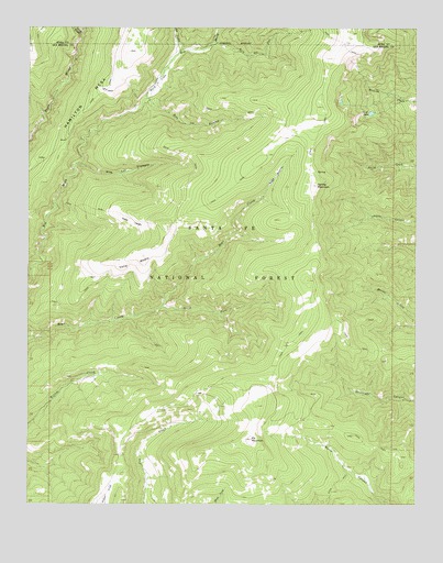
Elk Mountain, NM USGS Topographic Map
Click on map above to begin viewing in our Map Viewer.

This topographic map contains these locations and features:
Feature Name Type Latitude Longitude GNIS ID View Map
Burnt SpringSpringN35.7814°W105.5834°913699View Map
Elk MountainSummitN35.7667°W105.5539°906129View Map
Iron Gate Recreation SiteLocaleN35.8453°W105.6247°913700View Map
Lost LakeLakeN35.8527°W105.5152°908242View Map
Mora FlatsFlatN35.8603°W105.5836°908893View Map
Mount BarkerSummitN35.7634°W105.5697°936506View Map
Noisy BrookStreamN35.8734°W105.6083°909113View Map
Rio ValdezStreamN35.8689°W105.5764°910260View Map
Rito del OsoStreamN35.8711°W105.5656°910281View Map
Rito Las TrampasStreamN35.8389°W105.6103°910303View Map
Rito los EsterosStreamN35.8561°W105.5875°915887View Map
Santa Fe MountainsRangeN35.8000°W105.5172°897545View Map
South Fork Bear CreekStreamN35.8014°W105.5820°911229View Map
Spring MountainSummitN35.8336°W105.5322°911337View Map
Valle AltoAreaN35.7614°W105.5711°936814View Map
Valle LargoAreaN35.8236°W105.5922°912041View Map
Valle MedioAreaN35.8125°W105.5920°912043View Map
Vegas BonitaAreaN35.8361°W105.5453°912087View Map
Weener SpringSpringN35.7722°W105.5377°913703View Map

Note: Coordinates in the location and feature list above are referenced to NAD83 datum.


Copyright (C) 2008-2024 Ryan Niemi / Sunset Dynamics ... All Rights Reserved