TopoQuest Logo
Do you find TopoQuest useful?
Help keep TopoQuest running and adding new maps/features by donating!
Bitcoin:  19c7KJd3qBynnjoSw5npx9KScwjBe4ifkT
Litecoin:  LXs6TkuXGGXo1vDsWCkWVdjQX94eUKd6ui
Home View Maps Find Maps Find Places Resources & Links


Elevator Mountain, Arizona Topographic Map

USGS Map Title: Elevator Mountain, AZ
USGS Map MRC: 33109B5
DRG (GeoTIFF) Download: o33109b5.tif


Neighboring USGS Topographic Map Quads:


  Point of Pines East, AZ  
33109C6
 

  Willow Mountain SE, AZ  
33109C5
 

  Bee Canyon, AZ  
33109C4
 

  Park Creek Cabins, AZ  
33109B6
 

  Elevator Mountain, AZ  
33109B5
 

  Coronado Mountain, AZ  
33109B4
 

  Bryce Mountain, AZ  
33109A6
 

  Bonita Spring, AZ  
33109A5
 

  Copperplate Gulch, AZ  
33109A4


Map MRC Location:

N34°
W110°
N34°
W109°
H8 H7 H6 H5 H4 H3 H2 H1
G8 G7 G6 G5 G4 G3 G2 G1
F8 F7 F6 F5 F4 F3 F2 F1
E8 E7 E6 E5 E4 E3 E2 E1
D8 D7 D6 D5 D4 D3 D2 D1
C8 C7 C6 C5 C4 C3 C2 C1
B8 B7 B6 B5 B4 B3 B2 B1
A8 A7 A6 A5 A4 A3 A2 A1
N33°
W110°
N33°
W109°

Elevator Mountain, AZ USGS 1:24K Topographic Map Preview:
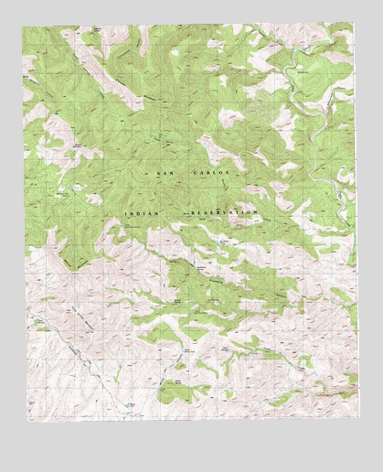
Elevator Mountain, AZ USGS Topographic Map
Click on map above to begin viewing in our Map Viewer.

This topographic map contains these locations and features:
Feature Name Type Latitude Longitude GNIS ID View Map
Boiling SpringSpringN33.1620°W109.5699°1789View Map
Brushy CreekStreamN33.1851°W109.5023°2040View Map
Brushy MountainSummitN33.2120°W109.6037°2041View Map
Brushy SpringsSpringN33.2134°W109.5712°2044View Map
Cienega CreekStreamN33.2412°W109.5231°2933View Map
Elevator MountainSummitN33.2273°W109.5829°4404View Map
Fifteenmile CanyonValleyN33.2209°W109.5106°28982View Map
Fifteenmile CorralLocaleN33.1917°W109.5095°4589View Map
Holding PastureAreaN33.2398°W109.5173°22525View Map
Kane SpringSpringN33.1570°W109.6208°6609View Map
Kane Spring MountainSummitN33.1531°W109.6017°6613View Map
Little Boiling SpringSpringN33.1598°W109.5620°7072View Map
Little Sycamore SpringSpringN33.1866°W109.5876°7200View Map
Maverick SpringSpringN33.2486°W109.5982°7790View Map
McEwen Trap SpringSpringN33.1963°W109.6082°7830View Map
Mescal MountainSummitN33.1767°W109.6123°7915View Map
NinemileAreaN33.2326°W109.5148°8654View Map
Sycamore SpringsSpringN33.1726°W109.5613°12091View Map
Sycamore TankReservoirN33.1805°W109.5522°12092View Map
Tule CreekStreamN33.1851°W109.5023°35506View Map
Upper Windy TankReservoirN33.1471°W109.5662°24125View Map
Windy SpringSpringN33.1323°W109.5756°22710View Map
Windy TankReservoirN33.1300°W109.5873°13919View Map
Windy WellWellN33.1345°W109.5759°13922View Map

Note: Coordinates in the location and feature list above are referenced to NAD83 datum.


Copyright (C) 2008-2024 Ryan Niemi / Sunset Dynamics ... All Rights Reserved