TopoQuest Logo
Do you find TopoQuest useful?
Help keep TopoQuest running and adding new maps/features by donating!
Bitcoin:  19c7KJd3qBynnjoSw5npx9KScwjBe4ifkT
Litecoin:  LXs6TkuXGGXo1vDsWCkWVdjQX94eUKd6ui
Home View Maps Find Maps Find Places Resources & Links


Edelstein, Illinois Topographic Map

USGS Map Title: Edelstein, IL
USGS Map MRC: 40089H6
DRG (GeoTIFF) Download: o40089h6.tif


Neighboring USGS Topographic Map Quads:


  Wyoming, IL  
41089A7
 

  Castleton, IL  
41089A6
 

  La Prairie Center, IL  
41089A5
 

  Princeville, IL  
40089H7
 

  Edelstein, IL  
40089H6
 

  Rome, IL  
40089H5
 

  Oak Hill, IL  
40089G7
 

  Dunlap, IL  
40089G6
 

  Spring Bay, IL  
40089G5


Map MRC Location:

N41°
W90°
N41°
W89°
H8 H7 H6 H5 H4 H3 H2 H1
G8 G7 G6 G5 G4 G3 G2 G1
F8 F7 F6 F5 F4 F3 F2 F1
E8 E7 E6 E5 E4 E3 E2 E1
D8 D7 D6 D5 D4 D3 D2 D1
C8 C7 C6 C5 C4 C3 C2 C1
B8 B7 B6 B5 B4 B3 B2 B1
A8 A7 A6 A5 A4 A3 A2 A1
N40°
W90°
N40°
W89°

Edelstein, IL USGS 1:24K Topographic Map Preview:
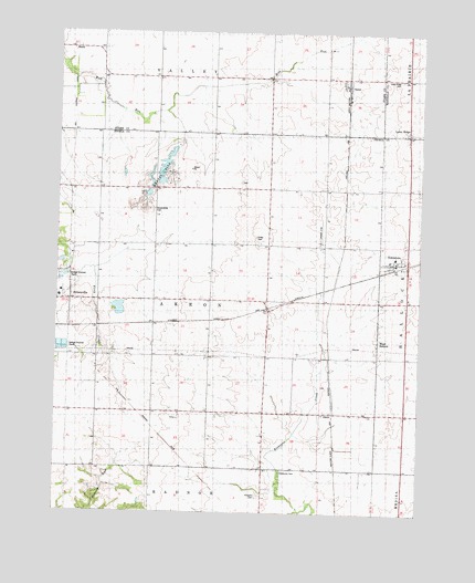
Edelstein, IL USGS Topographic Map
Click on map above to begin viewing in our Map Viewer.

This topographic map contains these locations and features:
Feature Name Type Latitude Longitude GNIS ID View Map
AkronPopulated PlaceN40.9039°W89.6540°422393View Map
Apostolic Christian CemeteryCemeteryN40.9318°W89.7497°1958038View Map
Apostolic Christian ChurchChurchN40.9311°W89.7493°1839879View Map
Blue School (historical)SchoolN40.9595°W89.7337°404607View Map
EdelsteinPopulated PlaceN40.9409°W89.6293°407763View Map
Edelstein Post OfficePost OfficeN40.9404°W89.6340°2788680View Map
Ertley CemeteryCemeteryN40.9467°W89.6815°1720272View Map
Foxx School (historical)SchoolN40.9884°W89.6962°408644View Map
Hawley School (historical)SchoolN40.9598°W89.6573°409943View Map
Hitchcock CemeteryCemeteryN40.8856°W89.6720°1720285View Map
Lake Shore Drive PondReservoirN40.9134°W89.6684°1691869View Map
Lake Shore Drive Pond DamDamN40.9134°W89.6684°1691868View Map
Lawn RidgePopulated PlaceN40.9739°W89.6293°422901View Map
Lawn Ridge CemeteryCemeteryN40.9880°W89.6324°411861View Map
Morrow School (historical)SchoolN40.9309°W89.7340°426931View Map
Potter School (historical)SchoolN40.9011°W89.6590°416080View Map
Prospect CemeteryCemeteryN40.8795°W89.6794°416237View Map
Rock Island Trail Prairie Nature PreserveParkN40.9700°W89.7450°2085552View Map
SpeerPopulated PlaceN40.9884°W89.6504°423196View Map
Speer Post OfficePost OfficeN40.9865°W89.6512°1821219View Map
Speer Volunteer Fire DepartmentBuildingN40.9875°W89.6520°2640561View Map
StarkPopulated PlaceN40.9956°W89.7440°423203View Map
Stark School (historical)SchoolN40.9886°W89.7345°419054View Map
Streitmatter CemeteryCemeteryN40.9539°W89.7167°1720322View Map
Streitmatter School (historical)SchoolN40.9600°W89.6962°419217View Map
Summit School (historical)SchoolN40.9000°W89.6970°419357View Map
Timmons School (historical)SchoolN40.9300°W89.6582°419729View Map
Townhall School (historical)SchoolN40.9309°W89.6973°419809View Map
Township of AkronCivilN40.9302°W89.6970°428574View Map
West HallockPopulated PlaceN40.9209°W89.6393°423297View Map
West Hallock CemeteryCemeteryN40.9244°W89.6385°1959152View Map
Wilson School (historical)SchoolN40.9011°W89.7351°421302View Map
Woertz CemeteryCemeteryN40.9611°W89.6872°1959148View Map

Note: Coordinates in the location and feature list above are referenced to NAD83 datum.


Copyright (C) 2008-2024 Ryan Niemi / Sunset Dynamics ... All Rights Reserved