TopoQuest Logo
Do you find TopoQuest useful?
Help keep TopoQuest running and adding new maps/features by donating!
Bitcoin:  19c7KJd3qBynnjoSw5npx9KScwjBe4ifkT
Litecoin:  LXs6TkuXGGXo1vDsWCkWVdjQX94eUKd6ui
Home View Maps Find Maps Find Places Resources & Links


Ebenezer, Missouri Topographic Map

USGS Map Title: Ebenezer, MO
USGS Map MRC: 37093C3
DRG (GeoTIFF) Download: o37093c3.tif


Neighboring USGS Topographic Map Quads:


  Morrisville, MO  
37093D4
 

  Pleasant Hope, MO  
37093D3
 

  Fair Grove, MO  
37093D2
 

  Willard, MO  
37093C4
 

  Ebenezer, MO  
37093C3
 

  Bassville, MO  
37093C2
 

  Brookline, MO  
37093B4
 

  Springfield, MO  
37093B3
 

  Galloway, MO  
37093B2


Map MRC Location:

N38°
W94°
N38°
W93°
H8 H7 H6 H5 H4 H3 H2 H1
G8 G7 G6 G5 G4 G3 G2 G1
F8 F7 F6 F5 F4 F3 F2 F1
E8 E7 E6 E5 E4 E3 E2 E1
D8 D7 D6 D5 D4 D3 D2 D1
C8 C7 C6 C5 C4 C3 C2 C1
B8 B7 B6 B5 B4 B3 B2 B1
A8 A7 A6 A5 A4 A3 A2 A1
N37°
W94°
N37°
W93°

Ebenezer, MO USGS 1:24K Topographic Map Preview:
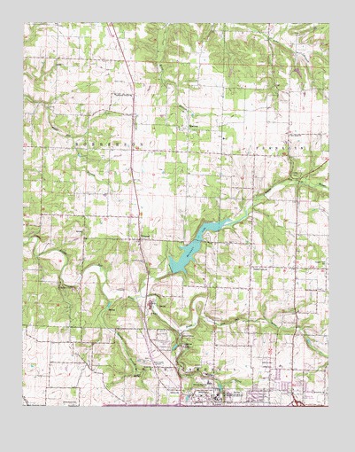
Ebenezer, MO USGS Topographic Map
Click on map above to begin viewing in our Map Viewer.

This topographic map contains these locations and features:
Feature Name Type Latitude Longitude GNIS ID View Map
AbbottLocaleN37.2914°W93.2641°740362View Map
Avalon ParkPopulated PlaceN37.3262°W93.2627°732672View Map
Bell View ChurchChurchN37.2881°W93.2552°713920View Map
Brick Church CemeteryCemeteryN37.2506°W93.3541°714684View Map
Calvary ChurchChurchN37.2553°W93.3152°715219View Map
Central Bible CollegeSchoolN37.2525°W93.2944°715669View Map
Dickerson BranchStreamN37.2600°W93.3069°736006View Map
Dickerson ParkParkN37.2548°W93.3071°716884View Map
Doling BranchStreamN37.2573°W93.2938°736007View Map
Dry Sac ArchArchN37.2786°W93.3028°2680472View Map
EbenezerPopulated PlaceN37.3403°W93.3071°717374View Map
Ebenezer Fire Protection DistrictBuildingN37.3405°W93.3071°2621195View Map
Fairview SchoolSchoolN37.2564°W93.2974°717802View Map
Flint Hill School (historical)SchoolN37.3475°W93.3646°732667View Map
Fulbright SpringSpringN37.2705°W93.3088°2747180View Map
Fulbright Spring ParkParkN37.2720°W93.3071°718281View Map
GlidewellPopulated PlaceN37.3045°W93.3271°718529View Map
Grandview ChurchChurchN37.2548°W93.2510°735629View Map
Grandview Golf CourseLocaleN37.2534°W93.2602°755192View Map
Greene CountyCivilN37.2580°W93.3420°758493View Map
Greenlawn CemeteryCemeteryN37.2639°W93.2752°718823View Map
Hillcrest High SchoolSchoolN37.2578°W93.2991°719611View Map
KTTS-AM (Springfield)TowerN37.2642°W93.3180°754280View Map
Lost Hill Natural ArchArchN37.2792°W93.3028°2680471View Map
MascotPopulated PlaceN37.2628°W93.2969°740360View Map
McDaniel LakeReservoirN37.3025°W93.3045°762878View Map
McDaniel Lake DamDamN37.2934°W93.3152°762877View Map
New Salem ChurchChurchN37.3384°W93.2663°723306View Map
North Fork Pea Ridge CreekStreamN37.2584°W93.2882°736025View Map
Pea Ridge CreekStreamN37.2739°W93.3107°724128View Map
Pleasant Hill School (historical)SchoolN37.3387°W93.2674°732669View Map
Pleasant ValleyPopulated PlaceN37.2959°W93.2821°737883View Map
Pleasant Valley ChurchChurchN37.2953°W93.2805°724622View Map
Pleasant Valley School (historical)SchoolN37.2956°W93.2802°732670View Map
Rainbow LakeReservoirN37.3591°W93.2629°763289View Map
Rainbow Lake DamDamN37.3600°W93.2635°763288View Map
Ritter SchoolSchoolN37.2628°W93.3219°725335View Map
Ritter Springs ParkParkN37.2795°W93.3394°725336View Map
Robberson Prairie ChurchChurchN37.3514°W93.3374°735821View Map
RosevillePopulated PlaceN37.2645°W93.2652°740361View Map
Schuyler School (historical)SchoolN37.2712°W93.3541°732668View Map
South Dry Sac RiverStreamN37.2859°W93.3266°726718View Map
South Fork Pea Ridge CreekStreamN37.2584°W93.2882°736038View Map
Spring BranchStreamN37.2850°W93.3396°726889View Map
Springfield Water Station (historical)LocaleN37.2739°W93.3107°732671View Map
Township of Franklin Number 2CivilN37.3135°W93.2524°766684View Map
Township of North Campbell Number 2CivilN37.2665°W93.2600°766689View Map
Township of North Campbell Number 3 (historical)CivilN37.2628°W93.2888°766690View Map
Township of North Campbell Number 3ACivilN37.2654°W93.3225°1990071View Map
Township of North Campbell Number 3BCivilN37.2578°W93.3685°1990072View Map
Township of Robberson Number 2CivilN37.3234°W93.3477°766693View Map
Willard Fire Protection District Station 2BuildingN37.2715°W93.3549°2620805View Map

Note: Coordinates in the location and feature list above are referenced to NAD83 datum.


Copyright (C) 2008-2024 Ryan Niemi / Sunset Dynamics ... All Rights Reserved