TopoQuest Logo
Do you find TopoQuest useful?
Help keep TopoQuest running and adding new maps/features by donating!
Bitcoin:  19c7KJd3qBynnjoSw5npx9KScwjBe4ifkT
Litecoin:  LXs6TkuXGGXo1vDsWCkWVdjQX94eUKd6ui
Home View Maps Find Maps Find Places Resources & Links


Dummer Ponds, New Hampshire Topographic Map

USGS Map Title: Dummer Ponds, NH
USGS Map MRC: 44071F3
DRG (GeoTIFF) Download: o44071f3.tif


Neighboring USGS Topographic Map Quads:


  Bunnell Mountain, NH  
44071G4
 

  Dixville Notch, NH  
44071G3
 

  Errol, NH  
44071G2
 

  Percy Peaks, NH  
44071F4
 

  Dummer Ponds, NH  
44071F3
 

  Teakettle Ridge, NH  
44071F2
 

  Stark, NH  
44071E4
 

  West Milan, NH  
44071E3
 

  Milan, NH  
44071E2


Map MRC Location:

N45°
W72°
N45°
W71°
H8 H7 H6 H5 H4 H3 H2 H1
G8 G7 G6 G5 G4 G3 G2 G1
F8 F7 F6 F5 F4 F3 F2 F1
E8 E7 E6 E5 E4 E3 E2 E1
D8 D7 D6 D5 D4 D3 D2 D1
C8 C7 C6 C5 C4 C3 C2 C1
B8 B7 B6 B5 B4 B3 B2 B1
A8 A7 A6 A5 A4 A3 A2 A1
N44°
W72°
N44°
W71°

Dummer Ponds, NH USGS 1:24K Topographic Map Preview:
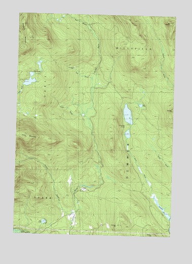
Dummer Ponds, NH USGS Topographic Map
Click on map above to begin viewing in our Map Viewer.

This topographic map contains these locations and features:
Feature Name Type Latitude Longitude GNIS ID View Map
Coos CountyCivilN44.6895°W71.3055°873177View Map
Cow MountainSummitN44.6967°W71.2501°866372View Map
Dummer HillSummitN44.6337°W71.2884°866656View Map
Dummer PondsLakeN44.6937°W71.2858°866658View Map
Jodrie BrookStreamN44.6934°W71.3187°867789View Map
Mount PatienceSummitN44.7462°W71.2534°869017View Map
Mud PondLakeN44.6992°W71.2757°868650View Map
Number Two BrookStreamN44.7081°W71.3129°868857View Map
Paris (historical)Populated PlaceN44.6512°W71.3209°871213View Map
Pike PondLakeN44.6321°W71.3506°869149View Map
Pond BrookStreamN44.6492°W71.2623°869288View Map
Roberts BrooksStreamN44.6378°W71.3273°869541View Map
Town of DummerCivilN44.6562°W71.2527°873582View Map
Trio PondReservoirN44.7120°W71.3645°1775422View Map
Trio Pond Western DamDamN44.7084°W71.3679°1775421View Map
Trio PondsLakeN44.7120°W71.3645°870502View Map
West Branch Phillips BrookStreamN44.7403°W71.3156°870754View Map
Whitcomb MountainRidgeN44.7303°W71.3706°870831View Map

Note: Coordinates in the location and feature list above are referenced to NAD83 datum.


Copyright (C) 2008-2024 Ryan Niemi / Sunset Dynamics ... All Rights Reserved