TopoQuest Logo
Do you find TopoQuest useful?
Help keep TopoQuest running and adding new maps/features by donating!
Bitcoin:  19c7KJd3qBynnjoSw5npx9KScwjBe4ifkT
Litecoin:  LXs6TkuXGGXo1vDsWCkWVdjQX94eUKd6ui
Home View Maps Find Maps Find Places Resources & Links


Duffield, Virginia Topographic Map

USGS Map Title: Duffield, VA
USGS Map MRC: 36082F7
DRG (GeoTIFF) Download: o36082f7.tif


Neighboring USGS Topographic Map Quads:


  Keokee, VA  
36082G8
 

  Big Stone Gap, VA  
36082G7
 

  East Stone Gap, VA  
36082G6
 

  Stickleyville, VA  
36082F8
 

  Duffield, VA  
36082F7
 

  Clinchport, VA  
36082F6
 

  Looneys Gap, TN  
36082E8
 

  Plum Grove, TN  
36082E7
 

  Church Hill, TN  
36082E6


Map MRC Location:

N37°
W83°
N37°
W82°
H8 H7 H6 H5 H4 H3 H2 H1
G8 G7 G6 G5 G4 G3 G2 G1
F8 F7 F6 F5 F4 F3 F2 F1
E8 E7 E6 E5 E4 E3 E2 E1
D8 D7 D6 D5 D4 D3 D2 D1
C8 C7 C6 C5 C4 C3 C2 C1
B8 B7 B6 B5 B4 B3 B2 B1
A8 A7 A6 A5 A4 A3 A2 A1
N36°
W83°
N36°
W82°

Duffield, VA USGS 1:24K Topographic Map Preview:
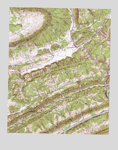
Duffield, VA USGS Topographic Map
Click on map above to begin viewing in our Map Viewer.

This topographic map contains these locations and features:
Feature Name Type Latitude Longitude GNIS ID View Map
Ash CemeteryCemeteryN36.6631°W82.8604°1481348View Map
Back ValleyBasinN36.7132°W82.8252°1481383View Map
Bailey CemeteryCemeteryN36.7220°W82.7554°1481397View Map
Baker CemeteryCemeteryN36.7445°W82.7888°1481411View Map
Bald Knob TunnelTunnelN36.6668°W82.7502°1481426View Map
Barnett CemeteryCemeteryN36.6486°W82.8130°1481466View Map
Benton CemeteryCemeteryN36.6370°W82.8593°1498030View Map
Big RidgeRidgeN36.6392°W82.8320°1269343View Map
Bobs BranchStreamN36.6423°W82.7713°1481898View Map
Bostic CemeteryCemeteryN36.6548°W82.8185°1498036View Map
Bowen - Peterson CemeteryCemeteryN36.7422°W82.7525°1498040View Map
Bowen CemeteryCemeteryN36.6932°W82.8645°1498039View Map
Burchette CemeteryCemeteryN36.6940°W82.8476°1482167View Map
Carter CemeteryCemeteryN36.6593°W82.8465°1498046View Map
Carter CemeteryCemeteryN36.7020°W82.7749°1498047View Map
Carter CemeteryCemeteryN36.7065°W82.8177°1498048View Map
Clendenen CemeteryCemeteryN36.6854°W82.8060°1482572View Map
Colt RidgeRidgeN36.6534°W82.7907°1482662View Map
Copper SidingLocaleN36.6629°W82.7504°1482704View Map
Darnell CemeteryCemeteryN36.6431°W82.8456°1482920View Map
DDA HeliportAirportN36.7112°W82.8007°1498656View Map
Deemie Tate CemeteryCemeteryN36.6410°W82.7721°1498059View Map
Delight SchoolSchoolN36.6462°W82.8385°1482978View Map
Devils RacepathGapN36.7043°W82.7743°1482992View Map
Dillion CemeteryCemeteryN36.6459°W82.8569°2766661View Map
District 6CivilN36.6635°W82.8401°1927282View Map
Drakes BranchStreamN36.6420°W82.8741°1483082View Map
Drakes GapGapN36.6465°W82.8427°1483083View Map
Dry BranchStreamN36.7329°W82.7974°1483107View Map
Dry CreekStreamN36.6862°W82.8702°1483114View Map
Dry HollowBasinN36.6262°W82.8313°1483122View Map
Duff CemeteryCemeteryN36.7284°W82.8579°1483155View Map
DuffieldPopulated PlaceN36.7190°W82.7960°1483156View Map
Duffield Post OfficePost OfficeN36.7116°W82.7993°2767210View Map
Duffield Primary SchoolSchoolN36.7099°W82.8030°1483157View Map
Duffield Volunteer Fire and Rescue Station 1BuildingN36.7268°W82.8009°2085976View Map
Dulaney - Tomlinson CemeteryCemeteryN36.6936°W82.8409°1488210View Map
Dulaney CemeteryCemeteryN36.6977°W82.8270°1498061View Map
Epperson CemeteryCemeteryN36.6269°W82.8373°2766675View Map
Falin BranchStreamN36.6357°W82.7866°1483343View Map
Falin BranchStreamN36.6448°W82.7638°1483344View Map
Falin CemeteryCemeteryN36.6380°W82.7921°2766677View Map
Falin CemeteryCemeteryN36.6444°W82.7656°1498065View Map
Fickle CemeteryCemeteryN36.6922°W82.8478°1483410View Map
Flanary CemeteryCemeteryN36.7055°W82.7699°2766686View Map
Floyd Frazier CemeteryCemeteryN36.6918°W82.7528°1498068View Map
Ford BranchStreamN36.6757°W82.7860°1483473View Map
Ford ValleyValleyN36.6786°W82.7556°1483479View Map
Fraley BranchStreamN36.6993°W82.8204°1483521View Map
Fraley CemeteryCemeteryN36.7061°W82.8214°1498072View Map
Fraley CemeteryCemeteryN36.7039°W82.8239°1498073View Map
FraleytownPopulated PlaceN36.7045°W82.8227°1492974View Map
Franklin CemeteryCemeteryN36.6714°W82.8175°1498075View Map
Frazier CemeteryCemeteryN36.7054°W82.7787°2766691View Map
Frazier CemeteryCemeteryN36.6477°W82.8201°2766692View Map
Freeman CemeteryCemeteryN36.6334°W82.7663°2766695View Map
Gilliam - Wade CemeteryCemeteryN36.6532°W82.8675°2766706View Map
GlenitaPopulated PlaceN36.6954°W82.7504°1498086View Map
Glenita ChurchChurchN36.6965°W82.7504°1483670View Map
Goode CemeteryCemeteryN36.6829°W82.7804°1498090View Map
Harris BranchStreamN36.7020°W82.8102°1483953View Map
Hill ChapelChurchN36.7395°W82.7546°1484109View Map
Hood CemeteryCemeteryN36.6974°W82.8451°2766676View Map
Horton BranchStreamN36.6693°W82.7827°1484234View Map
Horton CemeteryCemeteryN36.7320°W82.7602°1484236View Map
Horton CemeteryCemeteryN36.6695°W82.7846°1498098View Map
Horton CemeteryCemeteryN36.7262°W82.7690°1498099View Map
Horton ChapelChurchN36.6390°W82.7510°1484237View Map
Hortons Summit Post OfficePost OfficeN36.7265°W82.7671°1498494View Map
Hunter ValleyValleyN36.7090°W82.7956°1487048View Map
Irving BranchStreamN36.6279°W82.8060°1484364View Map
Kane CemeteryCemeteryN36.7115°W82.7896°1484519View Map
Kane GapGapN36.7326°W82.8241°1484520View Map
Lawson CemeteryCemeteryN36.7443°W82.8624°1484740View Map
Little Stock CreekStreamN36.6737°W82.7554°1484980View Map
Maness HollowValleyN36.6561°W82.8741°1485164View Map
McKinney CemeteryCemeteryN36.7015°W82.8215°1485311View Map
Minton CemeteryCemeteryN36.7384°W82.7818°1498116View Map
Mount View ChurchChurchN36.7015°W82.8507°1485654View Map
Natural TunnelPopulated PlaceN36.7001°W82.7504°1493339View Map
Necessary CemeteryCemeteryN36.6779°W82.7979°1498125View Map
Necessary CemeteryCemeteryN36.6643°W82.7985°1498126View Map
New Melody Church (historical)ChurchN36.6337°W82.8666°1498129View Map
Nickels CemeteryCemeteryN36.7204°W82.7979°1498130View Map
Pannell CemeteryCemeteryN36.7170°W82.7802°1498139View Map
PattonsvillePopulated PlaceN36.6995°W82.8513°1486088View Map
Pattonsville BranchStreamN36.6920°W82.8677°1486089View Map
Pattonsville School (historical)SchoolN36.6945°W82.8449°1498141View Map
Pentacost Church (historical)ChurchN36.6670°W82.7918°1498143View Map
Peters CemeteryCemeteryN36.6409°W82.7852°1498144View Map
PetersonPopulated PlaceN36.7284°W82.7974°1493421View Map
Peterson CemeteryCemeteryN36.7437°W82.7524°1498146View Map
Peterson CemeteryCemeteryN36.7312°W82.7954°1486169View Map
Peterson Chapel (historical)ChurchN36.7290°W82.7968°1498147View Map
Pine RidgeRidgeN36.7184°W82.7874°1498149View Map
Pine RidgeRidgeN36.7095°W82.8213°1486225View Map
Powers CemeteryCemeteryN36.6858°W82.8592°1498029View Map
Powers FordCrossingN36.6845°W82.8599°1493453View Map
Pridemore CemeteryCemeteryN36.6734°W82.7504°1498152View Map
Purchase CemeteryCemeteryN36.6706°W82.8121°1498156View Map
Purchase ChurchChurchN36.6701°W82.8118°1486454View Map
Purchase KnobSummitN36.6682°W82.8016°1493560View Map
Purchase RidgeRidgeN36.6879°W82.7982°1487075View Map
Purchase SchoolSchoolN36.6770°W82.7916°1486455View Map
Purchase ValleyBasinN36.6754°W82.8035°1486456View Map
Red Hill ChurchChurchN36.6940°W82.8460°1486536View Map
Rhoton CemeteryCemeteryN36.6659°W82.7652°1486577View Map
Rhoton CemeteryCemeteryN36.6984°W82.7521°1498161View Map
Rhoton CemeteryCemeteryN36.6643°W82.7740°1498162View Map
Rhoton CemeteryCemeteryN36.6531°W82.7693°1498163View Map
River KnobsRangeN36.6415°W82.7979°1486635View Map
Robinette CemeteryCemeteryN36.6495°W82.8529°1498167View Map
Robinette ValleyBasinN36.6270°W82.7791°1487077View Map
Rogers BranchStreamN36.6923°W82.8685°1486760View Map
Scotts BranchStreamN36.7240°W82.8607°1486987View Map
Sloan CemeteryCemeteryN36.6390°W82.8354°1487322View Map
Sloan CemeteryCemeteryN36.6459°W82.7888°1487323View Map
SloantownPopulated PlaceN36.6465°W82.7854°1493613View Map
Sloantown CemeteryCemeteryN36.6476°W82.7857°1498180View Map
Smith CemeteryCemeteryN36.6779°W82.8354°1487336View Map
Sols KnobSummitN36.6395°W82.7988°1493626View Map
Southwest Virginia Regional Jail Authority - Duffield FacilityBuildingN36.7229°W82.8041°2767135View Map
Speer-Gilliam-Sloan CemeteryCemeteryN36.6418°W82.8499°1498185View Map
Speers ValleyBasinN36.6382°W82.8563°1487433View Map
Sproles CemeteryCemeteryN36.6945°W82.8449°1487478View Map
Spurlock BranchStreamN36.7159°W82.7952°1487495View Map
Stone RidgeRidgeN36.7415°W82.7632°1487602View Map
Sturgill CemeteryCemeteryN36.6643°W82.8343°1487678View Map
SunbrightPopulated PlaceN36.7301°W82.7613°1493673View Map
Tomlinson CemeteryCemeteryN36.6701°W82.8213°1498198View Map
Town of DuffieldCivilN36.7196°W82.7961°2390151View Map
Troublesome CreekStreamN36.6479°W82.7504°1487993View Map
Walling CemeteryCemeteryN36.7423°W82.7521°1498205View Map
Warlf CemeteryCemeteryN36.6537°W82.8252°1498207View Map
Watts BranchStreamN36.6309°W82.7971°1488215View Map
WDUF-AM (Duffield)TowerN36.7084°W82.7916°1502458View Map
Williams CemeteryCemeteryN36.6581°W82.8613°1488391View Map
Williams CemeteryCemeteryN36.6973°W82.8696°1498212View Map
Williams CemeteryCemeteryN36.6420°W82.7827°1498213View Map
Willis Campbells CemeteryCemeteryN36.7143°W82.8688°1488397View Map

Note: Coordinates in the location and feature list above are referenced to NAD83 datum.


Copyright (C) 2008-2024 Ryan Niemi / Sunset Dynamics ... All Rights Reserved