TopoQuest Logo
Do you find TopoQuest useful?
Help keep TopoQuest running and adding new maps/features by donating!
Bitcoin:  19c7KJd3qBynnjoSw5npx9KScwjBe4ifkT
Litecoin:  LXs6TkuXGGXo1vDsWCkWVdjQX94eUKd6ui
Home View Maps Find Maps Find Places Resources & Links


Apple River, Illinois Topographic Map

USGS Map Title: Apple River, IL
USGS Map MRC: 42090E1
DRG (GeoTIFF) Download: o42090e1.tif


Neighboring USGS Topographic Map Quads:


  Calamine, WI  
42090F2
 

  Darlington, WI  
42090F1
 

  Wiota, WI  
42089F8
 

  Shullsburg, WI  
42090E2
 

  Apple River, IL  
42090E1
 

  South Wayne, WI  
42089E8
 

  Scales Mound East, IL  
42090D2
 

  Elizabeth NE, IL  
42090D1
 

  Warren, IL  
42089D8


Map MRC Location:

N43°
W91°
N43°
W90°
H8 H7 H6 H5 H4 H3 H2 H1
G8 G7 G6 G5 G4 G3 G2 G1
F8 F7 F6 F5 F4 F3 F2 F1
E8 E7 E6 E5 E4 E3 E2 E1
D8 D7 D6 D5 D4 D3 D2 D1
C8 C7 C6 C5 C4 C3 C2 C1
B8 B7 B6 B5 B4 B3 B2 B1
A8 A7 A6 A5 A4 A3 A2 A1
N42°
W91°
N42°
W90°

Apple River, IL USGS 1:24K Topographic Map Preview:
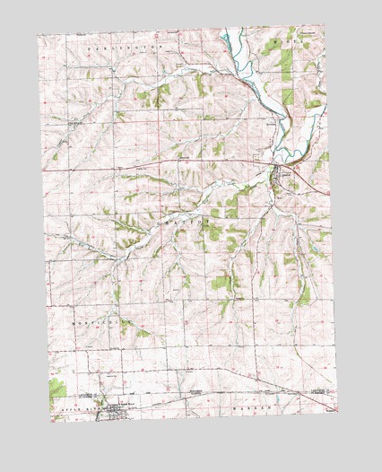
Apple River, IL USGS Topographic Map
Click on map above to begin viewing in our Map Viewer.

This topographic map contains these locations and features:
Feature Name Type Latitude Longitude GNIS ID View Map
0.37 ReservoirReservoirN42.5650°W90.0935°1793186View Map
1 ReservoirReservoirN42.5633°W90.0951°1793386View Map
Apple RiverPopulated PlaceN42.5050°W90.0987°403578View Map
Apple River Fire DepartmentBuildingN42.5003°W90.0896°2640485View Map
Apple River Post OfficePost OfficeN42.5035°W90.0970°2788764View Map
Apple River United Methodist ChurchChurchN42.5047°W90.0960°1987474View Map
Black Hawk Middle SchoolSchoolN42.5759°W90.0240°2715698View Map
Brannon SchoolSchoolN42.5833°W90.0651°1562154View Map
Copper CreekStreamN42.6083°W90.0362°1563390View Map
D and S FarmsLocaleN42.5142°W90.0419°2709963View Map
Davis FarmsLocaleN42.5133°W90.0367°2709958View Map
Dublin SchoolSchoolN42.6244°W90.1079°1564138View Map
Ernst DairyLocaleN42.5069°W90.0700°2680967View Map
Gill Brothers DairyLocaleN42.5383°W90.1244°2709954View Map
GratiotPopulated PlaceN42.5789°W90.0226°1565778View Map
Gratiot CemeteryCemeteryN42.5708°W90.0162°1565779View Map
Gratiot Volunteer Fire DepartmentBuildingN42.5793°W90.0229°2698036View Map
Hi View FarmLocaleN42.6239°W90.0792°2709898View Map
Highland CemeteryCemeteryN42.5150°W90.0990°1566389View Map
Johnny Cake SchoolSchoolN42.6225°W90.0101°1567201View Map
Kingsley CemeteryCemeteryN42.5811°W90.0840°1567510View Map
Levitt SchoolSchoolN42.5233°W90.0976°1567996View Map
Metz Number 1 G9922 DamDamN42.5650°W90.0935°1793185View Map
Metz Number 2 G9922 DamDamN42.5633°W90.0951°1793385View Map
Monson Udder FarmsLocaleN42.6111°W90.0039°2709961View Map
Red Rock SchoolSchoolN42.6244°W90.0635°1572155View Map
RiversidePopulated PlaceN42.5939°W90.0226°1577792View Map
Robelia Dairy FarmsLocaleN42.5658°W90.0847°2709962View Map
Saint Josephs ChurchChurchN42.5050°W90.0968°1987475View Map
Salty Hollow SchoolSchoolN42.5961°W90.1126°1573639View Map
Silent Hollow FarmLocaleN42.6044°W90.1108°2709904View Map
Spring Valley DairyLocaleN42.6214°W90.0617°2709964View Map
Stietz FarmsLocaleN42.5858°W90.0264°2709959View Map
Town of GratiotCivilN42.5633°W90.0342°1583308View Map
Trout BrookStreamN42.5783°W90.0260°1575659View Map
Village of Apple RiverCivilN42.5023°W90.0937°2397973View Map
Village of GratiotCivilN42.5797°W90.0235°1583307View Map
Whitcomb FarmsLocaleN42.5467°W90.0600°2611853View Map
Wolf CreekStreamN42.5833°W90.0173°1576931View Map

Note: Coordinates in the location and feature list above are referenced to NAD83 datum.


Copyright (C) 2008-2024 Ryan Niemi / Sunset Dynamics ... All Rights Reserved