TopoQuest Logo
Do you find TopoQuest useful?
Help keep TopoQuest running and adding new maps/features by donating!
Bitcoin:  19c7KJd3qBynnjoSw5npx9KScwjBe4ifkT
Litecoin:  LXs6TkuXGGXo1vDsWCkWVdjQX94eUKd6ui
Home View Maps Find Maps Find Places Resources & Links


Apache Peak, Arizona Topographic Map

USGS Map Title: Apache Peak, AZ
USGS Map MRC: 31110G4
DRG (GeoTIFF) Download: o31110g4.tif


Neighboring USGS Topographic Map Quads:


  The Narrows, AZ  
31110H5
 

  Mescal, AZ  
31110H4
 

  Benson, AZ  
31110H3
 

  Spring Water Canyon, AZ  
31110G5
 

  Apache Peak, AZ  
31110G4
 

  McGrew Spring, AZ  
31110G3
 

  Elgin, AZ  
31110F5
 

  Mustang Mountains, AZ  
31110F4
 

  Huachuca City, AZ  
31110F3


Map MRC Location:

N32°
W111°
N32°
W110°
H8 H7 H6 H5 H4 H3 H2 H1
G8 G7 G6 G5 G4 G3 G2 G1
F8 F7 F6 F5 F4 F3 F2 F1
E8 E7 E6 E5 E4 E3 E2 E1
D8 D7 D6 D5 D4 D3 D2 D1
C8 C7 C6 C5 C4 C3 C2 C1
B8 B7 B6 B5 B4 B3 B2 B1
A8 A7 A6 A5 A4 A3 A2 A1
N31°
W111°
N31°
W110°

Apache Peak, AZ USGS 1:24K Topographic Map Preview:
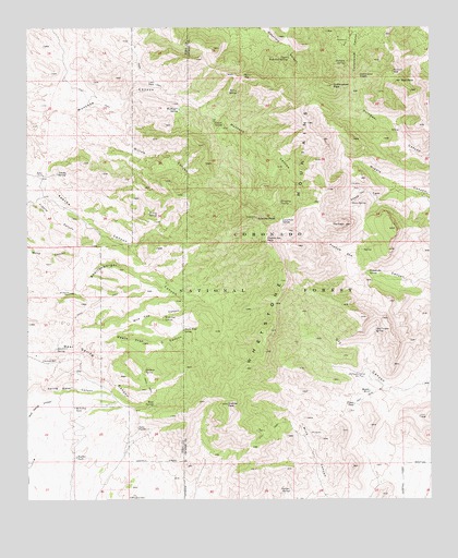
Apache Peak, AZ USGS Topographic Map
Click on map above to begin viewing in our Map Viewer.

This topographic map contains these locations and features:
Feature Name Type Latitude Longitude GNIS ID View Map
Apache PeakSummitN31.8248°W110.4290°25714View Map
Apache SpringSpringN31.8366°W110.4910°25721View Map
Basin SpringSpringN31.8489°W110.3853°2680335View Map
Bathtub SpringSpringN31.8658°W110.4017°26038View Map
Bear SpringSpringN31.7751°W110.4612°26105View Map
Blacktail SpringSpringN31.7901°W110.4915°26469View Map
Bootlegger SpringSpringN31.8534°W110.4531°26615View Map
Boulder TankReservoirN31.7614°W110.4855°26653View Map
Burro GapGapN31.8620°W110.4334°27046View Map
Burro SpringSpringN31.8579°W110.4345°27050View Map
Cement Trough SpringSpringN31.8594°W110.3967°2680338View Map
Christmas TankReservoirN31.7532°W110.4433°2680323View Map
Clyne WellLocaleN31.8006°W110.4664°2680324View Map
Copper Sands WellWellN31.7677°W110.4631°2680328View Map
Cottonwood PeakSummitN31.8595°W110.4054°28026View Map
Cottonwood SaddleGapN31.8618°W110.3970°28028View Map
Cottonwood SpringSpringN31.8722°W110.3969°2680331View Map
Cottonwood Trick TankReservoirN31.7572°W110.4464°2680322View Map
Coyote SpringSpringN31.8495°W110.4423°28124View Map
Death Trap CanyonValleyN31.7901°W110.4820°28353View Map
Death Trap SpringSpringN31.7948°W110.4517°28354View Map
Dripping SpringSpringN31.8287°W110.4215°28596View Map
Dry Canyon SpringSpringN31.7948°W110.3929°28620View Map
Dry Canyon WellWellN31.7831°W110.3970°28621View Map
East PeakSummitN31.8609°W110.3842°28780View Map
East Peak Trick TankReservoirN31.8617°W110.3864°2680318View Map
French Joe PeakSummitN31.8181°W110.4265°29191View Map
French Joe SpringSpringN31.8102°W110.3951°29192View Map
French Joe Trick TankReservoirN31.8106°W110.4002°2680321View Map
Glenn SpringReservoirN31.8211°W110.3994°2680333View Map
Glenn SpringSpringN31.8287°W110.4000°29340View Map
Goat SpringSpringN31.7520°W110.4673°37317View Map
Goat WellWellN31.7508°W110.4672°2680329View Map
Goat WellWellN31.7504°W110.4676°29364View Map
Granite PeakSummitN31.7751°W110.4384°29486View Map
Great Spring TankReservoirN31.7512°W110.4675°37324View Map
Hardwater SpringSpringN31.8561°W110.4081°2680332View Map
Hidden SpringsSpringN31.8386°W110.4008°2680337View Map
Iron SpringSpringN31.7553°W110.4358°2680317View Map
Juniper SpringSpringN31.7525°W110.4195°30672View Map
Lobo PassGapN31.8609°W110.4604°31162View Map
Lone Pine SaddleGapN31.8237°W110.4217°31210View Map
Lower Bear SpringSpringN31.7797°W110.4733°2680327View Map
Lower Wakefield SpringSpringN31.8640°W110.4534°37386View Map
Maverick WellWellN31.8048°W110.4879°31593View Map
McNalley TankReservoirN31.7745°W110.4860°31682View Map
Middle Dry TankReservoirN31.7788°W110.3945°2680315View Map
Middle TankReservoirN31.7788°W110.3945°31825View Map
Middle Wakefield SpringSpringN31.8737°W110.4437°39212View Map
Mine Canyon Trick TankReservoirN31.7655°W110.4145°2680316View Map
New Dry Canyon Trick TankReservoirN31.7906°W110.4000°2680320View Map
Ramsey WellWellN31.7870°W110.4954°33358View Map
Shellenberger Trick TankReservoirN31.8072°W110.4303°2680330View Map
Simpson SpringSpringN31.7843°W110.4642°34456View Map
South Fork Middle CanyonValleyN31.8323°W110.3840°34662View Map
The CapeCliffN31.8229°W110.4020°35214View Map
Upper Dry TankReservoirN31.7753°W110.3997°2680314View Map
Upper Guindani Trick TankReservoirN31.8515°W110.3983°2680336View Map
Upper TankReservoirN31.7753°W110.3997°35716View Map
Upper Wakefield SpringSpringN31.8670°W110.4195°35727View Map
Wakefield Northeast TankReservoirN31.8686°W110.4153°2680339View Map
Whetstone MountainsSummitN31.7948°W110.4252°36047View Map
White Wing SpringSpringN31.8514°W110.3942°2680334View Map
Wild Cow CanyonValleyN31.7943°W110.4729°36157View Map
Wild Cow SpringSpringN31.7990°W110.4579°36158View Map
Willow CanyonValleyN31.8526°W110.4784°36224View Map
Willow SpringSpringN31.8259°W110.4626°36242View Map

Note: Coordinates in the location and feature list above are referenced to NAD83 datum.


Copyright (C) 2008-2024 Ryan Niemi / Sunset Dynamics ... All Rights Reserved