TopoQuest Logo
Do you find TopoQuest useful?
Help keep TopoQuest running and adding new maps/features by donating!
Bitcoin:  19c7KJd3qBynnjoSw5npx9KScwjBe4ifkT
Litecoin:  LXs6TkuXGGXo1vDsWCkWVdjQX94eUKd6ui
Home View Maps Find Maps Find Places Resources & Links


Dixie Meadows, Oregon Topographic Map

USGS Map Title: Dixie Meadows, OR
USGS Map MRC: 44118E6
DRG (GeoTIFF) Download: o44118e6.tif


Neighboring USGS Topographic Map Quads:


  Susanville, OR  
44118F7
 

  Boulder Butte, OR  
44118F6
 

  Vinegar Hill, OR  
44118F5
 

  Cougar Rock, OR  
44118E7
 

  Dixie Meadows, OR  
44118E6
 

  Bates, OR  
44118E5
 

  Castle Creek, OR  
44118D7
 

  Prairie City, OR  
44118D6
 

  Isham Creek, OR  
44118D5


Map MRC Location:

N45°
W119°
N45°
W118°
H8 H7 H6 H5 H4 H3 H2 H1
G8 G7 G6 G5 G4 G3 G2 G1
F8 F7 F6 F5 F4 F3 F2 F1
E8 E7 E6 E5 E4 E3 E2 E1
D8 D7 D6 D5 D4 D3 D2 D1
C8 C7 C6 C5 C4 C3 C2 C1
B8 B7 B6 B5 B4 B3 B2 B1
A8 A7 A6 A5 A4 A3 A2 A1
N44°
W119°
N44°
W118°

Dixie Meadows, OR USGS 1:24K Topographic Map Preview:
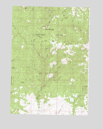
Dixie Meadows, OR USGS Topographic Map
Click on map above to begin viewing in our Map Viewer.

This topographic map contains these locations and features:
Feature Name Type Latitude Longitude GNIS ID View Map
Bennett CreekStreamN44.6165°W118.6483°1152985View Map
Boulder Group MineMineN44.5527°W118.6269°1155464View Map
Buck GulchValleyN44.5457°W118.6997°1152980View Map
Bull Run CreekStreamN44.5268°W118.7052°1155463View Map
Camp SpringSpringN44.6148°W118.6652°1139269View Map
Comer (historical)LocaleN44.5332°W118.6969°1152969View Map
Comer CreekStreamN44.5474°W118.7002°1140018View Map
Comer Post Office (historical)Post OfficeN44.5332°W118.6969°1165078View Map
Copperopolis MineMineN44.5575°W118.6806°1140111View Map
Cougar Ridge MineMineN44.5477°W118.6961°1155460View Map
Dixie ButteSummitN44.5827°W118.6261°1141075View Map
Dixie Butte Fire Lookout TowerTowerN44.5830°W118.6265°1167264View Map
Dixie MeadowsFlatN44.5857°W118.7158°1141083View Map
Dixie Meadows MineMineN44.6015°W118.6952°1141084View Map
Ella GulchValleyN44.5429°W118.6663°1152979View Map
Honeymoon CanyonValleyN44.5763°W118.7150°1152984View Map
Keystone MineMineN44.5479°W118.7033°1144592View Map
Lick Creek Trail (historical)TrailN44.5829°W118.7283°1144987View Map
Long Tom GulchValleyN44.5707°W118.7052°1152983View Map
Ragged RocksSummitN44.6249°W118.7316°1148137View Map
Ragged Rocks Trail (historical)TrailN44.6068°W118.7261°1148138View Map
Shatt MineMineN44.5263°W118.6949°1155462View Map
Smuggler MineMineN44.5496°W118.6794°1155461View Map
Standard CreekStreamN44.5327°W118.6974°1150332View Map
Standard MineMineN44.5454°W118.6816°1150333View Map
Sulphur CreekStreamN44.6146°W118.6483°1150578View Map
Wickiup CreekStreamN44.5638°W118.6969°1152982View Map
Wickiup SpringSpringN44.5862°W118.6836°1152311View Map

Note: Coordinates in the location and feature list above are referenced to NAD83 datum.


Copyright (C) 2008-2024 Ryan Niemi / Sunset Dynamics ... All Rights Reserved