TopoQuest Logo
Do you find TopoQuest useful?
Help keep TopoQuest running and adding new maps/features by donating!
Bitcoin:  19c7KJd3qBynnjoSw5npx9KScwjBe4ifkT
Litecoin:  LXs6TkuXGGXo1vDsWCkWVdjQX94eUKd6ui
Home View Maps Find Maps Find Places Resources & Links


Deer Lodge Canyon, Nevada Topographic Map

USGS Map Title: Deer Lodge Canyon, NV
USGS Map MRC: 37114H1
DRG (GeoTIFF) Download: o37114h1.tif


Neighboring USGS Topographic Map Quads:


  Eagle Valley Reservoir, NV  
38114A2
 

  Rice Mountain, UT  
38114A1
 

  Steamboat Mountain SW, UT  
38113A8
 

  Ursine, NV  
37114H2
 

  Deer Lodge Canyon, NV  
37114H1
 

  Eightmile Spring, UT  
37113H8
 

  Panaca Summit, NV  
37114G2
 

  Prohibition Flat, NV  
37114G1
 

  Modena, UT  
37113G8


Map MRC Location:

N38°
W115°
N38°
W114°
H8 H7 H6 H5 H4 H3 H2 H1
G8 G7 G6 G5 G4 G3 G2 G1
F8 F7 F6 F5 F4 F3 F2 F1
E8 E7 E6 E5 E4 E3 E2 E1
D8 D7 D6 D5 D4 D3 D2 D1
C8 C7 C6 C5 C4 C3 C2 C1
B8 B7 B6 B5 B4 B3 B2 B1
A8 A7 A6 A5 A4 A3 A2 A1
N37°
W115°
N37°
W114°

Deer Lodge Canyon, NV USGS 1:24K Topographic Map Preview:
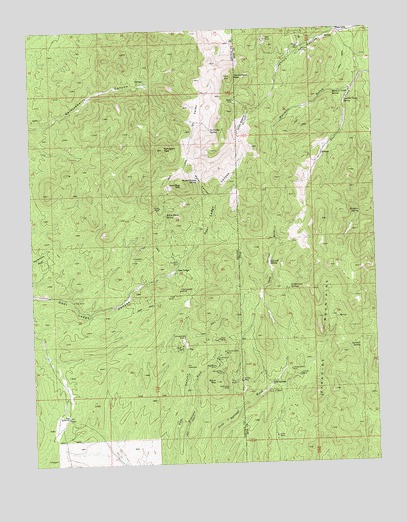
Deer Lodge Canyon, NV USGS Topographic Map
Click on map above to begin viewing in our Map Viewer.

This topographic map contains these locations and features:
Feature Name Type Latitude Longitude GNIS ID View Map
Big Buck MineMineN37.9027°W114.0603°838715View Map
Big SummitGapN37.8886°W114.1133°838775View Map
Buck MountainSummitN37.8983°W114.0600°845783View Map
Charley Ross MineMineN37.9069°W114.0566°839422View Map
Cottonwood SpringsSpringN37.9255°W114.0321°1426950View Map
Deer Lodge (historical)Populated PlaceN37.9308°W114.0739°854425View Map
Deerlodge Post Office (historical)Post OfficeN37.9308°W114.0739°864729View Map
Desert Springs (historical)LocaleN37.8841°W114.0547°852062View Map
Dursey CanyonValleyN37.9505°W114.0575°851293View Map
Eagle Valley Mining DistrictCivilN37.9475°W114.0525°855014View Map
East Mountain CanyonValleyN37.9386°W114.0622°851294View Map
Etna MineMineN37.8827°W114.0380°1427846View Map
Fay (historical)Populated PlaceN37.9080°W114.0700°856025View Map
Fay CemeteryCemeteryN37.9033°W114.0708°840427View Map
Fay Post Office (historical)Post OfficeN37.9080°W114.0700°864738View Map
Gatton PeakSummitN37.9102°W114.0580°851300View Map
Gold Bug MountainSummitN37.9555°W114.0711°845476View Map
Gold SpringsLocaleN37.8986°W114.0389°1428236View Map
Gold Springs Mining DistrictCivilN37.8814°W114.0633°855838View Map
Government PeakSummitN37.9860°W114.0518°845179View Map
Gypsy MineMineN37.9497°W114.0769°855837View Map
Hackett CemeteryCemeteryN37.9330°W114.0730°840849View Map
Helen MineMineN37.9508°W114.0766°855830View Map
Homestake MineMineN37.9247°W114.0725°841044View Map
Horseshoe MineMineN37.9116°W114.0714°841122View Map
Independence MineMineN37.9016°W114.0325°1428979View Map
Iris MineMineN37.9233°W114.0750°841301View Map
Jennie MineMineN37.8986°W114.0503°1429141View Map
Jennie MineMineN37.8986°W114.0508°841368View Map
Johnny CanyonValleyN37.9983°W114.0172°1429204View Map
Johnny MineMineN37.9936°W114.0261°1429205View Map
Jumbo MineMineN37.9005°W114.0286°1429264View Map
Little Buck MineMineN37.9050°W114.0597°841666View Map
Mahogany MountainsRangeN37.9622°W114.0753°847588View Map
Mahogany PeakSummitN37.9655°W114.0780°845551View Map
Mormon GulchValleyN37.9825°W114.0086°1430492View Map
Mormon Gulch SpringSpringN37.9815°W114.0148°1430493View Map
Mountain View MineMineN37.9036°W114.0586°855833View Map
North Fork Serviceberry CanyonValleyN37.9858°W114.0780°851292View Map
Ofer BasinValleyN37.9766°W114.0450°1430947View Map
Ofer MineMineN37.9964°W114.0400°1430948View Map
Ox ValleyBasinN37.9747°W114.0666°842667View Map
Ox Valley SpringSpringN37.9707°W114.0597°842668View Map
Paradise MountainsRangeN37.9225°W114.0066°1431091View Map
Paradise SpringSpringN37.9468°W114.0057°1431093View Map
Pikes Diggings (historical)LocaleN37.9069°W114.0716°846735View Map
Pope MineMineN37.9105°W114.0586°842933View Map
Red Eagle MineMineN37.8969°W114.0553°843140View Map
Rice CanyonValleyN37.9994°W114.0155°1431772View Map
Rice CanyonValleyN37.9994°W114.0155°843210View Map
Sawmill SpringSpringN37.9080°W114.0072°1432262View Map
Sawmill SpringSpringN37.9326°W114.0393°1432263View Map
Silver Star MineMineN37.9527°W114.0755°855836View Map
Snow MineMineN37.9319°W114.1091°855834View Map
Snowflake MineMineN37.9008°W114.0578°843803View Map
State LinePopulated PlaceN37.9989°W114.0122°1432927View Map
Summer Camp SpringSpringN37.9789°W114.0108°1433050View Map
Tempa MineMineN37.9486°W114.0791°844202View Map
The ArchArchN37.9219°W114.1108°844231View Map
Thor MineMineN37.8986°W114.0522°844290View Map
Water CanyonValleyN37.9514°W114.0597°844656View Map
Water Canyon SpringSpringN37.9566°W114.0649°844673View Map
White Horse MineMineN37.9469°W114.0766°855835View Map
White Horse SpringSpringN37.9468°W114.0767°844776View Map

Note: Coordinates in the location and feature list above are referenced to NAD83 datum.


Copyright (C) 2008-2024 Ryan Niemi / Sunset Dynamics ... All Rights Reserved