TopoQuest Logo
Do you find TopoQuest useful?
Help keep TopoQuest running and adding new maps/features by donating!
Bitcoin:  19c7KJd3qBynnjoSw5npx9KScwjBe4ifkT
Litecoin:  LXs6TkuXGGXo1vDsWCkWVdjQX94eUKd6ui
Home View Maps Find Maps Find Places Resources & Links


Dawsonville, Georgia Topographic Map

USGS Map Title: Dawsonville, GA
USGS Map MRC: 34084D1
DRG (GeoTIFF) Download: o34084d1.tif


Neighboring USGS Topographic Map Quads:


  Nimblewill, GA  
34084E2
 

  Campbell Mountain, GA  
34084E1
 

  Dahlonega, GA  
34083E8
 

  Juno, GA  
34084D2
 

  Dawsonville, GA  
34084D1
 

  Murrayville, GA  
34083D8
 

  Matt, GA  
34084C2
 

  Coal Mountain, GA  
34084C1
 

  Chestatee, GA  
34083C8


Map MRC Location:

N35°
W85°
N35°
W84°
H8 H7 H6 H5 H4 H3 H2 H1
G8 G7 G6 G5 G4 G3 G2 G1
F8 F7 F6 F5 F4 F3 F2 F1
E8 E7 E6 E5 E4 E3 E2 E1
D8 D7 D6 D5 D4 D3 D2 D1
C8 C7 C6 C5 C4 C3 C2 C1
B8 B7 B6 B5 B4 B3 B2 B1
A8 A7 A6 A5 A4 A3 A2 A1
N34°
W85°
N34°
W84°

Dawsonville, GA USGS 1:24K Topographic Map Preview:
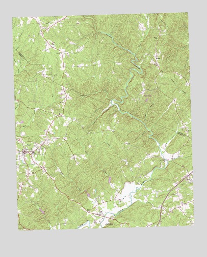
Dawsonville, GA USGS Topographic Map
Click on map above to begin viewing in our Map Viewer.

This topographic map contains these locations and features:
Feature Name Type Latitude Longitude GNIS ID View Map
Antioch ChurchChurchN34.4695°W84.0227°310588View Map
AurariaPopulated PlaceN34.4745°W84.0232°354415View Map
Auraria ChurchChurchN34.4781°W84.0241°357147View Map
Baggs BranchStreamN34.4354°W84.0327°310710View Map
Bainbridge ShaftMineN34.4995°W84.0152°1705268View Map
Barlow CutsMineN34.4981°W84.0166°357148View Map
Battle Branch MineMineN34.4745°W84.0419°357150View Map
Betz MineMineN34.4776°W84.0505°357152View Map
Blackburn Elementary SchoolSchoolN34.4546°W84.0242°2545646View Map
Blackburn State Park LakeReservoirN34.4494°W84.0312°336685View Map
Blackburn State Park Lake DamDamN34.4484°W84.0316°336684View Map
Blacks Mill DivisionCivilN34.3819°W84.1106°1936342View Map
Blackwell ShaftMineN34.4740°W84.0430°1705270View Map
Brice LakeReservoirN34.3957°W84.0750°336080View Map
BurtsboroPopulated PlaceN34.4784°W84.0896°331293View Map
Calhoun CreekStreamN34.4482°W84.0555°312157View Map
Camp CreekStreamN34.4762°W84.0380°327334View Map
Castleberry BridgeBridgeN34.4729°W84.0366°355032View Map
Church of GodChurchN34.4126°W84.1096°351311View Map
City of DawsonvilleCivilN34.4193°W84.1198°2404194View Map
Clear CreekStreamN34.4468°W84.0546°312714View Map
Dawson County CourthouseBuildingN34.4212°W84.1188°351313View Map
Dawson County Crossroads SchoolSchoolN34.4202°W84.1046°2545628View Map
Dawson County Detention CenterBuildingN34.4224°W84.1199°2734200View Map
Dawson County Elementary SchoolSchoolN34.4206°W84.1135°351314View Map
Dawson County Fire Department Station 1BuildingN34.4177°W84.1087°2604340View Map
Dawson County Fire Department Station 3BuildingN34.3867°W84.0102°2604399View Map
Dawson County High SchoolSchoolN34.4140°W84.1038°351315View Map
Dawson County Middle SchoolSchoolN34.4201°W84.1135°351316View Map
Dawson County Sheriff's OfficeBuildingN34.4224°W84.1193°2733504View Map
DawsonvillePopulated PlaceN34.4212°W84.1191°331529View Map
Dawsonville Church of GodChurchN34.4048°W84.1002°351318View Map
DoughertyPopulated PlaceN34.3823°W84.0649°355530View Map
Etowah (historical)Populated PlaceN34.4779°W84.0494°357173View Map
Etowah ChurchChurchN34.4304°W84.0030°313977View Map
Etowah MineMineN34.4537°W84.0521°357174View Map
Etowah River Watershed Dam Number 10DamN34.3851°W84.1066°336077View Map
Etowah River Watershed Dam Number 12DamN34.3934°W84.0749°336079View Map
Etowah River Watershed Dam Number 13DamN34.4018°W84.0582°336081View Map
Etowah River Watershed Structure Number 12 DamDamN34.3968°W84.0749°336909View Map
Forest School (historical)SchoolN34.3784°W84.0977°351320View Map
Gayden ShaftMineN34.4751°W84.0419°1705272View Map
Girl Scout Camp Echo LakeReservoirN34.3968°W84.0749°336910View Map
Gold Hill MineMineN34.4587°W84.0477°357182View Map
Gordon CutMineN34.4929°W84.0199°357184View Map
Harmony ChurchChurchN34.3934°W84.0135°315149View Map
Head LakeReservoirN34.4036°W84.0591°336082View Map
Hedwig-Chicago MineMineN34.4781°W84.0249°357189View Map
Hightower State NurseryLocaleN34.3782°W84.0605°344256View Map
Hutcheson Mill (historical)LocaleN34.4698°W84.0369°357191View Map
Josephine-Topabri MineMineN34.4690°W84.0310°357194View Map
LandrumPopulated PlaceN34.4143°W84.0194°332181View Map
Lilly CreekStreamN34.4179°W84.0213°316862View Map
Long BranchStreamN34.4318°W84.0307°317319View Map
Martin CemeteryCemeteryN34.3855°W84.0756°317742View Map
Palmer CemeteryCemeteryN34.3840°W84.0674°320163View Map
Palmer CreekStreamN34.3840°W84.0619°356455View Map
Pine Grove Montessori SchoolSchoolN34.4154°W84.1054°2346433View Map
Pleasant Hill ChurchChurchN34.4015°W84.0007°320912View Map
Pollard TunnelMineN34.4731°W84.0416°1705274View Map
Proctor CreekStreamN34.3957°W84.0432°356481View Map
Ralston MineMineN34.4898°W84.0207°357211View Map
Robinson Elementary SchoolSchoolN34.4210°W84.1046°2545550View Map
Rogers ShaftMineN34.4754°W84.0413°1705275View Map
Russell CreekStreamN34.3945°W84.0455°356508View Map
Snow CreekStreamN34.4437°W84.0610°323196View Map
Vandiver LakeReservoirN34.3865°W84.1079°336078View Map
Whim HillSummitN34.4851°W84.0216°333407View Map
Whim Hill MineMineN34.4851°W84.0230°357221View Map
Zion Hill ChurchChurchN34.4326°W84.0024°357227View Map

Note: Coordinates in the location and feature list above are referenced to NAD83 datum.


Copyright (C) 2008-2024 Ryan Niemi / Sunset Dynamics ... All Rights Reserved