TopoQuest Logo
Do you find TopoQuest useful?
Help keep TopoQuest running and adding new maps/features by donating!
Bitcoin:  19c7KJd3qBynnjoSw5npx9KScwjBe4ifkT
Litecoin:  LXs6TkuXGGXo1vDsWCkWVdjQX94eUKd6ui
Home View Maps Find Maps Find Places Resources & Links


Cuddy Valley, California Topographic Map

USGS Map Title: Cuddy Valley, CA
USGS Map MRC: 34119G1
DRG (GeoTIFF) Download: o34119g1.tif


Neighboring USGS Topographic Map Quads:


  Eagle Rest Peak, CA  
34119H2
 

  Pleito Hills, CA  
34119H1
 

  Grapevine, CA  
34118H8
 

  Sawmill Mountain, CA  
34119G2
 

  Cuddy Valley, CA  
34119G1
 

  Frazier Mountain, CA  
34118G8
 

  San Guillermo Mountain, CA  
34119F2
 

  Lockwood Valley, CA  
34119F1
 

  Alamo Mountain, CA  
34118F8


Map MRC Location:

N35°
W120°
N35°
W119°
H8 H7 H6 H5 H4 H3 H2 H1
G8 G7 G6 G5 G4 G3 G2 G1
F8 F7 F6 F5 F4 F3 F2 F1
E8 E7 E6 E5 E4 E3 E2 E1
D8 D7 D6 D5 D4 D3 D2 D1
C8 C7 C6 C5 C4 C3 C2 C1
B8 B7 B6 B5 B4 B3 B2 B1
A8 A7 A6 A5 A4 A3 A2 A1
N34°
W120°
N34°
W119°

Cuddy Valley, CA USGS 1:24K Topographic Map Preview:
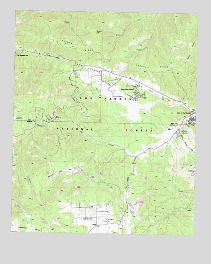
Cuddy Valley, CA USGS Topographic Map
Click on map above to begin viewing in our Map Viewer.

This topographic map contains these locations and features:
Feature Name Type Latitude Longitude GNIS ID View Map
Bethany Pines CampgroundLocaleN34.8447°W119.0795°275329View Map
Camp Trefoil Boy Scout Camp (historical)LocaleN34.8466°W119.0957°270227View Map
Chalker MineMineN34.7730°W119.0043°270386View Map
Cherry CreekStreamN34.8725°W119.0337°270402View Map
Cherry Creek CampgroundLocaleN34.8519°W119.0407°275327View Map
Cherry Creek CampsiteLocaleN34.8533°W119.0384°254427View Map
Chuchupate CampgroundLocaleN34.7872°W119.0018°270451View Map
Chuchupate Ranger StationLocaleN34.8078°W119.0118°270452View Map
Chula Vista CampgroundLocaleN34.8136°W119.1237°254423View Map
Conover Air Lodge AirportAirportN34.7627°W119.0589°1653463View Map
Cuddy CreekStreamN34.8178°W119.0015°270709View Map
Cuddy RanchLocaleN34.8094°W119.0173°270710View Map
Cuddy ValleyValleyN34.8241°W119.0232°270711View Map
El Camino Pines CampgroundLocaleN34.8436°W119.0937°275321View Map
Escapula PeakSummitN34.8639°W119.0701°254428View Map
Frazier MineMineN34.7675°W119.0893°271208View Map
Frontier Pines CampgroundLocaleN34.8386°W119.0959°275322View Map
Good Luck MineMineN34.7744°W119.0104°271355View Map
Jewel MineMineN34.7764°W119.0087°271788View Map
Lake of the Woods Census Designated PlaceCensusN34.8226°W119.0027°2408548View Map
Maule MinesMineN34.7666°W119.0101°272372View Map
McGill CampgroundLocaleN34.8155°W119.0993°275323View Map
Mill CanyonValleyN34.7947°W119.0415°254422View Map
Mount PinesLocaleN34.8094°W119.1084°275305View Map
Mount Pinos CampLocaleN34.7869°W119.0787°272578View Map
Mount Pinos CampgroundLocaleN34.8100°W119.1084°254424View Map
Our Lady of the Snows Catholic ChurchChurchN34.8150°W119.0059°1839494View Map
Pinon PinesAreaN34.8330°W119.0515°275324View Map
Pinon Pines EstatesPopulated PlaceN34.8289°W119.0429°254426View Map
Pleito Creek CampsiteLocaleN34.8680°W119.0887°254420View Map
Pleito Creek Rustic CampsiteLocaleN34.8722°W119.0871°275332View Map
Saint Nichalos CampgroundLocaleN34.8364°W119.0873°275320View Map
Salt Creek CampgroundLocaleN34.8541°W119.0490°275328View Map
Salt Creek CampsiteLocaleN34.8614°W119.0537°254429View Map
San Emigdio Girl Scout CampLocaleN34.8380°W119.0971°273467View Map
Seymour Sage FlatFlatN34.7844°W119.0943°275306View Map
StaufferPopulated PlaceN34.7544°W119.0668°273895View Map
Tecuya CampgroundLocaleN34.8458°W119.0868°275319View Map

Note: Coordinates in the location and feature list above are referenced to NAD83 datum.


Copyright (C) 2008-2024 Ryan Niemi / Sunset Dynamics ... All Rights Reserved