TopoQuest Logo
Do you find TopoQuest useful?
Help keep TopoQuest running and adding new maps/features by donating!
Bitcoin:  19c7KJd3qBynnjoSw5npx9KScwjBe4ifkT
Litecoin:  LXs6TkuXGGXo1vDsWCkWVdjQX94eUKd6ui
Home View Maps Find Maps Find Places Resources & Links


Crownpoint, New Mexico Topographic Map

USGS Map Title: Crownpoint, NM
USGS Map MRC: 35108F2
DRG (GeoTIFF) Download: o35108f2.tif


Neighboring USGS Topographic Map Quads:


  Standing Rock, NM  
35108G3
 

  Antelope Lookout Mesa, NM  
35108G2
 

  Becenti Lake, NM  
35108G1
 

  Dalton Pass, NM  
35108F3
 

  Crownpoint, NM  
35108F2
 

  Heart Rock, NM  
35108F1
 

  Mariano Lake, NM  
35108E3
 

  Hosta Butte, NM  
35108E2
 

  Casamero Lake, NM  
35108E1


Map MRC Location:

N36°
W109°
N36°
W108°
H8 H7 H6 H5 H4 H3 H2 H1
G8 G7 G6 G5 G4 G3 G2 G1
F8 F7 F6 F5 F4 F3 F2 F1
E8 E7 E6 E5 E4 E3 E2 E1
D8 D7 D6 D5 D4 D3 D2 D1
C8 C7 C6 C5 C4 C3 C2 C1
B8 B7 B6 B5 B4 B3 B2 B1
A8 A7 A6 A5 A4 A3 A2 A1
N35°
W109°
N35°
W108°

Crownpoint, NM USGS 1:24K Topographic Map Preview:
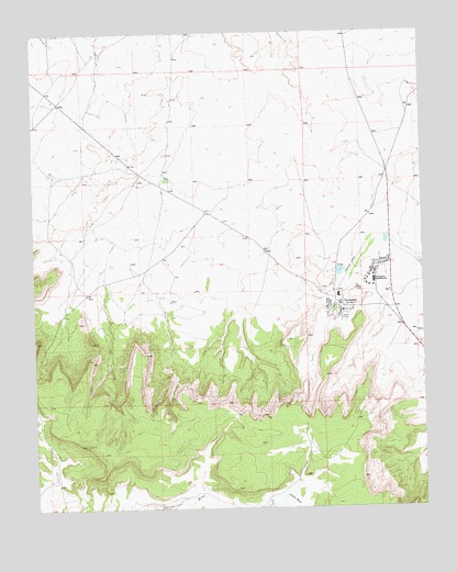
Crownpoint, NM USGS Topographic Map
Click on map above to begin viewing in our Map Viewer.

This topographic map contains these locations and features:
Feature Name Type Latitude Longitude GNIS ID View Map
15R-318A Water WellWellN35.6967°W108.1445°922365View Map
16K-332 Water WellWellN35.6267°W108.1881°921789View Map
320 Water WellWellN35.6634°W108.2370°921795View Map
94-202 Water WellWellN35.7178°W108.2278°922364View Map
9U-279 Water WellWellN35.7178°W108.2278°922363View Map
Begay Water WellWellN35.6967°W108.2348°922367View Map
BIA PM-5 Water WellWellN35.6714°W108.1567°922380View Map
Bible Baptist SchoolSchoolN35.6781°W108.1512°934052View Map
Borrega PassSchoolN35.6781°W108.2234°934050View Map
Casa de Estrella Site Historic SiteLocaleN35.6781°W108.1512°933547View Map
CrownpointPopulated PlaceN35.6781°W108.1512°902810View Map
Crownpoint AirportAirportN35.7177°W108.2016°936935View Map
Crownpoint Boarding SchoolSchoolN35.6847°W108.1409°888119View Map
Crownpoint Census Designated PlaceCensusN35.6880°W108.1494°2407689View Map
Crownpoint ChapterCivilN35.6989°W108.1727°2418902View Map
Crownpoint Elementary SchoolSchoolN35.6781°W108.1512°933996View Map
Crownpoint High SchoolSchoolN35.6781°W108.1512°933995View Map
Crownpoint Institute of TechnologySchoolN35.6781°W108.1512°901433View Map
Crownpoint Institute of Technology LibraryBuildingN35.6781°W108.1512°929997View Map
Crownpoint Police DepartmentBuildingN35.6956°W108.1509°2722491View Map
Crownpoint Post OfficePost OfficeN35.6781°W108.1512°937529View Map
Crownpoint SC Water WellWellN35.6842°W108.1420°922375View Map
Crownpoint Service Unit Indian Health Service HospitalHospitalN35.6987°W108.1395°2697008View Map
Crownpoint Volunteer Fire and RescueBuildingN35.6917°W108.1522°2657639View Map
Crownpoint-Con Water WellWellN35.6967°W108.1445°922366View Map
Lake Valley Navajo SchoolSchoolN35.6781°W108.1512°934236View Map
Navajo Nation Emergency Medical ServicesBuildingN35.6987°W108.1396°2657590View Map
NTUA 1 Water WellWellN35.6847°W108.1534°921803View Map
NTUA Number 2 Water WellWellN35.6953°W108.1445°921808View Map
PM-3 Water WellWellN35.6786°W108.1548°921797View Map
Pueblo Pintado City Ambulance ServiceBuildingN35.6987°W108.1397°2657756View Map
Saint Paul ChurchChurchN35.6781°W108.1512°920240View Map
SJ-1361 Water WellWellN35.6995°W108.2167°922368View Map
SJ-823 Water WellWellN35.7120°W108.1803°922361View Map
SJ-936 Water WellWellN35.6661°W108.2440°922376View Map
Tsc'ii'ahi Community SchoolSchoolN35.6781°W108.1512°934193View Map
United States Public Health Science Indian Hospital LibraryBuildingN35.6781°W108.1512°931372View Map

Note: Coordinates in the location and feature list above are referenced to NAD83 datum.


Copyright (C) 2008-2024 Ryan Niemi / Sunset Dynamics ... All Rights Reserved