TopoQuest Logo
Do you find TopoQuest useful?
Help keep TopoQuest running and adding new maps/features by donating!
Bitcoin:  19c7KJd3qBynnjoSw5npx9KScwjBe4ifkT
Litecoin:  LXs6TkuXGGXo1vDsWCkWVdjQX94eUKd6ui
Home View Maps Find Maps Find Places Resources & Links


Crofton, Nebraska Topographic Map

USGS Map Title: Crofton, NE
USGS Map MRC: 42097F4
DRG (GeoTIFF) Download: o42097f4.tif


Neighboring USGS Topographic Map Quads:


  Tabor SE, NE  
42097G5
 

  Gavins Point Dam, SD  
42097G4
 

  Menominee, NE  
42097G3
 

  Bloomfield NE, NE  
42097F5
 

  Crofton, NE  
42097F4
 

  Fordyce, NE  
42097F3
 

  Bloomfield SE, NE  
42097E5
 

  Hartington SW, NE  
42097E4
 

  Hartington, NE  
42097E3


Map MRC Location:

N43°
W98°
N43°
W97°
H8 H7 H6 H5 H4 H3 H2 H1
G8 G7 G6 G5 G4 G3 G2 G1
F8 F7 F6 F5 F4 F3 F2 F1
E8 E7 E6 E5 E4 E3 E2 E1
D8 D7 D6 D5 D4 D3 D2 D1
C8 C7 C6 C5 C4 C3 C2 C1
B8 B7 B6 B5 B4 B3 B2 B1
A8 A7 A6 A5 A4 A3 A2 A1
N42°
W98°
N42°
W97°

Crofton, NE USGS 1:24K Topographic Map Preview:
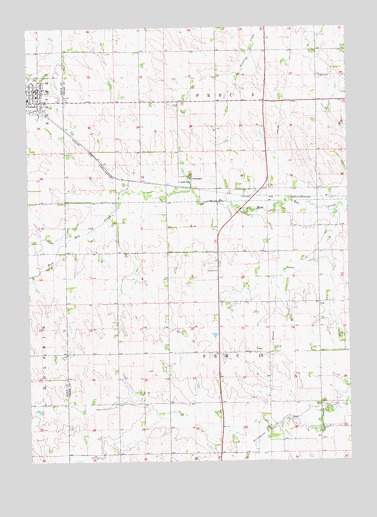
Crofton, NE USGS Topographic Map
Click on map above to begin viewing in our Map Viewer.

This topographic map contains these locations and features:
Feature Name Type Latitude Longitude GNIS ID View Map
City of CroftonCivilN42.7316°W97.4986°837950View Map
ConstancePopulated PlaceN42.7069°W97.4359°835275View Map
Constance Post Office (historical)Post OfficeN42.7069°W97.4359°1874525View Map
CroftonPopulated PlaceN42.7289°W97.4956°828463View Map
Crofton (historical)LocaleN42.7269°W97.4990°1884844View Map
Crofton CemeteryCemeteryN42.7297°W97.4864°828465View Map
Crofton Community SchoolsSchoolN42.7297°W97.4998°1884854View Map
Crofton Elevator Incorporated ElevatorLocaleN42.7267°W97.4948°1884847View Map
Crofton Police DepartmentBuildingN42.7289°W97.4956°1884850View Map
Crofton Post OfficePost OfficeN42.7316°W97.4962°1884848View Map
Crofton RescueBuildingN42.7304°W97.4963°2553791View Map
Crofton Volunteer Fire DepartmentBuildingN42.7307°W97.4964°1884853View Map
Eastern Township LibraryBuildingN42.7319°W97.4962°1884851View Map
Election Precinct 10CivilN42.6563°W97.4265°1929168View Map
Election Precinct 3CivilN42.7433°W97.4266°1929183View Map
Northside ParkParkN42.7347°W97.4998°1884842View Map
Precinct TenCivilN42.6556°W97.4170°1874462View Map
Precinct ThreeCivilN42.7417°W97.4253°1874461View Map
Sacred Heart Medical ClinicHospitalN42.7325°W97.4962°1884849View Map
Saint Joseph SchoolSchoolN42.7053°W97.4364°832948View Map
Southside ParkParkN42.7297°W97.4967°1884843View Map
Strunk Health CenterHospitalN42.7317°W97.4992°1884846View Map
Trinity Lutheran ChurchChurchN42.7311°W97.4970°1884858View Map
Tristate DentalHospitalN42.7317°W97.4956°1884845View Map

Note: Coordinates in the location and feature list above are referenced to NAD83 datum.


Copyright (C) 2008-2024 Ryan Niemi / Sunset Dynamics ... All Rights Reserved