TopoQuest Logo
Do you find TopoQuest useful?
Help keep TopoQuest running and adding new maps/features by donating!
Bitcoin:  19c7KJd3qBynnjoSw5npx9KScwjBe4ifkT
Litecoin:  LXs6TkuXGGXo1vDsWCkWVdjQX94eUKd6ui
Home View Maps Find Maps Find Places Resources & Links


Cowden Place, Texas Topographic Map

USGS Map Title: Cowden Place, TX
USGS Map MRC: 31102F7
DRG (GeoTIFF) Download: o31102f7.tif


Neighboring USGS Topographic Map Quads:


  Wheeler Ranch, TX  
31102G8
 

  Amburgey Ranch, TX  
31102G7
 

  Red Lakes, TX  
31102G6
 

  China Ranch, TX  
31102F8
 

  Cowden Place, TX  
31102F7
 

  Metz, TX  
31102F6
 

  Monahans, TX  
31102E8
 

  Monahans SE, TX  
31102E7
 

  Penwell SW, TX  
31102E6


Map MRC Location:

N32°
W103°
N32°
W102°
H8 H7 H6 H5 H4 H3 H2 H1
G8 G7 G6 G5 G4 G3 G2 G1
F8 F7 F6 F5 F4 F3 F2 F1
E8 E7 E6 E5 E4 E3 E2 E1
D8 D7 D6 D5 D4 D3 D2 D1
C8 C7 C6 C5 C4 C3 C2 C1
B8 B7 B6 B5 B4 B3 B2 B1
A8 A7 A6 A5 A4 A3 A2 A1
N31°
W103°
N31°
W102°

Cowden Place, TX USGS 1:24K Topographic Map Preview:
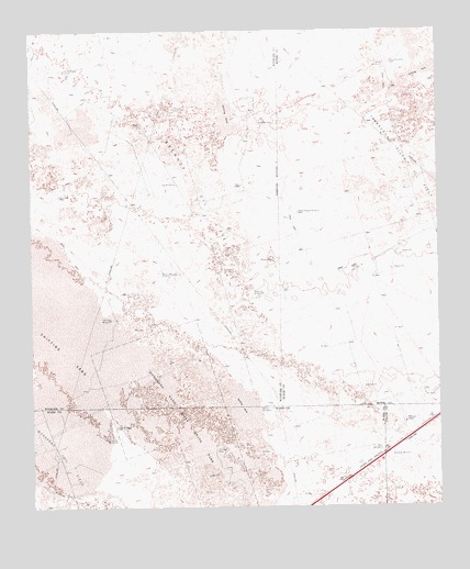
Cowden Place, TX USGS Topographic Map
Click on map above to begin viewing in our Map Viewer.

This topographic map contains these locations and features:
Feature Name Type Latitude Longitude GNIS ID View Map
Arenosa Oil FieldOilfieldN31.7035°W102.8182°1329664View Map
Cowden PlacePopulated PlaceN31.7260°W102.8038°1378170View Map
Coyote WindmillLocaleN31.6426°W102.8496°1333607View Map
Draw WindmillLocaleN31.6460°W102.8499°1334607View Map
East WindmillLocaleN31.7412°W102.7663°1335028View Map
Fielding WindmillLocaleN31.6385°W102.7649°1335779View Map
Five Sections WindmillLocaleN31.7485°W102.8096°1335856View Map
Highline WindmillLocaleN31.6812°W102.8038°1337755View Map
Jog WindmillLocaleN31.7101°W102.8304°1338753View Map
Little Diamond WindmillLocaleN31.7401°W102.8652°1340079View Map
Monahans Sand Hills State ParkParkN31.6476°W102.8229°1374977View Map
Monahans Sandhills State Park Nature TrailTrailN31.6387°W102.8182°2033349View Map
New Flag WindmillLocaleN31.6865°W102.8318°1342450View Map
North House WindmillLocaleN31.7024°W102.7927°1342757View Map
Old Flag WindmillLocaleN31.6743°W102.8510°1343145View Map
Polk WindmillLocaleN31.6401°W102.7682°1344322View Map
Sand WindmillLocaleN31.7415°W102.7640°1346551View Map
Williams RanchLocaleN31.6471°W102.7610°1350145View Map
Woods WindmillLocaleN31.6510°W102.8049°1350564View Map

Note: Coordinates in the location and feature list above are referenced to NAD83 datum.


Copyright (C) 2008-2024 Ryan Niemi / Sunset Dynamics ... All Rights Reserved