TopoQuest Logo
Do you find TopoQuest useful?
Help keep TopoQuest running and adding new maps/features by donating!
Bitcoin:  19c7KJd3qBynnjoSw5npx9KScwjBe4ifkT
Litecoin:  LXs6TkuXGGXo1vDsWCkWVdjQX94eUKd6ui
Home View Maps Find Maps Find Places Resources & Links


Cove Creek Gap, North Carolina Topographic Map

USGS Map Title: Cove Creek Gap, NC
USGS Map MRC: 35083F1
DRG (GeoTIFF) Download: o35083f1.tif


Neighboring USGS Topographic Map Quads:


  Hartford, TN  
35083G2
 

  Waterville, NC  
35083G1
 

  Lemon Gap, NC  
35082G8
 

  Luftee Knob, NC  
35083F2
 

  Cove Creek Gap, NC  
35083F1
 

  Fines Creek, NC  
35082F8
 

  Bunches Bald, NC  
35083E2
 

  Dellwood, NC  
35083E1
 

  Clyde, NC  
35082E8


Map MRC Location:

N36°
W84°
N36°
W83°
H8 H7 H6 H5 H4 H3 H2 H1
G8 G7 G6 G5 G4 G3 G2 G1
F8 F7 F6 F5 F4 F3 F2 F1
E8 E7 E6 E5 E4 E3 E2 E1
D8 D7 D6 D5 D4 D3 D2 D1
C8 C7 C6 C5 C4 C3 C2 C1
B8 B7 B6 B5 B4 B3 B2 B1
A8 A7 A6 A5 A4 A3 A2 A1
N35°
W84°
N35°
W83°

Cove Creek Gap, NC USGS 1:24K Topographic Map Preview:
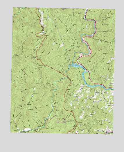
Cove Creek Gap, NC USGS Topographic Map
Click on map above to begin viewing in our Map Viewer.

This topographic map contains these locations and features:
Feature Name Type Latitude Longitude GNIS ID View Map
Andy BranchStreamN35.6715°W83.1038°1008732View Map
Asbury TrailTrailN35.6712°W83.0732°1008788View Map
Bald GapGapN35.6490°W83.1054°1008871View Map
Bald TopSummitN35.6491°W83.1086°1018934View Map
Ball BranchStreamN35.7193°W83.0857°1008890View Map
Baxter CreekStreamN35.7451°W83.1157°1008965View Map
Baxter Creek TrailTrailN35.7226°W83.1115°1008966View Map
Bennett BranchStreamN35.6559°W83.0732°1009175View Map
Bent Knee KnobSummitN35.6351°W83.0423°1019095View Map
Big Branch TrailTrailN35.7259°W83.1004°1009279View Map
Billy TopSummitN35.6956°W83.0097°1019177View Map
Bratcher GapGapN35.6465°W83.0921°1009582View Map
Brushy MountainSummitN35.7078°W83.0848°1019339View Map
Buzzard RoostSummitN35.7454°W83.0455°1019457View Map
Caldwell ForkStreamN35.6309°W83.0876°1009905View Map
Camp BranchStreamN35.6709°W83.0065°1009938View Map
Canadian TopSummitN35.6483°W83.1034°1019504View Map
CataloocheePopulated PlaceN35.6401°W83.0801°1023421View Map
Cataloochee CampgroundLocaleN35.6312°W83.0855°2775207View Map
Cataloochee CreekStreamN35.6940°W83.0493°1010094View Map
Cataloochee Group CampLocaleN35.6507°W83.0738°2775208View Map
Cataloochee Horse CampLocaleN35.6288°W83.1156°2775209View Map
Cataloochee Ranger StationLocaleN35.6398°W83.0818°1010096View Map
Chesnut Flat RidgeRidgeN35.6358°W83.0387°1008639View Map
Chestnut FlatsFlatN35.6443°W83.0282°1010246View Map
Clark CemeteryCemeteryN35.6706°W83.0410°1010290View Map
Coffee RidgeRidgeN35.6999°W83.0002°1010360View Map
Coggins BranchStreamN35.6698°W83.0879°1010367View Map
Cold Springs CreekStreamN35.7370°W83.0243°1010390View Map
Conard BranchStreamN35.6695°W83.1004°1010430View Map
Cooks KnobSummitN35.6572°W83.1116°1027395View Map
Correll BranchStreamN35.6695°W83.0832°1010492View Map
Cotton PatchLocaleN35.7395°W83.0346°1018078View Map
Cove Creek GapGapN35.6323°W83.0446°1010499View Map
Cowpen TopSummitN35.6682°W83.0568°1019823View Map
Davidson BranchStreamN35.6368°W83.1204°1010671View Map
Davidson GapGapN35.6515°W83.1101°1010672View Map
Den BranchStreamN35.6254°W83.0896°1010782View Map
Dicks BranchStreamN35.7162°W83.0376°1010807View Map
Dicks GapGapN35.7018°W83.0646°1010811View Map
Dock Caldwell CemeteryCemeteryN35.6272°W83.1159°1009904View Map
Dogwood FlatsFlatN35.7140°W83.0738°1010866View Map
Dogwood Flats CreekStreamN35.7276°W83.0729°1010868View Map
Double GapGapN35.7226°W83.0851°1010879View Map
Dude BranchStreamN35.6820°W83.0896°1010935View Map
Early CreekStreamN35.6876°W83.0590°1010969View Map
Fork MountainSummitN35.6705°W83.1245°1020314View Map
Gilliland CreekStreamN35.7218°W83.0799°1011497View Map
Grassy BranchStreamN35.7459°W83.0065°1011625View Map
Grassy KnobSummitN35.6976°W83.0313°1020510View Map
H D Burris Child CemeteryCemeteryN35.6499°W83.1226°2775246View Map
Half Acre RidgeRidgeN35.6252°W83.0598°1011795View Map
Hall BranchStreamN35.6518°W83.0732°1011796View Map
Hall RidgeRidgeN35.6331°W83.0304°1011805View Map
Hall TopSummitN35.6427°W83.0308°1020592View Map
Hannah - Hoaglan CemeteryCemeteryN35.6451°W83.0541°1011842View Map
Hannah CemeteryCemeteryN35.6740°W83.0947°1011843View Map
Harrell CemeteryCemeteryN35.7379°W83.0765°1011868View Map
Hazel TopSummitN35.6346°W83.0389°1011947View Map
Hicks BranchStreamN35.7382°W83.0299°1012024View Map
Hicks CemeteryCemeteryN35.7320°W83.0346°1012026View Map
High Knob RidgeSummitN35.7119°W83.0466°1020746View Map
Hoglen BranchStreamN35.6457°W83.0757°1012106View Map
Hoglen GapGapN35.6470°W83.0513°1012107View Map
Horsepen GapGapN35.7054°W83.0090°1012214View Map
Hunter BranchStreamN35.6620°W83.0243°1012280View Map
Hunter BranchStreamN35.7370°W83.0154°1012281View Map
Hunter CemeteryCemeteryN35.6579°W83.0229°1012284View Map
Hurricane CreekStreamN35.7234°W83.0276°1012303View Map
Ivy GapGapN35.7276°W83.0857°1012384View Map
Jesse RidgeRidgeN35.6465°W83.1096°1012472View Map
L Davidson BranchStreamN35.6387°W83.1213°1012652View Map
Laurel BranchStreamN35.6737°W83.0138°1012702View Map
Laurel BranchStreamN35.6807°W83.0376°1012703View Map
Lawson Jenkins - Kerr CemeteryCemeteryN35.6684°W83.0748°2775266View Map
Leatherwood BranchStreamN35.7268°W83.0754°1012768View Map
Little Cataloochee Baptist Church CemeteryCemeteryN35.6637°W83.0967°2775269View Map
Little Cataloochee ChurchChurchN35.6643°W83.0974°1012927View Map
Little Cataloochee CreekStreamN35.6684°W83.0718°1012928View Map
Liz BranchStreamN35.6648°W83.0421°1013051View Map
Long BunkRidgeN35.6898°W83.1183°1013148View Map
Longarm MountainSummitN35.7034°W83.0674°1013181View Map
Lower Double BranchStreamN35.6340°W83.0846°1013241View Map
Mathews BranchStreamN35.6293°W83.1007°1013368View Map
McMahan's GraveCemeteryN35.6956°W83.1035°2775277View Map
Messer BranchStreamN35.6726°W83.0151°1013477View Map
Messer GapGapN35.7084°W83.0560°1013479View Map
Middle RidgeRidgeN35.6455°W83.1029°1013515View Map
Mossy BranchStreamN35.6287°W83.0932°1013724View Map
Mount SterlingSummitN35.7016°W83.1224°1015818View Map
Mount Sterling GapGapN35.7004°W83.0976°1013768View Map
Mount Sterling LookoutLocaleN35.7023°W83.1224°1018082View Map
NelliePopulated PlaceN35.6265°W83.1124°1021616View Map
Noland GapGapN35.6523°W83.0993°1013972View Map
Noland MountainSummitN35.6597°W83.0879°1021657View Map
O E Kerr African CemeteryCemeteryN35.6719°W83.0728°2775287View Map
OlaPopulated PlaceN35.6695°W83.0979°1021726View Map
Palmer CemeteryCemeteryN35.6406°W83.0821°2775293View Map
Palmer ChapelChurchN35.6265°W83.1093°1014194View Map
Palmer Chapel CemeteryCemeteryN35.6286°W83.1095°2775294View Map
Palmer CreekStreamN35.6309°W83.0876°1014195View Map
Palmer Creek TrailTrailN35.6357°W83.1193°1014196View Map
Piney MountainSummitN35.6433°W83.0478°1021966View Map
Poplar Cove BranchStreamN35.7434°W83.0101°1014587View Map
Rathbone CoveValleyN35.7176°W83.0060°1014746View Map
Redman CemeteryCemeteryN35.6740°W83.0001°1014795View Map
Rough ForkStreamN35.6257°W83.1110°1015101View Map
Rough RidgeRidgeN35.6842°W83.1225°1015103View Map
Sal PatchGapN35.6394°W83.0580°1015170View Map
Scottish MountSummitN35.6922°W83.0856°1015337View Map
Shelton LaurelPopulated PlaceN35.6809°W83.0076°1022590View Map
Short BunkRidgeN35.6587°W83.1110°1015483View Map
Slickrock BranchStreamN35.7245°W83.0404°1015586View Map
Slim RidgeRidgeN35.7013°W83.0621°1015589View Map
Snelson BranchStreamN35.6629°W83.0418°1015637View Map
Stevens CreekStreamN35.6723°W83.0229°1015824View Map
Stinking Camp BranchStreamN35.7393°W83.0721°1015853View Map
Sutton CemeteryCemeteryN35.7379°W83.0890°1015966View Map
Sutton CemeteryCemeteryN35.7401°W83.0871°1015967View Map
Sutton Top LookoutLocaleN35.7334°W83.0513°1018083View Map
Teaberry RidgeRidgeN35.6257°W83.0285°1016056View Map
Teague CemeteryCemeteryN35.6665°W83.0126°1016059View Map
Toms BranchStreamN35.7184°W83.0024°1016190View Map
Township of White OakCivilN35.6533°W83.0242°1026785View Map
Upper Double BranchStreamN35.6334°W83.0832°1016333View Map
Wading Branch RidgeRidgeN35.7024°W83.0623°1016385View Map
Walters DamDamN35.6945°W83.0496°1016435View Map
Walters DamDamN35.6951°W83.0499°1017270View Map
Waterville LakeReservoirN35.6920°W83.0397°1016436View Map
White Oak ChurchChurchN35.6668°W83.0179°1016589View Map
White Oak Community CenterLocaleN35.6559°W83.0040°1016591View Map
White Oak CreekStreamN35.6748°W83.0343°1016592View Map
White Oak Flats BranchStreamN35.7487°W83.0340°1016594View Map
White Oak MountainSummitN35.6683°W83.0568°1023204View Map
Wilkins CreekStreamN35.6870°W83.0343°1016685View Map
Winding Stair BranchStreamN35.6459°W83.0768°1016740View Map
Woody BranchStreamN35.6712°W83.1035°1016825View Map
Wright BranchStreamN35.6257°W83.0071°1016845View Map
Wright KnobSummitN35.6252°W83.0203°1023329View Map

Note: Coordinates in the location and feature list above are referenced to NAD83 datum.


Copyright (C) 2008-2024 Ryan Niemi / Sunset Dynamics ... All Rights Reserved