TopoQuest Logo
Do you find TopoQuest useful?
Help keep TopoQuest running and adding new maps/features by donating!
Bitcoin:  19c7KJd3qBynnjoSw5npx9KScwjBe4ifkT
Litecoin:  LXs6TkuXGGXo1vDsWCkWVdjQX94eUKd6ui
Home View Maps Find Maps Find Places Resources & Links


Cougar Lake, Washington Topographic Map

USGS Map Title: Cougar Lake, WA
USGS Map MRC: 46121G4
DRG (GeoTIFF) Download: o46121g4.tif


Neighboring USGS Topographic Map Quads:


  White River Park, WA  
46121H5
 

  Norse Peak, WA  
46121H4
 

  Goose Prairie, WA  
46121H3
 

  Chinook Pass, WA  
46121G5
 

  Cougar Lake, WA  
46121G4
 

  Bumping Lake, WA  
46121G3
 

  Ohanapecosh Hot Springs, WA  
46121F5
 

  White Pass, WA  
46121F4
 

  Spiral Butte, WA  
46121F3


Map MRC Location:

N47°
W122°
N47°
W121°
H8 H7 H6 H5 H4 H3 H2 H1
G8 G7 G6 G5 G4 G3 G2 G1
F8 F7 F6 F5 F4 F3 F2 F1
E8 E7 E6 E5 E4 E3 E2 E1
D8 D7 D6 D5 D4 D3 D2 D1
C8 C7 C6 C5 C4 C3 C2 C1
B8 B7 B6 B5 B4 B3 B2 B1
A8 A7 A6 A5 A4 A3 A2 A1
N46°
W122°
N46°
W121°

Cougar Lake, WA USGS 1:24K Topographic Map Preview:
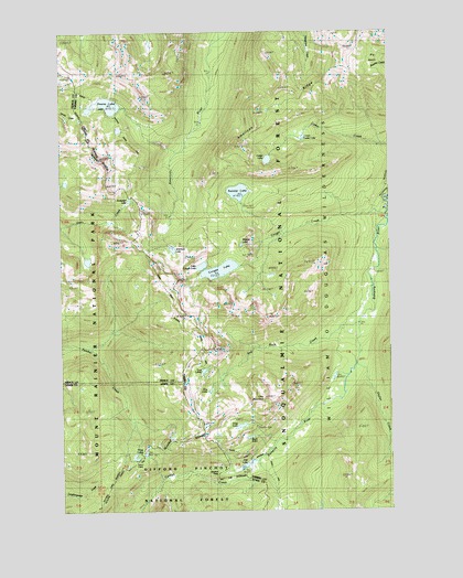
Cougar Lake, WA USGS Topographic Map
Click on map above to begin viewing in our Map Viewer.

This topographic map contains these locations and features:
Feature Name Type Latitude Longitude GNIS ID View Map
American LakeLakeN46.8181°W121.4586°1515851View Map
Anderson LakeLakeN46.8310°W121.4749°1515876View Map
Big BasinBasinN46.8662°W121.3826°1516461View Map
Buck LakeLakeN46.7690°W121.4302°1517035View Map
Bumping Lake TrailTrailN46.8048°W121.3868°1517092View Map
Carlton PassGapN46.7593°W121.4420°1517405View Map
Cedar LakeLakeN46.8414°W121.4223°1517568View Map
Cougar CreekStreamN46.8284°W121.3768°1518152View Map
Cougar LakeLakeN46.8127°W121.4406°1518177View Map
Crag LakeLakeN46.7720°W121.4336°1518262View Map
Crag MountainSummitN46.7790°W121.4242°1518263View Map
Dewey LakeLakeN46.8560°W121.4821°1518737View Map
Dewey Lake TrailTrailN46.8496°W121.4487°1518738View Map
Fish LakeLakeN46.7617°W121.4315°1519588View Map
Little Cougar LakeLakeN46.8138°W121.4477°1522187View Map
Lower Cedar LakeLakeN46.8471°W121.4087°1522533View Map
One LakeLakeN46.7813°W121.4450°1524055View Map
Red Rock CreekStreamN46.7996°W121.3870°1524955View Map
Sheller CreekStreamN46.7876°W121.3893°1525656View Map
Swamp LakeLakeN46.8331°W121.4335°1526828View Map
Swamp Lake TrailTrailN46.8315°W121.3965°1526830View Map
Three LakesLakeN46.7643°W121.4715°1527155View Map
Two LakesLakeN46.7862°W121.4479°1527573View Map
Wildcat LakeLakeN46.8192°W121.4325°1528138View Map

Note: Coordinates in the location and feature list above are referenced to NAD83 datum.


Copyright (C) 2008-2024 Ryan Niemi / Sunset Dynamics ... All Rights Reserved