TopoQuest Logo
Do you find TopoQuest useful?
Help keep TopoQuest running and adding new maps/features by donating!
Bitcoin:  19c7KJd3qBynnjoSw5npx9KScwjBe4ifkT
Litecoin:  LXs6TkuXGGXo1vDsWCkWVdjQX94eUKd6ui
Home View Maps Find Maps Find Places Resources & Links


Cornville, Arizona Topographic Map

USGS Map Title: Cornville, AZ
USGS Map MRC: 34111F8
DRG (GeoTIFF) Download: o34111f8.tif


Neighboring USGS Topographic Map Quads:


  Clarkdale, AZ  
34112G1
 

  Page Springs, AZ  
34111G8
 

  Sedona, AZ  
34111G7
 

  Cottonwood, AZ  
34112F1
 

  Cornville, AZ  
34111F8
 

  Lake Montezuma, AZ  
34111F7
 

  Cherry, AZ  
34112E1
 

  Middle Verde, AZ  
34111E8
 

  Camp Verde, AZ  
34111E7


Map MRC Location:

N35°
W112°
N35°
W111°
H8 H7 H6 H5 H4 H3 H2 H1
G8 G7 G6 G5 G4 G3 G2 G1
F8 F7 F6 F5 F4 F3 F2 F1
E8 E7 E6 E5 E4 E3 E2 E1
D8 D7 D6 D5 D4 D3 D2 D1
C8 C7 C6 C5 C4 C3 C2 C1
B8 B7 B6 B5 B4 B3 B2 B1
A8 A7 A6 A5 A4 A3 A2 A1
N34°
W112°
N34°
W111°

Cornville, AZ USGS 1:24K Topographic Map Preview:
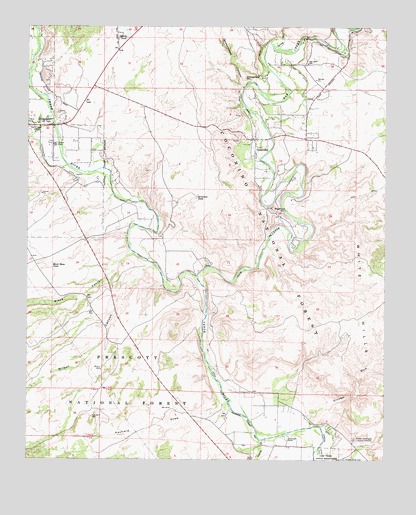
Cornville, AZ USGS Topographic Map
Click on map above to begin viewing in our Map Viewer.

This topographic map contains these locations and features:
Feature Name Type Latitude Longitude GNIS ID View Map
BignottiPopulated PlaceN34.6772°W111.9502°41876View Map
Bignotti Recreation SiteLocaleN34.6808°W111.9567°2074347View Map
Black CanyonValleyN34.6847°W111.9646°26375View Map
Black Canyon Recreation SiteLocaleN34.6844°W111.9644°2073958View Map
Black Mesa TankReservoirN34.6816°W111.9924°26411View Map
BridgeportPopulated PlaceN34.7214°W111.9965°26738View Map
Cherry CreekStreamN34.6306°W111.9182°27545View Map
Cloverleaf RanchLocaleN34.6309°W111.9093°27744View Map
Cornerstone Christian AcademySchoolN34.7085°W111.9954°2543705View Map
CornvillePopulated PlaceN34.7178°W111.9215°27961View Map
Cornville Census Designated PlaceCensusN34.7390°W111.9086°2407662View Map
Cornville DitchCanalN34.7209°W111.9213°27962View Map
Cornville First Southern Baptist ChurchChurchN34.7186°W111.9000°2670818View Map
Cornville Post OfficePost OfficeN34.7184°W111.9238°44883View Map
Grandpa WashValleyN34.6370°W111.9018°29467View Map
Gyberg TankReservoirN34.7472°W111.9663°29637View Map
Hayfield DrawValleyN34.6414°W111.9324°29807View Map
Hayfield Draw WindmillLocaleN34.6300°W111.9765°41872View Map
Immaculate Conception Catholic ChurchChurchN34.7446°W111.9707°2671174View Map
JordanPopulated PlaceN34.6903°W111.9057°41869View Map
KVRD-AM (Cottonwood)TowerN34.7209°W111.9993°43426View Map
KVRD-AM (Cottonwood)TowerN34.7209°W111.9993°45047View Map
Middle Verde Yavapai - Apache CemeteryCemeteryN34.6311°W111.8859°31830View Map
Oak CreekStreamN34.6778°W111.9424°32432View Map
Oak Creek DitchCanalN34.7422°W111.8910°32434View Map
Oak Creek Elementary SchoolSchoolN34.7401°W111.9018°32436View Map
Ok DitchCanalN34.6389°W111.9243°32487View Map
One in Christ ChurchChurchN34.7031°W111.9907°2671608View Map
Prarie Lane Recreation SiteLocaleN34.6922°W111.9575°2073957View Map
Seventeen TankReservoirN34.7005°W111.9417°34293View Map
Sheeps CrossingCrossingN34.6709°W111.9385°41875View Map
Sheepshead CanyonValleyN34.7322°W111.9252°34356View Map
Sheepshead MountainSummitN34.7356°W111.9252°34357View Map
Skidmore Lane Recreation SiteLocaleN34.6919°W111.9575°2073956View Map
Smelter CityPopulated PlaceN34.7397°W111.9963°41874View Map
Solair Estates Airport (historical)AirportN34.7103°W111.8952°45342View Map
Spring CreekStreamN34.7439°W111.9149°34729View Map
SugarloafSummitN34.6978°W111.9149°34916View Map
Tat Momolikot DamDamN34.6509°W111.9374°23823View Map
Tavacsi Elementary SchoolSchoolN34.6976°W111.9928°2543537View Map
Trick TankReservoirN34.6309°W111.9768°41871View Map
Turquoise Triangle Recreational Vehicle ParkLocaleN34.7221°W111.9896°2669726View Map
VerdePopulated PlaceN34.7161°W111.9949°41873View Map
Verde Santa Fe Golf ClubLocaleN34.7238°W111.9681°2669799View Map
Verde Valley Church of the NazareneChurchN34.7086°W111.9953°2671432View Map
Verde Valley Fire District Station 31BuildingN34.7043°W111.9897°2672610View Map
Verde Valley Fire District Station 32BuildingN34.7189°W111.9043°2672611View Map
Verde Valley Reformed ChapelChurchN34.7032°W111.9740°2671434View Map
Verde Village Census Designated PlaceCensusN34.7120°W111.9940°2407671View Map
Wilbur CanyonValleyN34.6809°W111.9579°36147View Map
Wilbur WellWellN34.6509°W111.9746°36150View Map
Yavapai Apache Health ClinicBuildingN34.6274°W111.8921°2667665View Map

Note: Coordinates in the location and feature list above are referenced to NAD83 datum.


Copyright (C) 2008-2024 Ryan Niemi / Sunset Dynamics ... All Rights Reserved